


Rivers and River Systems: Formation, Course, and East African Examples
Discover the formation, course, and significance of river systems with a focus on East African rivers. Learn about their stages, processes, and impact on the environment and human activities.
What is A river?
A river is a natural watercourse that flows over the land surface, moving from its source to its mouth, carrying water, sediments, and nutrients along the way. The river system includes the river itself and its network of tributaries, creating a complex and vital part of the hydrological cycle. Below is an exploration of the key concepts of rivers and river systems, with examples from East Africa to illustrate their characteristics.
The Source of a River.
A river begins at its source, the point where the water originates. The source may come from rainwater, meltwater from glaciers, springs, or lakes.
Example: The River Nile starts in the remote headstreams of Burundi, where it collects water from the surrounding highlands. The Mubuku River on the slopes of Mount Rwenzori originates from meltwater from glaciers and orographic rainfall in the region.
The River's Course.
The course of a river is the path it takes as it flows from its source to its mouth. As the river travels, it is joined by tributaries—smaller rivers or streams that flow into the main river, adding more water and expanding the system.

Example: The Victoria Nile, a major tributary of the Nile River, flows from Lake Victoria and meets the main Nile in Uganda, forming part of a vast river system that eventually flows into Egypt and the Mediterranean Sea.
River Systems.
A river system refers to the entire network of a river and its tributaries. These systems play a crucial role in shaping the landscape and supporting ecosystems along their course.
Example: The Tana River system in Kenya includes several tributaries such as the Thika River, contributing to the overall flow of the Tana River as it travels towards the Indian Ocean.
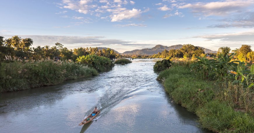
River Mouth.
The mouth of a river is where the water flows into another body of water, such as a lake, sea, or ocean. The mouth is where the river deposits sediments and can form various landforms such as deltas or estuaries.
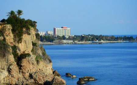
Example: The Nile River flows into the Mediterranean Sea, while the Omo River empties into Lake Turkana in Kenya, forming an important ecosystem in the region.

Upper and Lower Parts of a River.
The upper part of a river is closer to its source, characterized by steep gradients, faster flowing water, and features such as rapids and waterfalls. The lower part is nearer to the mouth, where the river becomes slower, wider, and more meandering, often depositing sediments as it reaches its final destination.
Example: The Upper Nile in Uganda, near Lake Albert, flows through rugged terrain, while the river slows down significantly in Egypt before reaching the Mediterranean.
Rivers and their systems are vital components of the natural world, shaping landscapes, providing water for ecosystems, and supporting human activities. In East Africa, rivers like the Nile, Mubuku, and Omo form intricate networks that serve both environmental and socio-economic functions. Understanding the source, course, and mouth of these rivers helps us appreciate the complexity and importance of river systems in East Africa and around the world.

At this stage, it is important to learn the following concepts, which will help us later on in the concept of rivers and river system.
Catchment area or basin.
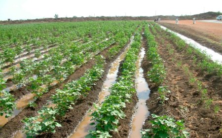
This refers to the region, which drains all the rainwater that falls on it into a river or stream, which then carries the water to the sea or lake.

Water shed or divide
This is a highland region or elevated boundary separating the headstreams of rivers to different river systems or basins. For example, the uplift of parts of western Uganda during the formation of the western rift Valley resulted into the formation of a watershed. Kafu River became Kafu- Nkusi. Kafu River flows to Lake Kyoga while Nkusi River flows to Lake Albert.

River regime
This refers to the seasonal variation in the volume of water in a river. It partly depends on seasonal variation in rainfall. For instance, visitors to Karamoja in north eastern Uganda in the dry season are surprised to find high bridges over narrow streams and even across completely dry streambeds. However, those who live there all the year round know how conditions vary from season to season. Heavy rainstorms during the wet season cause the water level to rise drastically.
Vertical erosion
This refers to erosion, which wears down the riverbed. It results into the deepening of the river channel through the process of abrasion mainly.
Lateral erosion
This refers to erosion, which wears down the banks of the river valley it results into the widening of the river channel. It is most marked at the curved bends of a river.
Head ward erosion
This is erosion at the source of a stream or river and it results into the lengthening of a river valley. It takes place when a river cuts back upstream of the valley above its original source.Rain-wash, gulling, soil creep and spring sapping cause it.
River profile.
There are two types of river profiles;

Longitudinal profile of a river
This is a section showing the slope of a river from its source to its mouth. The gradient is steeper in the upper part (youthful stage), moderate in the middle (mature stage) and very low in the la part (old stage). The long profile shows the distance covered by a river. The various stages are discussed in detail later on.
Cross-profile of a river:
This is a section showing the vertical shape of a river from bank to bank. In the upper or youthful stage, the valley is V-shaped because of intense vertical erosion on the river bed. This results in the valley being deep. In the middle or mature stage, the valley is open U-shape due to laten erosion which widens the valley. I the lower or old stage the valley is wide open due to more lateral erosion. However, deposition of the river bed makes the depth of the valley shallow.
WORK OF RIVERS
As rivers flow, they perform the triple function of erosion, transport and deposition. In so they modify the surface features of their basins.
RIVER EROSION
The erosive work of rivers consists of four interacting processes;
Hydraulic action
This is caused by the force of especially fast moving water, which loosens and sweeps out weak materials by water surging into cracks hence breaking up solid rock. Hydraulic action involves all those processes by which a river mechanically loosens, lifts and removes material from its channel.
The force of moving water can sweep out loose material, while turbulence and swirling together with water entering into cracks can break up solid rock. Bubbles bursting on the river send shock waves against the riverbank, and the spontaneous and sudden change of water from liquid to vapour and back again, which results into pieces of rock to be sucked out of the river's channel bed and sides. Both these processes undermine the river's bank, a process known as cavitation.
Abrasion or corrosion
This is the wearing away of the bed and banks of a river using the load as the 'grinding tool". The materials (sand and pebbles) which the river is carrying do the job. These act as sand paper or file on the rock. Corrasion is most effective during floods when boulders and pebbles in swirling turbulent water abrade and drill potholes in the channel bed.
Mountain rivers such as Nyamwamba, Mubuku, Sironko, Manafa, Mpanga, Naro Moru, Ikiwe etc contain such huge boulders that during floods, these boulders are swept downstream, and in the process abrading the channel bed and sides. Numerous potholes in the bed of rivers Naro, Moru and Ikiwe in Kenya show the effectiveness of corrosion in pothole drilling. The result of abrasion or corrasion is to scour and excavate the bed, adding to the load, which in turn is itself used as a corrasive agent.

The transportation of the boulders down stream depends on the ability of the river. Once the river energy decreases as a result of decreases in gradient, reduction in amount of water, widening of the river channel or any other reason, the boulders are deposited. The big boulders are deposited first and small ones later. The differences in boulder sizes is a result in differences in rock hardness, attrition due to collision of rocks with each other and the time and distance the boulders have travelled.
Solution or corrosion
This involves the solvent action of a river. Soluble rocks are dissolved and carried away in solution. Rocks such as limestone and rock salt are quickly worn away through this process. Corrosion occurs at all times and does not depend much on river velocity or discharge. It depends on the chemical composition of the water e.g. the concentration of acids (carbonic, humic etc)
Attrition
This consists of wearing down of the load itself as the fragments are in constant collision with each other and with the bed. As the river carries its load downstream, boulders collide with each other and with other material. The impact causes the boulders to disintegrate into smaller pieces, which gradually become smoothened and rounded as attrition continues downstream. Such smoothened and rounded material can be seen in Rivers Nyamwamba, Mubuku, Ruimi, Naro, Moru, Ewaso Ngiro, Ruvu and others all of which originate from mountains and therefore derive their boulders from the mountainsides.
TRANSPORTATION
The material carried by a river is called its load. The load is carried in a number of ways w particles are swirled along in suspension Larger particles proceed in a series of hops, touching the bed at intervals, a process known as salutation. Pebbles are rolled along by gravity and by the pushing power of water. Rivers in flood move the big stories and boulders. It is when rivers flooding that most impressive movement of material occurs.
DEPOSITION
This mainly results from a reduction in the speed of velocity of a river. The river can no longer carry its load and therefore deposits it. Materials deposited by rivers are given a general name of alluvium. The reduction in speed of a river may be due to reduced gradient, channel shape, size, and such factors. The heavy load is deposited first while the fine load is deposited further downstream. Deposition is greatest in the lower courses especially during flood discharge.
THE DEVELOPMENT OF A RIVER VALLEY
As a river gradually develops its long profile, so the cross-profile and the general features of its valley also develop. Like a plant or animal, a river has a life cycle. In the beginning, it is in the stage of youth and moves to the state of maturity and finally the old stage. A river valley is thus divided into three distinctive stages;
1. The youth, upper or torrent stage.
2. The mature, middle or valley stage.
3. The old, lower or senile stage.
DAVISIAN CYCLE OF EROSION
It is difficult to discuss the development of a river's long profile (length from source to mouth) without mentioning William Morris Davis, the American geomorphologist who proposed the ideal geographic cycle concept also known as erosional cycle. W. M. Davis (1850-1930), after travelling extensively and studying landscapes in North America, proposed the concept of the ideal geographic cycle in which he assumed that landscapes develop through distinct stages of youth, maturity and old age
Davis introduced the idea that landforms were the product of structure, process, and time. He used the example of river-system development to illustrate a general model of landscape change, which he called the geographical cycle, and which is more widely known as the cycle of erosion, or Davisian cycle.
According to Davis the youthful stage begins with an uplift of the land (through earth movements, vulcancity etc), which creates a youthful landscape dominated by steep slopes and irregular surfaces. Rain falling on this useful landscape soon concentrate in depressions and develop youthful river systems with V-shaped valleys and other youthful features.
Youthful river systems soo a begin to plane down the landscape and reduce the steep gradients to more gentle slopes. Tais produces a mature landscape against which mature rivers flow. In this mature stage, sirea ms widen their valleys through meandering and floodplain formation,
Prolonged river erosion finally reduces the mature landscape to an almost flat undulating landscape, which according to Davis gave the name peneplain, and on it old stage rivers flow. In old age, rive es are approaching their base level and meander more widely, depositing sediment across extensive, low-lying plains called peneplains. The application of the concepts of youth, ma' urity, and old age to landscapes created by fluvial processes led Davis to write: "A young land-form has young streams of torrential activity, while an old form would have an old stream of deliberate or even feeble current.
What Davis could not know, because no measurements had been made at that time, was that far from being feeble, large, lowland rivers, such as the Mississippi and the Brahmaputra, have a velocity that is actually higher than that in their upland tributaries. Many later researchers, such as the influential German geomorphologist Walter Penck, have criticized Davis's model for over-simplification and for not, in fact, actually being cyclic. but instead a one-directional process that changes a landscape from highland to peneplain. Because base levels have changed many times, particularly as a result of adjustments associated with the growth and retreat of ice sheets over the past 2 million years, it is unlikely that the formation of fluvial landscapes can be a unidirectional process. Rejuvenation, for example, is far commoner than Davis appreciated. However, despite such incorrect assumptions, Davis's model still represents an important framework within which geographers can explain landform development.
Conclusion
Rivers and their systems play a crucial role in shaping landscapes, supporting ecosystems, and providing essential resources for human activities. From their sources in highlands, glaciers, or lakes, rivers travel through different stages—youthful, mature, and old—each characterized by distinct features such as erosion, transportation, and deposition. In East Africa, notable river systems like the Nile, Tana, and Omo illustrate the importance of rivers in regional hydrology, agriculture, and biodiversity. Understanding river formation and behavior not only helps in managing water resources but also in appreciating the dynamic processes that continually reshape our environment.
Frequently Asked Questions (FAQs)
-
What is a river system?
A river system includes the main river and its network of tributaries, which together drain a specific area. -
What are the three main stages of a river?
- Youthful stage: Characterized by steep gradients, rapid flow, and active vertical erosion.
- Mature stage: The river has a moderate slope, meanders more, and experiences both vertical and lateral erosion.
- Old stage: The river slows down, meanders widely, and deposits sediments, forming floodplains and deltas.
-
What are the main processes by which rivers shape the land?
Rivers modify landscapes through erosion, transportation, and deposition of materials. -
How does river erosion occur?
Erosion occurs through four main processes:- Hydraulic action: Water force breaks rocks apart.
- Abrasion: River load scrapes against the riverbed and banks.
- Solution (corrosion): Water dissolves soluble rocks.
- Attrition: Particles collide and break into smaller pieces.
-
What factors affect a river's ability to transport material?
- The river’s velocity (speed of flow).
- The volume of water (discharge).
- The gradient (slope).
- The size and weight of materials being carried.
-
What is a watershed?
A watershed is a highland or boundary separating different drainage basins, directing water into specific rivers or streams. -
What is river rejuvenation?
Rejuvenation occurs when a river gains renewed energy due to changes in land elevation, causing it to cut deeper into its valley and form new landforms. -
What is the difference between vertical and lateral erosion?
- Vertical erosion deepens the river channel, common in the upper course.
- Lateral erosion widens the river channel, more dominant in the middle and lower courses.
-
What is the significance of rivers in East Africa?
- They provide water for domestic, agricultural, and industrial use.
- They generate hydroelectric power (e.g., River Nile).
- They support biodiversity and ecosystems.
- They facilitate transportation and trade.
-
How do human activities impact rivers?
- Deforestation and poor land use increase soil erosion, leading to siltation.
- Pollution from industries and agriculture affects water quality.
- Dams and irrigation projects alter river flow and ecosystems.