


Soils in East Africa: Types, Formation, and Key Characteristics
Discover the types, composition, and formation processes of soils in East Africa. Learn about key soil components, weathering, leaching, and other processes that shape soil profiles in the region.
SOILS IN EAST AFRICA
What is Soil?
The term soil is derived from a Latin word 'solum' that means ground. Soil therefore can be defined as the loose layer or material of earth's crust, which supports plant growth. Soil is composed of inorganic and organic materials, water, gasses and living organisms.
Inorganic material
These are minerals derived from the disintegration of the parent rock. The mineral component of soil is made up of an arrangement of particles that are less than 2.0 mm in diameter. Depending upon the rock materials from which they were derived, these assorted mineral particles ultimately release the chemicals on which plants depend for survival, such as potassium, calcium, magnesium, phosphorus, sulfur, iron and manganese.
Organic material
Organic materials constitute another essential component of soils derived from decayed plants and to a lesser extent animal life. Some of the organic material includes residue of plants for example, the remains of plant roots deep within the soil, or materials that fall on the ground, such as leaves on a forest floor. These materials become part of a cycle of decomposition and decay, by the action of bacteria, protozoa, fungi, and other micro-organisms, a cycle that provides important nutrients to the soil. In general, soil fertility depends on a high content of organic materials also known as humus.
Water
Water enters the soil from rain or irrigation and moves down by gravity or upwards by capillarity action. The water becomes a weak solution of various organic and inorganic compounds. The chemical processes, which take place in the soil, do so mainly in solution and plants derive most food from these solutions by way of their roots. The amount of water in the soil varies from nil in arid areas to water-logging. Coarse soils, such as those consisting of mostly of sand, tend to hold less water than do soils with finer textures, such as those with a greater proportion of clays.
Air in the soil
Except where the soil is water logged, a certain amount of air is contained between the individual particles or the pore spaces of the soil. Nitrogen is readily available which is derived from the oxidation of organic materials in the soil. Other gasses include oxygen, which moves through pore spaces in soil.
SOIL FORMING PROCESS
Numerous processes are involved in the formation of soil. The process involves the stages discussedbelow.
Weathering
The first step in soil formation (pedogenesis) process is weathering. A very large part of the soil is derived from the underlying bed-rock or parent material. Through weathering, the physical disintegration and chemical decomposition of exposed bedrock, minerals in the soil are derived. The bed-rock itself does not directly give rise to soil. Rather, the gradual weathering of bed-rock, through physical and chemical processes, produces a layer of rock debris called regolith. Further weathering of this debris leads to increasingly smaller and finer particles, ultimately resulting in the creation of soil. Areas with heavy rainfall and hot temperatures experience rapid chemical weathering and the formation of deep soils e.g. areas of Wakiso, Mpigi, Mukono and Jinja in the Lake Victoria basin. In some instances, the weathering of bedrock creates parent materials that remain in one place. In other cases, rock materials are transported far from their source e.g. blown by wind, carried by movingwater, and borne inside glaciers.
Humification and cheluviation.
Humification is the process by which organic matter is decomposed to form humus. The organic matter is derived from mainly decaying plants and animals or secretions of living organisms. Fallen leaves and decaying grasses and roots are the main sources of organic matter. Soil organisms such as bacteria and fungi break down the organic matter, which then helps to develop distinct organic layers of a soil profile. Forested areas such as the Congo basin, West African coastland and the Amazon basin have soils with high humus contents.
As organic matter decomposes, it releases nutrients and organic acids. These acids attack clays and other minerals in the A-Horizon, releasing iron and aluminium. The acids further combine with iron and aluminium to form organic-metal compounds known as chelates. The chelates are soluble and readily transported downwards through the soil a process known as cheluviation.
Leaching
Leaching or eluviation (wash out) involves the removal by water of soluble minerals and humus from the 'A' horizon of the soil profile to the underlying 'B' horizon. The process leads to an impoverished 'A' horizon of the soil profile as valuable plant nutrients have been washed away. Hot wet tropical conditions lead to high rates of weathering and leaching resulting in the formation of complete soil profiles but with the 'A' horizon having a colour ranging from brown, yellowish to reddish due to the concentration of oxides after leaching the silica e.g. on the hill tops in many regions of Buganda.
Illuviation.
Illuviation (or washing in) is the re-deposition and accumulation of the leached materials washed from the 'A' horizon into 'B' horizon of the soil profile. Horizon 'B' is enriched with solutions and minerals and this is responsible for the development of the darker-colour zone. B (see Fig 23.000) is where there is maximum accumulation of the minerals and colloids.
Calcification
Calcification is the process in which soil water containing dissolved salts moves upwards in the soil and deposits them in the 'A' horizon. It takes place mainly in the arid and semi arid regions by capillarity action. Such water brought to the upper layers of the soil is often charged with dissolved carbonates and other salts, and upon reaching higher levels, evaporation produces an accumulation of solid calcium carbonate and other salts in the 'A' horizon. This process is common in the karst regions of East Africa such as Nyakasura and Tororo in Uganda, Tanga in Tanzania and Kilifi in Kenya and leads to the development of shallow soil profiles.
Gleization.
Gleization occurs in wet or cool climatic environments where there is impeded drainage or water logging e.g. along rivers and in swamps such as along Mpologoma and Katonga Rivers. This is most likely to occur in depressions where the underlying rock is impermeable and where the water table is high enough to enter the soil profile. Areas with heavy rainfall and poor drainage also experience water logging or anaerobic conditions. Under such conditions, the pore spaces fill with stagnant water, which becomes de-oxygenated. The water-logging excludes oxygen so that chemical reduction takes place changing the reddish-coloured iron oxides to ferrous compounds which produce bluish or greenish grey clays which are very sticky e.g. at Kajjansi and Lweeza in the Lake Victoria basin. This process leads to the development of soils with shallow profiles.
Podzolization.
This is defined as the removal of iron and aluminium oxides together with humus. It is more common in cool climates where precipitation is greatly in excess of evapo-transpiration and where soils are well drained or sandy. As the natural vegetation is mainly coniferous forests, rain percolating through it becomes progressively more acidic. It dissolves an increasing number of bases (Ca, Mg, Na, and K), silica, iron and aluminium. The r horizon, drained of coloured minerals by leaching, and the reddish-brown B-horizon, where the minerals are re-deposited.
Salinization.
This occurs where the rate of evapo-transpiration is greater than the amount of precipitation especially where the water table is near to the surface. As moisture is evaporated from the surface, salts are drawn upwards in solution by capillarity action. Further evaporation results in the deposition of salts as a hard crust. It is common in dry irrigated areas.
SOIL PROFILE.
A soil profile is a vertical section through the soil from the surface to the underlying bedrock showing different horizons. The horizons show different materials, texture, consistencies, and colour at different depth. A fully developed soil profile is divided into four successive layers known as horizons designated by letters A, B, C and D. Each soil type has a unique soil profile but generally, there is the top soil, sub-soil, weathered parent material and the parent rock.

Soil Profile
Basic parts of a soil profile
Horizon A - On the surface or upper layer, there is an accumulation of leaves and other fallen plant material. Below this is where bacteria and fungi are most active, and there is decomposed and decomposing organic matter. This accounts for the high humus content. The humus gives it the dark colour. This zone is referred to as the eluviation zone i.e. there is downward loss of dissolved minerals and organic matter from the A-Horizon to the underlying B Horizon.
Horizon B-This is found below the A Horizon. It is referred to as the illuviation zone. It is where the minerals and organic matter removed in solution from the A-Horizon are re-deposited. Illuviation is thus a process of in washing. This zone is usually darker than A horizon. The A and B-horizons make up the true soil.
Horizon C-This is found below the B Horizon. It chiefly consists of recently weathered material or regolith resting on the bed rock.
Horizon D-This is the last horizon below the C Horizon. It consists of the solid under lying parent or bed rock. There is no weathering and hence no soil formation.
FACTORS INFLUENCING THE DEVELOPMENT OF SOI PROFILES
Climate
Climate influences the development of soil profiles through weathering. Weathering involves the physical disintegration and chemical decomposition of rocks under the influence of rainfall and temperature. Around the equator, the heavy rainfall received throughout the year and hot temperatures lead to high weathering rates and the formation of deep and mature soil profiles e.g. inthe Lake Victoria basin.
In arid and semi-arid regions, rainfall is low and unreliable, temperatures are very hot and there is scarcity of vegetation. The weathering processes are therefore very slow leading to the formation of incomplete soil profiles without humus e.g. in Chalbi desert in northern Kenya, Kaabong and Turkana regions.Furthermore, in arid and semi-arid climatic regions a soil forming process known as calcification takes place. It involves the process in which soil water carrying dissolved salts moves upwards from the lower horizons of the soil profiles and deposits them in the 'A' horizon by capillarity action. Upon reaching the A horizon, evaporation takes place due to the hot temperatures to produce an accumulation of solid salts in the 'A' horizon. It leads to the development of shallow soil profiles e.g. in limestone regions of Tanga in northern Tanzania and Kilifi in Kenya.
In tundra climatic regions such as Greenland and Siberia, precipitation is very low and temperatures are very cold. The sub-soil is permanently frozen. The low temperatures limit bacterial activity. These conditions lead to the formation of incomplete soil profiles.
The process of leaching influences the development of soil profiles. It takes place when water carries materials especially clay, iron, and aluminum oxides in solution down from the A horizon to the B horizon of the soil profile. Removal of these oxides in this manner is known as eluviation, the process that gives the A horizon its name. Having lost the materials, the horizon is left with impoverished soils unsuitable for crop cultivation and other plant growth. Leaching is prevalent in equatorial climatic regions which receive heavy rainfall such as Mukono, Mpigi, Wakiso and Nyanza.
The process by which iron, aluminum and clay materials are leached from the A horizons and deposited and accumulate in the B horizons is termed as illuviation. It affects the development of the soil profile in that it accounts the dark colour of the soils in the B horizon. The dark colour indicates the presence of large quantities of organic matter.
Drainage
The development of soil profiles is affected by drainage. Soils forming in areas with poor or impended drainage are frequently saturated by water and appear grey, blue, or green because the minerals that give them the red and yellow colours have been leached away. Such soils occur in wetland areas along Rivers Katonga and Mpologoma, and around the shores of Lake Kyoga in Gogonyo, Bukungu, L.wampanga and Amolatar. The process of soil formation in such areas is termed as gleization. It also takes place in areas with wet-cool climatic conditions.
Nature of vegetation
The nature of vegetation influences the development of soil profiles. Areas with a thick vegetation cover such as the equatorial areas with tropical rainforests on the Ssese Islands and around the shores of Lake Victoria have soils with a significant organic matter and the 'A' horizon is thus stained dark brown or black. The process by which organic matter is decomposed to form humus is termed hification. This decomposition is aided by humid conditions brought about by heavy rainfall and the hot temperatures experienced. The thick vegetation also helps to hold the soils together in the same position for soil profile development. Complete soil profiles therefore develop.
Areas with scanty vegetation such as in the arid and semi-arid regions of Karamoja and Marsabit, have limited humus and their 'A' horizons. The A horizons are light in colour due to absence of humus. Furthermore, the soils are easily washed away by erosion preventing the development of complete soil profiles.
Mineralisation occurs under extreme conditions in which decomposition of organic matter is broken down into basic parts i.e. carbon dioxide, water and silica. This greatly influences the development of the 'A' horizon of the soil profile.
Effect of topography on soil profile development
In flatlands, deposition exceeds erosion. There is thus accumulation of debris and subsequent development of true soil profiles. In valleys as mentioned under drainage, water logging is likely to occur which may hinder the development of a true soil profile. On gentle slopes, erosion is balanced with deposition hence the development of an incomplete soil profile.
Human activities.
Human activities such as mining, quarrying, road construction and agriculture interfere with the development of soil profiles. Over cultivation for example results in a soil profile with an impoverished A- Horizon. Over grazing as in Turkana, Karamoja and Masailand promoted the removal of the top soil by agents of erosion such as wind and running water. This affects the development of complete soil profiles.
Time.
Time is required for the development of soil profiles. The longer the process the well developed the profile is and vice-versa.
SOIL CATENA
A catena is Latin word meaning 'chain'. A soil catena therefore shows a sequence of soils on mountain or hill slope from top to the valley bottom. A soil catena thus shows different characteristics in terms of colour, depth, texture and water content and other constituents of soils as they progress from the hill top to the valley bottom. It illustrates how soils can change down a slope where there are no marked changes in climate and the parent rock but rather due to changes or variations in topography, vegetation and drainage.

Diagram for soil Catena
On hills especially in Buganda and Busoga such as Naguru, Makerere, Mulago, Lubya, Nakayima, Mwiri and Wanyange hills, a similar pattern of soil catena exists. In most cases the soils on the hill top have been leached due to the hot temperatures and heavy rainfall which washes down the iron and aluminium oxides from the A-Horizon to the underling horizons leaving impoverished soils known as laterite soils.
On the upper slopes where the gradient is very steep, the movement of weathered rock material and soil erosion are very rapid. This results in the formation of thin or shallow soils with large particles and little moisture. Soils on the steep slopes are thus generally thin, stony and immature, and contain little moisture with a lot of bare rocks between them because of erosion and mass movement. The soils also lack organic matter.
Soils on lower slopes tend to be deeper and dark due to the reduced gradient and accumulation of weathered materials and soils eroded and deposited fro the upper slopes. The soils also tend to be wetter than those of the upper slopes as they can retain more water. Furthermore, the soils tend to be more fertile due to being enriched by deposition from the upper slopes.
The valley bottom is usually occupied by swamps or stagnant water. Gleization results in the formation of fine grained clay and peat soils. Such soils frequently saturated by water appear grey, blue, or green because the minerals that give them the red and yellow colours are missing. The soils are also acidic in nature.
Factors influencing the development of soil catena
As already noted from the above explanations, relief plays an important role in the development of a soil catena. Soils will differ from the hill top through the steep slopes, gentle slopes and finally the valley bottom. The relief determines the rate of surface run-off of water and the amount of soil that will be removed by erosion on the slope. The amount of soil held on the hill slope will also depend on the nature of vegetation. Dense vegetation helps to hold the soil particles together leading to the formation of deep soils. The falling leaf litter and roots decay to form humus with a dark colour. On the other hand scanty vegetation promotes erosion and mass wasting resulting in the formation of thin soils with little or no humus. The soils are therefore light in colour. Human activities such as grazing animals, cultivation of crops, quarrying and lumbering on slopes all affect the resulting soil profile.
SOIL PROPERTIES
Soil texturenomsvom um hosSoil texture is concerned with the various sizes of the smaller mineral particles in the soil. The particles are measured in terms of diameter.
As texture controls the size and spacing of soil spores, it directly affects the soil water content, water flow and aeration. Soils with predominantly large particles tend to drain quickly and have lower fertility. Very fine-textured soils may be poorly drained, tend to become waterlogged, and are therefore not well-suited for agriculture. Soils with a medium texture and a relatively even proportion mof all particle sizes are most versatile.
Soil structure.
Soil structure refers to the presence of lumps or clusters (aggregates) of soil particles. Each aggregate is separated from adjoining aggregates by natural surfaces of weakness. Under certain conditions, the aggregates are coated with surface films of material that keep them separate. In other cases, aggregates are held pack together by forces of internal cohesion. Aggregates pack together into large, fairly regular shaped units called peds. Aggregates caused by breakage during ploughing are called clods. Soil structure is described in terms of the shape, size and stability of peds within the soil. A soil without aggregation of single particles is said to be structure less. There are four main types of soil structure: platy consisting of thin, flat pieces, blocky - angular ped with flat surfaces, prismatic - peds in vertical columns and spheroidal - rounded peds. Soil structure is of great importance because it influences the ease with which water penetrates a dry soil, the susceptibility of the soil to erosion, and the ease of cultivation. It also ensures a good balance between soil, water, air and nutrients.
Soil colour
An examination of a soil profile in the field reveals that soil is clearly divided into several more or less distinct layers by colour difference. The colours are produced by variations in iron oxides from the mineral content of the soil. These produce a range of red and oranges in freely drained soils and of greys, blue and greens in water logged soils often seen in swampy lowlands. Decayed organic matter gives the soil a black colour. However, the natural colours of the bulk of the soil are determined by themineral matter.
Soil consistency.
Soil consistency refers to the quality of stickiness of wet soil, to the plasticity of moist soil, and to the degree of coherence or hardness of soil when it holds only a small amount of moisture or in the dry state. To test the stickiness of a wet soils press a quality of soil between your thumb and fingers. Separate your thumb and finger and observe the extent to which the soil sticks to your skin. To test plasticity, roll a small amount of wets soil into a rod shape. If plasticity is high, the soil can be rolled into a long, thin shape. When a soil is dry consistency is expressed by various levels of hardness, ranging from loose to extremely hard.
Soil porosity
Porosity is the total volume of pure space within a given volume of soil. This ratio is expressed as a percentage. The pore space usually constitutes about half of the volume of the B and C-horizons. Water and air share the pore space in variable proportions. The smaller pores generally contain water, and the large ones contain air.
Soil acidity or pH
This is a measure of acidity or alkalinity of the soil. Most soils have pH values between 4 and 8. Soils with pH values about 8 have excess salts or are said to be extremely alkaline. Soils with pH values below four are very acidic. Soil pH depends on a variety of factors including all the six soil-forming factors explained earlier plus the growing season, cropping practices and water content. Moreover, leaching processes remove alkaline from the soils and therefore tend to lower pH with time, particularly in the young soils. Fertilizers containing sulphur or nitrogen also tend to lower the soil pH. However, the pH can be raised by application of lime if it is too low. Extremely high pH values can be lowered by application of gypsum. The pH value of the soil helps to determine soil colour, availability of nutrients, solubility of all materials in the soil, the amount of nutritious stored in the soil and the activities of micro-organismos, particularly bacteria.
MAJOR SOIL TYPES
Soils have been classified into three major categories:-
· Zonal soils
· Intrazonal soils
· Azonal soils.
ZONAL SOILS
These are soils that have been classified according to climate. Climate exerts a profound influence on their formation, growth and naturity. They develop mostly on gentle slopes, which are well drained. Climate also influences the resulting vegetation types. Zonal soils are thus mature with well- developed profiles due to prolonged action of climate and vegetation.
Zonal soils are mainly divided into two main groups; the pedocals and pedacfers. Pedocals are soils rich in calcium carbonate or lime. They develop in fairly dry areas and the soils are unleached or onlyslightly so.
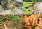
Red desert soils
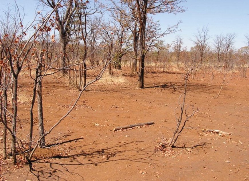
Because of limited moisture in the desert areas, chemical weathering and the soil-forming processes operate very slowly. The dry climate also results in vegetation which is too sparse to allow an accumulation of organic matter. The resulting soils tend to be thin, stony or sandy, yellowish grey to reddish brown with no humus. They contain much salt because of the absence of leaching. Desert soils generally lack the basic requirement for agriculture namely moisture and nutrients. Application of irrigation and fertilizers is therefore of absolute necessity.
Chernozem soils
These soils offer a striking example of origin of soils due to climate and very little to the parent rock. These soils develop in cool temperate continental climatic conditions. The thick grass cover and the roots decay to provide an important source of organic matter. The organic matter gives the soil its black colour. They have a loose and crumbly texture and are rich in humus because there is insufficient rain to carry the grass derived humus deeper. Deep black chernozem soils of high fertility are found in the areas of the tall-grass and mid-grass prairies in the Alberta, Saskatchewan and Manitoba Provinces of Canada.
Chestnut soils
These soils are similar to chernozems in that they are formed in areas with a cool temperate continental climate. However, they form in areas which are drier and therefore with short-grass. The vegetation is relatively sparse and does not provide a significant organic content to the soil. The soils are therefore lighter-colored and in most cases brown e.g. in the drier regions of the Prairie Provinces of Canada. They are also found in the drier parts of the Argentine pampas and South African Veld, High plains of U.S.A., the steppe-lands of Russia among other areas.
Pedalfers
On the other hand, pedalfers are made up of three units, 'ped' meaning soil, 'al' and 'fer' symbolising aluminium and iron. Pedalfers are therefore soils rich in aluminium and iron. The resultant type of soil is closely related to the nature of weathering that takes place under the different types of climate. Generally, they develop in humid regions with high rainfall, which promotes leaching. In low latitude areas, the hot humid conditions give rise to the formation of latosols, tropical red earths and tropical black soils. In high latitudes climate leads to the development of tundra and Arctic brown soils under conditions of low annual temperatures and a permanently frozen sub-soil.
Tropical black soils
In savannah regions with grassland vegetation, the grasses die back during the dry season. These grasses decay to provide organic matter resulting in soils with a thin, dark layer of humus. However, during the wet season, leaching due to heavy rainfall removes the silica from the upper profile leaving behind red-coloured oxides of iron and aluminium. In East Africa, such soils are refereed to as blackcotton soils.
Laterite or ferruginous soils
These soils are formed under tropical conditions of rapid weathering of the parent rock brought about by hot temperature and heavy rainfall. Laterites form from any type of rock, which is leached. Leaching results in the formation of an aluminium and iron-rich layer and when exposed and allowed to dry forms a very hard pan and only softens when wetted. The washing down of mineral nutrients results in the soils being unfit for crop cultivation. The soils tend to be soft but on exposure to wet and dry conditions, they become very hard. The term laterite is derived from a Latin word for 'brick'. The soils are widely used to make bricks. Laterites are well developed on the hills of Buganda and are mainly used as grazing land.
Latosols or ferralitic soils
These soils are formed under conditions of rapid weathering of the parent rock brought about by hot temperature and heavy rainfall. The soils formed tend to bee deep. The heavy rainfall and hot temperatures result in a dense vegetation cover usually of tropical rainforests. Continuous leaf fall within the forests gives a thick leaf litter layer which is rapidly decomposed to form humus. However, the soil is poor in nutrients that can be absorbed by plant roots because the nutritious minerals have been washed out of the soils by heavy rainfall and hot temperatures over thousands of years. The soils are therefore not agriculturally productive. This explains why once the sources of nutrients (trees) have been removed, the soil rapidly loses its fertility. It further explains why shifting cultivators have to move to clear new plots else where. Latosols occur in the Amazon basin in South America, Congo basin in Africa, Madagascar and parts of Indonesia.
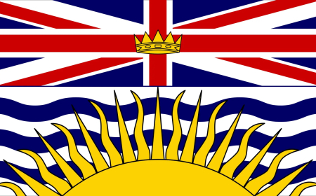
Podzols
These soils develop in moist cool temperate climates and have a black, dark brown to grey colour surface layer. They are associated with coniferous forests. Below this leached surface layer often occurs a hard, thin stratum, consisting either of re-deposited humus compounds forming a hard, dark impervious band, or of sand grains or gravel, stained reddish-brown and cemented by ferric salts (iron pan). The soils are not rich in humus and are leached so that they tend to be acidic and infertile. They occur extensively in British Columbia in Canada.
Temperate Brown soils
These soils form in cool temperate western margin climatic regions, which have natural vegetation of deciduous forests. These soils are rich in humus derived from decaying vegetation. Precipitation exceeds evapo-transpiration to allow leaching, the soils occur in many parts of Britain.
Tundra soils
These soils develop in areas of low annual temperatures, a permanently frozen sub soil and a slow rate of evaporation. Chemical weathering and biological activity are both very limited, and water logging is common in summer. Deep soils cannot develop under such conditions whereby soils are permanently frozen a factor, which limits both, chemical and biological weathering. Such soils mainly occur in Greenland and Siberia.
INTRAZONAL SOILS
Relief and parent rock are the main controlling factors in the development of intrazonal soils than climate and vegetation. They depend on a specific kind of parent rock such as limestone, on the presence of large amounts of salts and on the presence of water. Intrazonal soils are divides into thee groups namely calcareous, hydromorphic and halomorphic soils.
Calcareous soils
These soils develop from rocks of limestone parent material. There are two types of calcareous soils, the terra rossa and rendzina soils. Terra rossa refer to loosely reddish residual soils, which form in limestone depressions under semi-arid conditions or during a prolonged summer drought as in the Mediterranean areas. The rainfall leads to carbonation weathering and the silicates are leached out of the soils to leave a residual deposit rich in iron hydroxides. They occur extensively in Australian valleys.
The rendizina soils on the other hand are dark coloured with a surface horizon of friable, almost angular, loam, lying on a sub soil containing limestone or chalk fragments. They form from limestone rock origin but under humid conditions. The rainfall supports the growth of grasses and woodlands which decompose to form humus. This gives the A- Horizon the dark or black/dark-brown colour of the soil. The parent rock is chemically weathered and silicates are leached out of the soils to leave a residual deposit rich in iron hydroxides.
Hydromorphic soils
These are soils having a constantly high water content e.g. gleyed and peat soils.
Peat soils
These soils develop in low-lying areas and valleys, which are poorly drained or water logged with virtually no air and few organisms. Instead of oxidation, reduction takes place forming ammonia, sulphides, marsh gases and ferrous oxides. Although the decay of vegetation is partial due to lack of oxygen, it enables a considerable thickness of peat to accumulate. There are various forms of peat soils. Fen-peat soils develop where the water contains much calcareous material derived from limestone or other alkaline salts. Meadow soils are those that develop along flood plains where there is flooding during part of the year and accompanied by deposition of silt and mud e.g. in the swampy regions around the shores of Lakes Kyoga and Victoria. Bog peat soils develop on moorlands while the dry peat soils develop on sandy heath lands. Extensive deposits of bog peat are found in the northern United States, Canada, Russia, the Scandinavian countries, England, and Ireland.
Gley soil
This occurs in saturated soils where pore spaces are filled with water to the exclusion of air. The lack of oxygen leads to anaerobic conditions and reduction (chemical weathering) of iron compounds to form from ferric to ferrous form. The resulting soil colour is grey-blue.
Halomorphic soils
These are soils with high levels of soluble salts which render them saline.
Saline soils or solonchaks
These soils have soluble salts in considerable quantities. They mainly develop in areas with hot dry climates where in the absence of leaching, mineral salts are brought to the surface by capillarity action e.g. in areas of Marsabit, Kalahari, Namib and Semliki lowlands. The parent rock or underground water contains a lot of carbonates, bicarbonates and sulphates (like common salt). On reaching the surface, the water evaporates leaving a thick crust of salts. In case of rainfall the salts may be washed out so that the saline layer is in the B- horizon hence referred to as solonetz soils.
AZONAL SOILS
These are soils that cannot be sharply distinguished from one another because they are of recent formation. Their development is incomplete and so no clear marked horizons. They are therefore referred to as 'young soils without clear soil profiles. They are of recent formation and therefore have not been exposed to soil forming processes long enough to develop mature characteristics. They tend to be skeletal as they are derived from unconsolidated materials e.g. alluvium, sand and volcanic ash. They include the following;
Volcanic, soil
These consist of young deposits of lava, ash and cinder and pumice derived from recent volcanic activity. These materials weather easily and are transported down to the lower slopes by rain-wash and torrents. In East Africa, they are best developed in Kisoro in south western Uganda.
Alluvial soils.
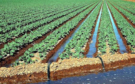
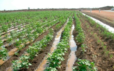
These are soils derived from a mixture of sand, silt and clay transported and re-deposited along watercourses by running water. The soils tend to be fine textured and fertile e.g. on the Ganges and Indus river in India and the Nile Valley in Africa. In East Africa, they can be found long rivers; Tana, Athi and Nzoia in Kenya and Manata, Mpanga and Rwizi in Uganda.
Marine soils
These soils are derived from marine origin and built along low lying coasts in the form of mud flats, sand banks and dunes e.g. at Murchison bay near Luzira on the shores of Lake Victoria, as well as along the East African coast at the Rufigi and Ruvuma river mouths.
These are of glacial origin and consist of tills, out washed sands and gravel and clay deposits. They are found on the slopes of Mountains Kenya, Rwenzori and Kilimanjaro.
Mountain soils
These soils consist largely of fragments which disintegrate physically mainly by frost action and but suffer little chemical change. They are mainly stony with many rock fragments and hence not suitable for agriculture. They are also known as screes soils e.g. on the upper slopes of Mts. Rwenzori, Kilimanjaro and Kenya.
Wind deposited soils.
These include sand sheets and loess. They are formed as a result of wind erosion and deposition. They are common in arid and semi arid regions such as Karamoja and Turkana regions.
CLASSIFICATION OF MAJOR SOIL TYPES IN EAST AFRICA
The soils of East Africa can be divided into 4 major categories:-
Volcanic soils.
These soils are formed from volcanic materials. They have a thick, loose, granular, dark grey to black A - Horizon over a yellowish brown or brownish C - Horizon. They may be course or fine textured and usually have a high silt content. They are very porous, with high organic matter content and high water- storage capacity. Although differences in parent material may influence the fertility of these soils, they generally have a high fertility and good physical properties. Volcanic soils are found in the following areas of East Africa:- Aberdare and Mau Escarpments, Mount Kenya region, Mount Elgon region, Kigezi Highlands, Mount Kilimanjaro region and parts of Karamoja. Most volcanic soils support high population densities. Areas with volcanic soils are the most densely populated regions in East Africa. Because of their fertility, they support intensive cultivation. Various crops are grown ranging from coffee, tea, and banana to grains like maize. The soils support the growth of luxuriant vegetation particularly forests giving rise to forestry. However, in Karamoja the volcanic soils are not fully utilized owing to low rainfall.
Laterite or ferruginous soils.
These soils form from any type of rock, which has been leached. They form under conditions of rapid weathering brought about by hot temperature and heavy rainfall. Where the vegetation has been removed, the heavy rainfall causes bases and silica to be removed from the A-horizon and deposited in the underlying horizons through a process known as leaching. The percolating rain water causes dissolution of primary rock minerals and decrease of easily soluble elements as sodium, potassium, calcium, magnesium, and silicon. This gives rise to a residual concentration of more insoluble elements predominantly iron and aluminium. The concentration of iron and aluminium gives the scil its characteristic reddish colour.
Laterites consist mainly of the minerals Kaolinite, goethite, hematite, hematite and gibbsite which form in the course of weathering. Moreover, many laterites contain quartz as relatively stable relic mineral from the parent rock. The iron oxides, hematite among others cause the red-brown colour of laterites.
Laterite soils tend to be deep due to the rapid weathering. Their formation is favoured by a flat or gentle relief which prevents erosion of the surface cover. The leaching results in valuable plant nutrients being washed or carried down from the topsoil to lower horizons that plant roots cannot easily reach them. The soils are thus infertile and support poor plant growth.Laterites can be as well soft and friable as firm and physically resistant. Some laterites are sometimes cut into blocks and used as brick stones for house-building. The term laterite which is derived from the Latin word 'later' meaning brick stone is given because of this usage. The soils are also widely used in the tropics for the construction of simple roads.
Characteristics of laterite soils.
· They chiefly occur in savannah and equatorial regions where temperatures are hot and rainfall is heavy
· The A-horizon contains much aluminium and iron oxides.
· The colour of the soil ranges from brown, through yellow to reddish due to the concentration of iron and aluminium oxides after leaching.
· Great depth due to rapid weathering and beak down of the parent material.
· Form distinct horizons.
· Thin humus layer due to intense bacteria activity.
· Highly pervious i.e. free draining soil.
· Highly deficient in plant nutrients.
· They have a loose structure and if exposed to heavy rainfall, are easily eroded.
· They vary in texture from clay to loaming sand.
· Very hard and will not soften when wetted.Lm.
· Form above the water table where constant alternate wetting and drying penetrates.
· They are sometimes refereed to as tropical red or yellow earths.
Laterites are best developed on the flat-topped hills of Uganda. They are very poor soils since they lack nutrients for plant growth. They are therefore not utilized for cultivation. They support short grass and bushes used as pasture for cattle, sheep and goats. They are also used for brick making and quarried to provide earth for road construction.
Clay soils.
These soils are found in broad river valleys or plains that are water logged. They are usually gray in colour because of their periodic or permanent saturation by water. Their fertility varies widely but the topsoil contains considerable amounts of organic material. They occur in the following areas along the Yala, Tana and Turkana Rivers in Kenya, and a long the Katonga, Kagera and Rwizi Rivers in Uganda. The soils contain considerable amounts of organic material and therefore used for agricultural purposes. They are also used in the manufacture of pots, bricks and tiles.
Sandy soils.
These are moderately to strongly weathered soils with moderate fertility. Their top soil is low is organic content. They are often stony and rocky. They are best developed along the East Africa co and north eastern Kenya. The soils tend to be poorly drained and crops that require little moisture sch as sisal are grown. They support scanty grass giving rise to animal rearing.
FACTORS INFLUENCING SOIL FORMATION
Soils vary widely from place to place. Many factors determine the chemical composition and physical structure of the soil at any given location. Soil formation depends on a number of factors, which are interrelated. These factors are discussed below.
Climate
In many ways climate is the most important single factor in the formation of soils. Its importance lies in its control of the rate and nature of weathering. In low land tropics, the hot temperatures and heavy rainfall throughout the year result in high intensity of weathering. It is estimated that in tropical regions the effectiveness of weathering is almost ten times that of the Polar Regions and three times more than that of the temperate regions. As a result, deeper weathering is a characteristic of tropical regions. Climate also influences soil formation in the following ways:-
In East Africa, areas around the equator experience hot temperatures and heavy rainfall. These have led to rapid chemical, weathering and the formation of deep soils e.g. the tropical red soils in the Lake Victoria basin. Furthermore, the hot temperatures and heavy rainfall lead to washing down of minerals from the top layer to the underlying horizons a process known as leaching. Silica is leached down from the surface layers (horizon A) to the underlying horizon leaving the soils with iron and aluminium contents, which cannot be leached. This results into the formation of reddish soils known as lateritic soils e.g. on the hill tops in Buganda.
Rainfall also leads to the formation alluvial soils through the deposition of weathered materials along river courses. This is especially so during flood time when rivers carry eroded materials and deposit them as alluvial soils e.g. the clay soils around Lake Kyoga and western shores of Lake Victoria.
In arid and semi-arid regions such as northern Kenya and north eastern Uganda rainfall is low and unreliable and temperatures are hot throughout the year. Physical weathering processes dominate. These conditions have given rise to the formation of reddish-brown soils of thin, sandy texture containing much salt.
Some type of parent rock subjected to different climatic conditions will produce different types of soils. For example rendzina soils are dark coloured resulting from weathering of limestone or chalk rocks in humid conditions while terra rossa soils on the other hand are light coloured reddish residual soils resulting from weathering of limestone or chalk rocks but under arid conditions.
Climate determines the resulting vegetation, which grows in an area. This in turn affects the soil forming process as it determines the amount of humus available in the soil. Humus consists of remains of plants and to lesser extent of animals, which have decomposed through the action of bacteria and other organisms. Areas with forest vegetation have a lot of leaf and twig fall resulting into a high humus content of the soil e.g. around the Mabira and Malabigambo forests in Uganda. On the other hand, xerophytes provide very little humus to the soil.
Climate exerts a strong influence on the type of soils formed. Zonal soils are largely determined by climatic factors. Desert soils are thin and stony with no humus due to limited of water and scanty vegetation. Humid tropical regions tend to have deep, dark coloured soils due to rapid weathering and much humus.
Climate further determines the living organisms in the soil, which influence soil formation. Bio- chemical changes by soil organisms are very responsive to temperature and moisture changes. Bacteria act on dead leaves and animals leading to the formation of humus especially in tropical regions like the Lake Victoria basin.
Parent rock or parent material
The parent rock is broken down by mechanical and chemical weathering into substances, which make up the largest part of the soil. Rocks differ in many ways such as hardness, joints, colour, texture and mineral composition and thus influence soil formation in several ways as seen below:-
Rock resistance
Soft rocks such as limestone at Tororo, sandstone, mica in Kotido and Moroto and volcanic rocks forming dykes west of Lake Turkana are weathered easily and this accelerates the rate of soil formation. Deep soils result. On the other hand, resistant rocks such as granite in Maragoli and quartz limit the rate of physical weathering resulting in the formation of thin soils.
Mineralogical composition of the rock
In any place, the mineral or inorganic matter of the parent rock will have an influence on the fertility of the soil formed. The mineral matter may be derived either from the local bedrock or from transported material by wind, ice or running water. For example, rocks of volcanic origin weathered to produce fertile soils in the Kigezi and Kenya Highlands. On the other hand, granite and sandstones, which are composed of large quantities of inert silica, produce soils of low fertility.
Age of the parent rock
Rocks of recent formation have not been exposed for long to weathering to produce well-developed soil e.g. the volcanic soils of Kisoro. On the other hand old rocks have been exposed for long to weathering processes and tend to produce well developed deep soils e.g. on the slopes of Mount Elgon.
Rock joints
Well-jointed rocks allow easy infiltration of water and gasses into the rocks thus accelerating the rate of chemical weathering and deep soil formation. Most igneous rocks are well jointed caused by the process of cooling. Faulting has also led to the formation of jointed rocks in the rift valley areas of Nakuru and Naivasha resulting into deep soil formation. Poorly jointed parent rocks take long to break down hence forming thin soils.
Permeability
Permeable rocks allow water to seep through them promoting chemical weathering and the formation of deep soils e.g. limestone rocks at Nyakasura near Fort Portal and Hima near Kasese. Impermeable rocks do not allow water to seep through them hence their disintegration and breakdown is reduced.
Colour
Dark coloured rocks are more susceptible to weathering than light coloured rocks hence form deep soils. Dark coloured rocks such as granites expand and contract more than light coloured rocks leading gradual rock disintegration and formation of deep soils e.g. in Soroti and Kumi in eastern Uganda, as well as Kongwa and Iringa in Tanzania.
RELIEF
This refers to the general appearance of the landscape. The nature of the slope will influence soil development from thin to deep soils. This is largely because relief controls the rate of weathering, and the removal of or deposition of material. The influence of relief can be seen in the following:-
Generally, on steep slopes erosion by surface run-off is more rapid than on gentle slopes. This prevents deep rock weathering. Consequently, steep slopes develop thin infertile soils eg. on the upper slopes of Mts. Kenya and Rwenzori. The rapid removal of weathered materials also prevents the formation of deep soils and mature soil profiles. Furthermore, soils in hilly areas which receive heavy rainfall are heavily leached.
On gentle slopes, the surface run-off of water is reduced. More water is thus retained slopes and this promoted chemical weathering and the formation of deep soils e.g. on the lower slopes of Mts. Elgon and Kilimanjaro, as well as the gentle slopes in the Kigezi Highlands. In addition, deposition often exceeds erosion which results in the formation of deep soils with mature soil profiles. Furthermore, deep soils support the growing of dense vegetation. Apart from providing humus to the soil, the vegetation promoted both mechanical and chemical weathering by the power of its expanding roots.
Hill tops especially the flat-topped hills in the Lake Victoria basin where rainfall is heavy and temperatures are hot, leaching takes place leading to the formation of laterite soils. Similarly, flat lands subjected to leaching lead to the formation of infertile soils e.g. on the Nyika plateau in Kenya.
In plains and valleys, soils tend to be deep and fertile soils due to deposition of materials from the upper slopes e.g. the Kisoro plains. However, lowlands, which are poorly drained or subjected to flooding, tend to develop poor soils. The water logging slows down the rate of weathering and soil formation. Soils formed tend to be acidic e.g. the clay soils at Kajansi, Seeta and Kamonkoli. Water logging also limits the amount of organic matter in the soil e.g. areas around the shores of Lake Kyoga such as Nakasongola and Kamuli.
LIVING ORGANISMS
This is the effect of plants and animals on soil formation. The nature of vegetation influences soil formation in the following ways:-
A dense vegetation cover provides humus or organic compounds through decomposition, which make up the soil. This takes place in two stages namely mineralization and humification. Mineralization is the initial stage of decomposition. It involves the breaking down of dead plant tissues by soil micro- organisms to produce soluble organic substances. Humification, which is the second stage involves the regrouping the dead plant material which has been mineralised into large molecules to form humus. Therefore, areas with a dense vegetation cover such as those with tropical rainforests like Mabira, Bugala, Malabigambo and Budongo forests provide a lot of humus derived from the decay of leaves and twigs.
Vegetation determines the amount of water retained which in turn will determine the rate of weathering. Tropical forests like the Mt. Elgon forest retain more moisture or water resulting in the formation of deep soils.
The vegetation helps to protect the soils from erosion and deep soils form e.g. the plated forests on hills slopes at Kateera in Kiboga and Mafuga in Kabale. In areas where the vegetation is scanty e.g. on Mt Kadam, soils are eroded resulting in the formation of thin soils.The influence of animals on soil formation is in a number of ways;The influence of animals on soil formation is largely mechanical. Earthworms, termites, moles and other living organisms contribute to soil formation. Earthworms in particular change the texture of the soil as it passes through their digestive systems. Burrowing animals such as rabbits churn up rock fragments thus improving aeration and drainage, which promote weathering and soil formation.
Micro-organisms such as bacteria fix nitrogen in root nodules of plants. Man's activities change the nature of soil. Overgrazing for example loosens and exposes the top soils to erosion resulting in the formation of thin infertile soils. Quarrying involves rock break up and it aids soil formation e.g. in the hills of Kigezi. Other human activities include use of fertilizers which change the soils, cultivation which affects the fertility of the soil, swamp reclamation and others all of which change the nature of soils in the affected areas.
TIME
The soils forming process is very long and slow and a lot of time is needed for the full operation of all the factors that affect soil formation. The amount of time a soil requires to develop varies widely according to the action of the other soil-forming factors. Young soils may develop in a few days from the alluvium or from the ash from volcanic eruptions. Other soils may take hundreds of thousands of years to form.
The duration of time taken by soils to form influence its characteristics. Well-developed soils have been acted upon by all the soil forming processes for a considerable period of time. Soils, which have not been exposed for long to the soil forming process, are said to be young and immature e.g. some young volcanic soils of Kisoro in south western Uganda. On the other hand, old soils that have been leached for thousands of years are likely to be infertile. Therefore, the resulting soil formed requires a lot of time.