


Sea Level Changes: Causes, Effects, and Landform Transformations
Explore the causes and effects of sea level changes, including eustatic and isostatic movements, climate change, glaciation, and tectonic activity. Learn how rising and falling sea levels impact coastal landforms, marine transgression, and regression.
What is Sea Level Changes?
Sea level changes refer to a rise and fall in the level of the sea relative to that of the land. Some s level changes are minor while others are on a worldwide scale. Worldwide changes in sea level a referred to as eustatic movements. The changes in sea level at any particular location are the sum of the eustatic and regional effects. The movements may cause either a rise in the level of the sea relative to that of the land or the rise of the land relative to that of the sea. Sometimes, the change in a local sea level can be abrupt. Earthquakes can cause land to rise or fall suddenly with respect to the sea. For example, an earthquake in 1899 in Alaska raised parts of the coast by as much as 14 m. Sometimes, the change in sea level can be slow and gradual.
CAUSES OF A RISE AND FALL IN SEA LEVELCLIMATE
Climate
Climate plays an important role in sea level changes as shown below.
Glaciation and deglaciation
Glaciation refers to the formation of large masses of ice especially in the temperate and polar regions. In the tropics, glaciers only occur in high altitude areas above 4,700 metres above sea level like on Mount Kenya, Rwenzori and Kilimanjaro. Large quantities of water are locked up in form of ice masses when glaciers form resulting into a fall in sea level.
This was mainly so during the Quaternary period. On the other hand, one of the most important causes of a rise in sea level is connected with postglacial changes, when a widespread rise in the sea level was caused by a return of water to the seas and oceans as ice-masses melted. For example after the Pleistocene period, large masses of ice or glaciers melted releasing large quantities of water which drained to the seas hence contributing to a rise in sea level.
Rainfall
Changes in climate resulting into increased precipitation lead to a rise in sea level. In Uganda in 1997 and 1998, the El Nino weather phenomenon led to heavy prolonged rains causing most lake levels rising and submerging the surrounding ports, landing sites and other areas. Lakes Victoria and Kyoga had their level rising dramatically. On the other hand, long periods of drought certainly cause a fall in the level of the sea like. Lakes in northern Kenya such as Logipi south of Lake Turkana. Evaporation Excessive evaporation from the water bodies due to increased desertification leads to a fail in the level of the sea relative to that of the land. In East Africa, excessive evaporation and prolonged drought is responsible for the fall in lake levels of Lakes Rukwa in southern Tanzania and Turkanas in northern Kenya. Lake Chad bordering the Sahara desert is another example.
Temperature changes
Temperature changes have an effect on the expansion and contraction of the seawater. A rise in the temperature of the water will cause its expansion and a rise in sea level while a fall in temperature will cause contraction and a fall in sea level.
Global warming
Due to the current trends such as Greenhouse effects, world temperatures are progressively rising. The Greenhouse effect is the capacity of certain gases in the atmosphere to trap heat emitted from the earth's surface, thereby insulating and warming the earth. The burning of fossil fuels such as coal, oil and natural gas, as well as other activities such as clearing forest land for agriculture or urban settlements, releases some of the same gases that trap heat in the atmosphere, including carbon dioxide, methane, and nitrous oxide. As these gases build up in the atmosphere, they trap more heat near the earth's surface, causing earth's climate to become warmer than it would naturally.
This unnatural heating effect refereed to as global warming is responsible for the increase in the earth's temperature in the last 100 years. This is resulting into the melting of permanent ice sheets especially in Greenland and Antarctica, which release water to the sea hence, a rise in sea level. The earth is now in a warm interglacial period and ice covers only about 10 percent of the land surface, compared with 30 percent during the last ice age. In East Africa, glaciers on Mounts Rwenzori, Kenya and Kilimanjaro are receding.
Solar winds
These are streams of gases, which are constantly being emitted by the sun in all directions. These combine with hydrogen in the atmosphere to produce rain, which contributes to a rise in sea level.
TECTONICS
These include warping, tilting, plate tectonics and down faulting.
Warping
Warping for example led to the formation of Lake Victoria and Lake Kyoga basins. This resulted into the reversal of major rivers such as Katonga, Kagera and Kafu, which then poured their waters into these basins. This resulted into a gradual rise in the level of the lakes (Victoria and Kyoga) together with the rainfall received.
Faulting
Earth movements involving up lifting along the coast result into a fall in the level of the sea relative to that of the land. A fall in sea level has occurred along the coasts of Ghana and Liberia, which were uplifted.
Sea-floor spreading
In addition, Plate tectonics result into the expansion of ocean basins, which produces a fall in the lev of the sea. In the oceanic crust, this process is called sea floor spreading, because the splitting plate are spreading apart from each other. The Atlantic Ocean is getting lager as plate movements on North and South America to move away from Europe and Africa.
Earthquakes
A tsunami is a very large sea wave that is generated by a disturbance along the ocean floor. The disturbance can be an earthquake, a landslide, or a volcanic eruption. Most tsunamis occur when a major fault under the ocean floor suddenly slips. The displaced rock pushes water above it like a giant paddle, producing powerful water waves at the ocean surface. The ocean waves spread out and move across the ocean until they reach the coastline, where their height increases as they reach the continental shelf causing severe flooding. There are common along the coasts of Japan and can be felt up to the East African coast.
Isostasy: Understanding Land and Sea Level Changes
What is Isostasy?
Isostasy refers to the vertical movement of the Earth's crust due to the loading or unloading of weight, which causes land to either sink or rise relative to sea levels. These changes, known as isostatic adjustments, occur due to natural geological processes such as erosion, sediment deposition, glaciation, and melting of ice sheets.
How Isostatic Changes Affect Sea Levels
1. Isostatic Land Uplift and Sea Level Fall
- The continents are composed of lighter sial (continental crust) floating on the denser sima (oceanic crust) beneath.
- When weathering and erosion wear down a landmass, the removal of material reduces pressure on the semi-liquid mantle.
- As a result, the land rises relative to the sea level, causing an apparent fall in sea level.
- Example:
- In Canada’s Hudson Bay region, land is rising at a rate of 10 mm per year due to the melting of glaciers that once pressed it down.
2. Isostatic Subsidence and Sea Level Rise
- The deposition of sediments, glacial ice, or volcanic material adds weight to the land, causing it to sink.
- This sinking of the land results in a relative rise in sea level.
- Example:
- The Louisiana coast (USA) is sinking at a rate of 10 mm per year due to the heavy accumulation of sediments from the Mississippi River Delta.
Isostatic Adjustments in Coastal and Deltaic Regions
- Deltas are particularly affected by isostasy because of the continuous accumulation of sediments.
- The growing weight of deposited materials can lead to subsidence, causing coastal flooding and rising sea levels.
- Example:
- East Africa’s Rufiji Delta (Tanzania) experiences subsidence due to heavy sedimentation, which influences coastal erosion and wetland formation.
SEDIMENTATION AND RIVERS
Many rivers flow to the sea. These rivers carry large quantities of sediments and water which deposited on the sea hence contributing to a rise in sea level e.g. Rivers Ruvuma, Rufigi, Matanda and Wami in Tanzanian and Tana, Galana-Sabaki, Pemba and others in Kenya all flow to the Indian Ocean. In addition, these rivers coupled with increased rainfall result into increased amount of wa discharged into the seas, hence a rise in sea level.
HUMAN ACTIVITIES
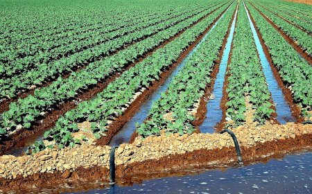
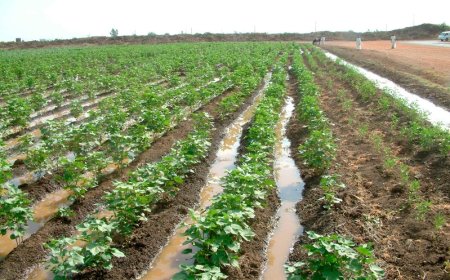
Various human activities can lead to sea level changes. The pumping of water or oil from the ground can lead to the gradual sinking of the ground. For example, parts of the Imperial Valley in California have dropped more than 8 m as groundwater has been withdrawn for irrigation.
What are the Effects of sea level changes?
Changes in the level of the sea relative to that of the land may have a great effect on the form of the coast. When the level of the sea rises, which is also, termed marine transgression, areas around the coast become submerged or flooded. On the other hand, when the level of the sea falls, which is also termed marine regression, areas which were covered by water, emerge or appear. There are therefore two basic kinds of coasts:-
· Submerged coasts resulting from a rise or positive change in the base level.
· Emerged coasts resulting from a fall or negative change in the base level.
Not all coasts fit neatly into the above two categories involving a clear change in the level of the sea relative to that of the land. There are some neutral coasts, where little or no relative changes have taken place. In addition, there are compound coasts, which have been raised and depressed several times relative to the sea level and different results may be super imposed.
SUBMERGED FEATURES
When the level of the sea rises, coastal areas which were originally dry, became submerged. The resulting features can be divided into two broad groups i.e. highland features and features in lowland areas.
Features in highland regions
Rias
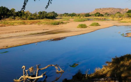
These are long, narrow, drowned river valleys in highland areas. They are formed when the lower parts of river valleys are flooded due to a rise in sea level. They are funnel shaped, wider and deeper at the entrance than inland and hence suitable for harbours. The rias along the East African coast were formed as a result of local faulting and warping along the coast which produced a rise in sea level. The drowned mouths of Rivers Mwachi at Kilindini harbour while that of the Kombeni River forms the Mombasa harbour. Similarly, Dar es Salaam, Tudor, Tanga and Mtwara harbours along the East African coast occur at rias.
Island
These are places of land surrounded by water. When a highland region is submerged, the top parts of the land which are not covered by water from islands. For example the Ssese, Kome,Sigulu and Ukerewe islands in Lake Victoria.
Peninsular
This is a piece of land projecting into the sea. It is formed where highlands and valleys lie at right angles to the coast. When the level of the sea rises, the valleys are submerged leaving the highlands projecting into the sea as peninsulars e.g. the Entebbe peninsular on the shores of Lake Victoria.
Fiord
This is a drowned glaciated river valley in highland regions. It is characterised by an inlet of the seaor ocean extending far inland between steep rock walls. Fjords tend to be most shallow near the mouth, and deepest inland. Before glaciation, a river is winding between interlocking spurs and the valley cross profile is V-shaped. The river valley is filled with a glacier which erodes the interlocking spurs into straight sides and the valley cross profile is changed from V-shape to U-shape. When the level of the sea rises and submerged this valley a fiord is formed. They are not found in East Africa since we don't have glaciers in low altitude areas. Many of the world's fiords are located in Norway. Norway's longest fiord, extends inland for 204 km and attains a depth of 1,308 m. Fiords are also found along the coasts of Sweden, British Columbia, Alaska, Iceland, Greenland, Nova Scotia, Maine, southern Argentina, and New Zealand.
Submerged features on lowland coasts
Estuaries.
These are drowned river mouths in low land areas. They are funnel shaped, wider and shallower at the entrance than in land. They are similar to rias accept, whereas rias occur in highland regions, estuaries occur in low land areas. Then the level of the sea rises and submerges the mouth of a river, estuaries are formed e.g. at the mouth of rivers Rufigi and Wami along the East African coast.
illustration
Creeks
These are similar to estuaries in that they are drowned river valleys in low land areas. However they differ from estuaries in that they are smaller and tidal. They are formed when small water-inlets along sea or lake coasts are submerged as a result of a rise in sea level. The creeks along the East African coast such as at Mtwapa, Tudor, Reitz and Kilifi. Most of these were formed as a result of local sinking along the coast followed by submergence.
Mud flats
These occur where rivers join the sea or lake especially where wave activity is weak and the longshore drift shuts down. Deposition in such regions creates barriers or embankments that shelter the mainland from ocean waves. The calm environment within the lagoons formed e fine sediment to deposit forming a mud flat which if flooded with a rise in sea level form mud flatse.g. at Lamu and Tanga along the East African coast.
Swamps and marshes:
A rise in sea level leads to the formation of marshes along sea coasts e.g. at Lindi and Mtwara along the Indian Ocean coast, and swamps along lake shores e.g. Sango Bay and Lwamunda swamp alongthe shores of Lake Victoria.
EMERGED FEATURES
When the level of the sea falls, areas which were originally covered by water, appear or emerge leading to the formation of emerged features. These features occur both in highland and lowlandcoasts.
Emerged landforms in highland areas
Raised beaches
This is a beach found above the shoreline of a sea or lake. When the level of the sea falls, a new beach is formed at a lower level. The original beach left high above the present zone of wave deposition is referred to as the raised beach e.g. at Bagamoyo three beach levels can be identified at 2 metres, 8 metres and at 12 metres above sea level. Other raised beaches can be seen at Mama Ngina Drive in Mombasa, Timbuani, Diani and Shimoni beaches along the East Africa coast.
Raised Cliff.
This is a cliff found above the shoreline of a sea or lake. When the level of the sea falls, a new cliff is created at the lower level by wave erosion. The original cliff left high above the present zone of wave erosion and high tide is referred to as a raised cliff e.g. at Lamu and Malindi on the Kenya coast and Bagamoyo, Kilwa and Tanga on the Tanzania coast.
Terraces and waterfalls.
When the level of the sea falls, a river renews it's down cutting (rejuvenation) in order to reach the new base level. Fentures of rejuvenation are thus formed like paired river terraces and knick points with associated waterfalls.
Other landforms.
Notches are V-shaped cuts formed as a result of under cutting of the coastline between the high and low water tides. They are progressively enlarged into a cliffs or caves. The cliffs are progressively worn down to form wave cut platforms while the cave roofs may collapse to form geos. When the level of the sea falls, all the above features are raised above the current zone of wave erosion and shore line e.g. the raised notches at Kilindini harbour entrance and Mtwapa, raised wave cut platform on which Oceanic Hotel is located at Mombasa and Mama Ngina Drive in Mombasa.
Emerged features in lowland areas
Coastal plain
When the level of sea falls and a gently sloping continental shelf is exposed, and coastal plain is formed like at Vipingo Sisal Estate and Kikambala plains at Kilifi in Kenya. Madagascar's coastal plain along the Mozambique Channel in the west. Liberia has a coastal plain, extending about 80 km inland which is fringed with lagoons and swamps. The coastal plains at the Gulf of Mexico are renown in the world.
Even coastlines.
Even coastlines without bays and headlands e.g. north coast of the Gulf of Mexico.
Value of features resulting from sea level changes.
1. Both rias and fiords often provide natural harbours. Kilindini, Dar es Salaam, Lagos and Abijan are examples.
2. The landform scenery attracts tourists e.g. the raised beaches, cliffs and caves at Mama Ngina Drive in Mombas hence earning the respective countries foreign exchange.
3. Mud flats are reclaimed for agricultural purposes along the East African coast.3.The landforms are used for research or educational purposes.4.5.Rias form natural route ways inland.6.The raised beaches are a source of sand at Mombasa and Dar es Salaam.7.Rias are used as sites for ports e.g. at Mombasa and Dar-es-Salaam.
Short comings of features resulting from sea level change.
a) Settlement is difficult along the sides of a fiord because there is very little or no level land e.g. in Norway and Sweden.
b) The swamps and marshes act as breeding grounds for mosquitoes which cause disease toman.
c) It is often extremely difficult to get inland from the head of a fiord. They are thereforenotuseful as sites for ports.
Table of Key Facts: Sea Level Changes
| Category | Key Facts |
|---|---|
| Definition | Sea level changes refer to the rise and fall in the level of the sea relative to the land. They can be minor or occur on a global scale (eustatic movements). |
| Types of Sea Level Change | - Eustatic changes: Global sea level shifts due to changes in water volume. - Isostatic changes: Local sea level shifts due to land movements. - Tectonic changes: Result from land rising or sinking due to earthquakes, warping, or faulting. |
| Causes of Rising Sea Levels | - Glacial melting: Ice sheets melt, adding water to oceans (e.g., post-Pleistocene period). - Increased rainfall: More precipitation raises sea levels (e.g., 1997-98 El Niño in Uganda). - Thermal expansion: Rising temperatures cause seawater to expand. - Sedimentation: Rivers deposit large amounts of sediments into the sea. - Isostatic subsidence: Land sinking due to glacial weight or heavy sedimentation (e.g., Mississippi Delta). - Human activities: Groundwater extraction leads to land sinking (e.g., Imperial Valley, California). |
| Causes of Falling Sea Levels | - Glaciation: Water is trapped in ice, reducing ocean volume. - Evaporation: Excessive heat leads to water loss, reducing sea levels (e.g., Lake Chad shrinkage). - Isostatic rebound: Land rises after ice sheets melt (e.g., Hudson Bay, Canada). - Tectonic uplift: Land rising due to faulting or warping (e.g., coasts of Ghana and Liberia). - Sea-floor spreading: Expanding ocean basins lower sea levels. |
| Effects of Sea Level Changes | - Marine transgression (rising sea levels): Coastal areas are submerged. - Marine regression (falling sea levels): Land once underwater emerges. - Coastal erosion & flooding: Higher sea levels cause land loss and flooding. - Formation of new landforms: Submerged or emerged features develop. |
| Submerged Coastal Features (Due to Rising Sea Levels) | - Rias: Drowned river valleys forming natural harbors (e.g., Kilindini, Dar es Salaam). - Islands: Highlands surrounded by water (e.g., Ssese Islands in Lake Victoria). - Estuaries: Drowned river mouths (e.g., Rufiji and Wami rivers). - Fiords: Deep, glaciated valleys submerged by seawater (common in Norway, not in East Africa). - Swamps & mudflats: Form along coastlines (e.g., Lindi and Mtwara swamps). |
| Emerged Coastal Features (Due to Falling Sea Levels) | - Raised beaches: Former shorelines left above current sea level (e.g., Mombasa, Bagamoyo). - Raised cliffs: High cliffs left above the current shoreline (e.g., Lamu, Malindi). - Coastal plains: Exposed seabed due to receding water (e.g., Kilifi coastal plain). - Even coastlines: Straight coasts without bays (e.g., Gulf of Mexico). |
| Value of Features Formed by Sea Level Changes | - Tourism: Raised beaches and cliffs attract visitors (e.g., Mama Ngina Drive, Mombasa). - Harbors & ports: Rias and estuaries provide natural ports (e.g., Mombasa, Dar es Salaam). - Agriculture: Mudflats are reclaimed for farming. - Research & education: Landforms provide insights into geological history. - Fishing & navigation: Estuaries and rias offer productive fishing grounds. |
| Challenges of Sea Level Changes | - Flooding & land loss: Rising sea levels threaten settlements and infrastructure. - Mosquito breeding grounds: Swamps increase malaria risks. - Difficult navigation: Fiords make inland travel challenging. - Coastal erosion: Loss of beaches and habitats. |
1. What are the main causes of sea level changes?
Sea level changes are caused by several factors, including:
- Eustatic Changes – These occur due to global variations in the amount of water in the oceans, mainly influenced by climate change, glaciation, and the melting of ice sheets.
- Isostatic Changes – These are caused by the rising or sinking of landmasses due to tectonic movements, glacial rebound, or sediment deposition.
- Tectonic Activity – Earthquakes, volcanic activity, and plate movements can uplift or submerge coastal areas, altering sea levels locally.
- Thermal Expansion – As global temperatures rise, ocean water expands, contributing to rising sea levels.
2. What is the difference between eustatic and isostatic sea level change?
- Eustatic Change refers to global sea level changes due to variations in the volume of water in the oceans, often driven by climate factors such as melting glaciers or thermal expansion.
- Isostatic Change is a local sea level change caused by the vertical movement of land due to factors like glacial rebound, subsidence, or tectonic uplift.
For example, during the Ice Age, glaciers compressed the land, and after melting, the land rebounded (isostatic adjustment), while the added water from melting ice sheets raised global sea levels (eustatic change).
3. How does climate change affect sea level rise?
Climate change contributes to sea level rise in two main ways:
- Melting Ice Caps and Glaciers – Rising temperatures cause polar ice caps and glaciers to melt, adding more water to the ocean.
- Thermal Expansion – As ocean temperatures rise, water expands, leading to higher sea levels.
According to scientific estimates, global sea levels have risen by approximately 20 cm (8 inches) since 1900, and if carbon emissions continue at the current rate, sea levels could rise by 1 meter or more by 2100.
4. What is marine transgression and regression?
- Marine Transgression occurs when sea levels rise relative to the land, causing the ocean to advance inland, submerging coastal areas.
- Marine Regression happens when sea levels fall or land rises, causing the shoreline to move seaward and exposing new land.
For example, after the Ice Age, melting ice caused marine transgression, submerging many coastal areas. Conversely, when water was locked in glaciers, marine regression exposed vast continental shelves.
5. How do tectonic activities influence sea level changes?
Tectonic movements such as earthquakes, volcanic eruptions, and plate shifts can significantly impact sea levels by:
- Raising or lowering landmasses – Subduction zones may lower coastal areas, making them prone to flooding, while uplifted areas may experience regression.
- Creating or destroying ocean basins – Tectonic forces can alter the volume of ocean basins, indirectly affecting global sea levels.
- Triggering tsunamis – Underwater earthquakes can generate massive waves, leading to sudden and extreme changes in local sea levels.
A real-world example is the 2004 Indian Ocean tsunami, where an undersea earthquake caused a dramatic change in sea levels along the affected coastlines.
6. What are the effects of rising sea levels on coastal regions?
Rising sea levels can lead to severe consequences, including:
- Coastal Erosion – Higher water levels erode shorelines, threatening infrastructure and human settlements.
- Flooding and Submersion – Low-lying areas, such as islands and coastal cities, are at risk of permanent submersion.
- Saltwater Intrusion – Seawater can infiltrate freshwater sources, affecting agriculture and drinking water supplies.
- Loss of Biodiversity – Rising sea levels can destroy coastal ecosystems like mangroves, coral reefs, and wetlands.
Countries like Bangladesh, the Maldives, and parts of Florida are already experiencing the impacts of sea level rise.
7. How can human activities contribute to sea level changes?
Human activities that accelerate sea level rise include:
- Burning Fossil Fuels – This increases greenhouse gas emissions, leading to global warming and ice melt.
- Deforestation – Reducing forests limits carbon absorption, increasing atmospheric temperatures.
- Groundwater Extraction – Excessive groundwater use causes land subsidence, making coastal areas more vulnerable to flooding.
- Coastal Development – Building on coastal areas disrupts natural barriers like mangroves and wetlands, worsening the impact of sea level rise.
To mitigate these effects, reducing carbon emissions, protecting wetlands, and adopting sustainable water management are crucial.
8. What are some adaptation strategies for rising sea levels?
Communities and governments can take the following measures:
- Building Sea Walls and Barriers – Structures like the Thames Barrier in London help prevent flooding.
- Managed Retreat – Relocating populations from high-risk coastal areas.
- Restoring Natural Defenses – Protecting mangroves, coral reefs, and wetlands to buffer storm surges.
- Improving Drainage Systems – Enhancing urban planning to handle extreme weather and flooding.
- Raising Infrastructure – Constructing buildings and roads at higher elevations to avoid inundation.
The Netherlands, for example, has successfully implemented an advanced flood protection system with dikes and sea walls.
9. Can sea level changes be reversed?
While sea level rise cannot be reversed in the short term, we can slow it down by:
- Reducing Carbon Emissions – Switching to renewable energy sources can limit global warming.
- Reforestation and Carbon Capture – Increasing vegetation can help absorb excess carbon dioxide.
- Geoengineering Solutions – Some scientists propose artificial methods to reflect sunlight or remove CO₂ from the atmosphere.
- Better Water Management – Controlling groundwater extraction can reduce land subsidence.
Although some sea level rise is inevitable, taking action now can prevent catastrophic future scenarios.
10. How do scientists measure sea level changes?
Scientists use various techniques to monitor sea level fluctuations:
- Satellite Altimetry – Satellites like NASA’s TOPEX/Poseidon and Jason-3 measure ocean surface height.
- Tide Gauges – Instruments placed along coastlines track local sea level variations.
- GPS and Radar – These tools help detect land movement that affects relative sea levels.
- Sediment Analysis – Studying coastal sediments helps reconstruct past sea level changes.