


Lakes in East Africa: Types, Formation, and Key Examples
Discover the major lakes in East Africa, their types, formation processes, and significance. Learn about tectonic, erosion, deposition, and artificial lakes, with key examples like Lake Victoria, Tanganyika, and Bunyonyi.
What is a Lake?
A lake is a hollow, more or less extensive, in the earth's surface, which contains water, Lakes vary in size, shape, depth and salinity. Some lakes are very small e.g. ponds and cirque (corrie) lakes found in glaciated mountains such as Rwenzori and Kenya, while others are of a great size e.g. Lakes Superior, Victoria and Baikal. Although most lakes are permanent, some contain water in the wet season only. Lake Chad for example, which borders the hot desert, degenerates into a swamp during the long hot dry season.
Classification of Lakes: Types and Examples from East Africa
Lakes are natural or artificial water bodies that form in hollows where water accumulates. They can be classified based on how these hollows were created. Understanding these classifications helps in appreciating the geography, ecology, and economic value of lakes, especially in East Africa, which is home to some of the world's most significant lakes.
1. Lakes Produced by Erosion
Erosion lakes form when natural forces like wind, water, or glaciers wear away the land, creating depressions that later fill with water. These lakes are common in areas where glacial or river erosion has shaped the landscape.
Example from East Africa:
- Lake Bunyonyi (Uganda) – This scenic lake, known as the “Switzerland of Africa,” was formed by river erosion followed by damming due to lava flows from volcanic activity. It is Africa’s second-deepest lake, reaching depths of about 900 meters.
2. Lakes Produced by Deposition
Deposition lakes occur when materials like sand, silt, or volcanic lava block river channels or valleys, causing water to accumulate behind them. These lakes are often shallow and may change over time due to continued sedimentation.
Example from East Africa:
- Lake Chilwa (Malawi, near Tanzania border) – This shallow, seasonal lake was formed due to sediment deposition. It supports fishing communities and diverse bird species.
3. Lakes Produced by Tectonic Movements
Tectonic lakes form when movements in the Earth's crust—such as faulting, warping, or sinking—create deep depressions. These lakes are usually large and deep, and many of Africa’s Great Lakes belong to this category.
Examples from East Africa:
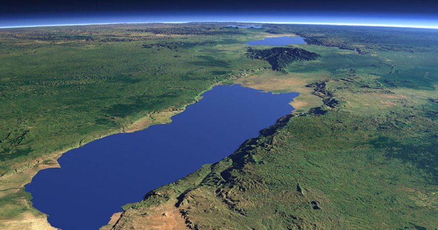
- Lake Victoria (Uganda, Kenya, Tanzania) – The largest lake in Africa, Lake Victoria was formed due to warping of the Earth’s crust. It is a key water source for the Nile River and supports millions of people through fishing and agriculture.
- Lake Tanganyika (Tanzania, Burundi, DRC, Zambia) – The second deepest lake in the world (after Lake Baikal), this rift valley lake was formed by faulting. It holds some of the clearest freshwater and is home to many endemic fish species.
- Lake Turkana (Kenya, Ethiopia) – A tectonic lake that sits in a desert, making it one of the most saline large lakes in Africa. It supports a unique ecosystem and is crucial for local pastoralist communities.
4. Lakes Produced by Human Activities
Humans create artificial lakes (also called reservoirs) by constructing dams, diverting rivers, or excavating land to store water for domestic, agricultural, and hydroelectric power generation.
Examples from East Africa:
- Lake Kyoga (Uganda) – Though partially natural, Lake Kyoga’s water levels are regulated by the Nalubaale Dam, making it a hybrid natural-artificial lake.
- Lake Kariba (Zambia-Zimbabwe, but influencing East Africa’s energy supply) – One of the largest man-made lakes in the world, created by damming the Zambezi River to generate hydroelectric power.
- Masinga Dam (Kenya) – An artificial reservoir on the Tana River, part of the Seven Forks hydropower project, providing water for irrigation and electricity generation.
Lakes produced by tectonic movements
Tectonism refers to the forces originating from the interior of the earth, which lead to faulting, volcanicity and warping. These forces have been responsible for the formation of various depressions occupied by water called lakes.
Lakes formed by faulting
Faulting refers to the fracturing of the earth's crust leading to vertical and horizontal displacement of rocks. As noted on page 39 convectional currents due to radioactivity and geochemical reactions lead to the formation of tensional and compressional forces which explain the origin of fault lakes.
All the lakes resulting from faulting occur in the East African rift valley e.g. L. Turkana, L Baringo, L. Naivasha in Kenya L. Tanganyika, L. Malawi and L. Eyasi in Tanzania and L. Albert, L. George and L. Edward in Uganda. Most fault lakes are elongated, steep sided and of great depth. All the lakes lie on the floor of the rift valley. Some of the fault lakes are discussed further below.
Lake Tanganyika
Lake Tanganyika is bordered on the north by Burundi, on the east by Tanzania, on the south by Zambia, and on the west by the Democratic Republic of the Congo. The lake, 680 km long, and is the longest freshwater lake on the earth. The width of the lake is relatively narrow, varying from 16 to 72 km. The greatest depth is 1,436 m (4,710 ft), making it one of the deepest lakes in the world. The lake is fed by rivers such as Malagarasi, Ruzizi, Kalambo, Ugala and Rugufu.
Lake Albert
Lake is located in western Uganda and north eastern Democratic Republic of the Congo. It covers a total area of 5,350 sq km and the surface of the lake is 600 m (2,000 ft) above sea level. The lake is 160 km long and about 35 km at the widest part, with no depth exceeding 17 m. The lake is bounded by fault scarps e.g. the Butiaba scarp and fed by rivers such as the Nile, Semliki, Nkusi, Muzizi, Wasa, Waiga, Wambabya and others.
Lake Edward
Lake Edward is located at the boarder and share by Uganda and the Democratic Republic of the Congo. It has an area of about 2150 sq km and is connected on the northeast with Lake George by means of the Kazinga Channel. The lake surface is at an altitude of 912 m above sea level. The Rutshuru River, a headstream of the White Nile, feeds the lake. Others rivers feeding the lake include Nyamweru, Ishasha, Birira, Nyamugasani and Nchwera. The lake has only one outlet, the Semliki River, which links it with Lake Albert to the north. High escarpments run along the western shore of the lake and the Rwenzori Mountains rise on the north-western shore.
Lake Turkana.
This lake is located in northern northwestern Kenya, with the northernmost tip in southwestern Ethiopia. The lake is a massive inland sea, covering nearly 6,400 square kilometers, making it the largest desert lake in the world. This single body of water is more than 250 kilometers long, comparable in length to the entire Kenyan coast. It is fed by rivers which include the Omo River, from the north, but has no outlet.
Lake Malawi
Lake Malawi lies between Malawi on the west and Tanzania and Mozambique on the east. It is 580 km long and an average of 40 km wide. The area of the lake is estimated at 22,490 sq km and its surface is about 472 m (about 1550 ft) above sea level. An outlet of Lake Malawi flows into the Zambezi River.
Lake Magadi
This is the southernmost lake in the Kenya rift valley, lying in a catchment of faulted volcanic rocks. Lake Magadi is 30 km long and 3.2 km wide. During the dry season, it is 80% covered by soda. The lake is an example of a "saline pan". The lake water, which is dense sodium carbonate brine, precipitates vast quantities of the mineral sodium sesqui-carbonate. In some places, the salt is up to 40 m thick. The lake is recharged mainly by saline hot springs that discharge into alkaline "lagoons" around the lake margins, there being little surface runoff in this arid region. Most hot springs lie along the northwestern and southern shorelines of the lake. During the rainy season a thin layer of brine less than one meter covers much of the saline pan, but this evaporates rapidly leaving a vast expanse of white salt that cracks to produce large
Formation of fault lakes
Several theories can be used to explain the formation of fault lakes. However, the tensional theory is used here. Tensional forces pulled the earth's crust apart on either side of a central block leading to the formation of normal fault lines. This was followed by the gradual subsidence of the central block to form a rift valley. This primary faulting was followed by secondary faulting on the floor of the rift valley. This tensional forces again acted on the layers of the earth crust forming the rift valley leading to the formation of normal fault lines. As the central subsided, depressions were formed on the rift valley floor. These depressions were later filled with water from inflowing rivers and rainfall to form rift valley lakes.

Compressional forces on the other hand push the earth's crust together from on either side of a central block leading to the formation of reversed fault lines. This was followed by the gradual subsidence of the central block to form a rift valley. This primary faulting was followed by secondary faulting on the floor of the rift valley. Depressions are formed on the rift valley floor which are later filled with water to form fault lakes.
Sometimes faulting is accompanied by tilting of the land on the side of the rift valley, as in step faulting. If there happens to be more than one tilted block water may collect at the base of the higher tilted block to form a lake e.g. Lake Ol Bolossat on the northern western corner of the Abadere ranges.
Lakes resulting from vulcanicity
These include crater lakes, caldera lakes and lava dammed lakes.
Lava dammed lakes
Lava dammed lakes are formed by a quiet eruption of basic lava through numerous fissures thereby cooling and solidifying in a valley to block a drainage system or river. Water collects behind the solidified lava to form lakes the same shape as the valleys. Lake Mutanda for example was formed by lava flow from the Sigitwe volcanic cone and blocking a river.

Most lava-dammed lakes are small, winding and deep. Lake Bunyonyi in Kabale is about 25 km long, 7 km wide with a depth varying between 44-99 meters. Other lava-dammed lakes include Chahafi, Murche and Kayumba in Kisoro.
Crater lakes
Crater lakes are roughly circular steep sided lake basins. They are generally small with a low rim of pyroclasts and local rock usually less than 50 meters high. The basins or hollows are formed by violent gaseous explosions which remove the overlying crystalline rocks forming wide circular depressions, which are eventually filled by water to form lakes, e.g. in the Lake George-Edward region there are over 200 explosion craters many of which have small lakes such as Lakes Katwe, Nyungu, Nyamsingire, Nyamunuka, Kikorongo and Kyamwiga. Crater lakes are also formed on the summit of dormant and extinct volcanoes e.g. Kilimanjaro and Elgon.
Crater lake.
Caldera lakes are similar to crater lakes in that they are roughly circular, steep-sided lake basins. However, they are larger and surrounded by a high rim of pyroclasts and local rock. The basins or depressions are formed when vents are blown by violent gaseous explosions through the country rocks. They can also be formed when the weight of the overlying cone becomes too great and it collapses in the chasm beneath the volcano. Once filled with water caldera lakes are formed eg Lakes Ngozi, Embagali and Ngorongoro in Tanzania.

Lakes formed by warping
These lakes occupy basin-like depressions formed as a result of warping. The lakes are characterised by being large in area but with a shallow depth. Lakes Kyoga and Victoria are examples of lakes formed by crystal warping and uplift. Lake Victoria is a very large lake in East Africa occupying areas in Uganda, Kenya, and Tanzania.
It has an area of 69,490 sq km and lies 1,130 m (3,720 ft) above sea level. The lake is 337 km long at its greatest length, and stretches about 240 km at its greatest width, with amaximum depth of 82 meters. Victoria is the world's second largest freshwater lake, after Lake Superior. It derives its water from several rivers such as Kagera, Katonga, Nzoia, Yala, Nyando, Sondu, Mogusi and others. The lake is drained by the Nile River.
Lake Kyoga on the other hand is located in the mid-center of Uganda. It covers a total area of 7,090 sq miles and lies in flooded branches of the low western flowing Kafu River. The lake is saucer-shaped with a depth not exceeding 5.7 meters deep. It is fed by rivers such as Kafu, the Victoria Nile, Adip, Lumbuye and others.
Before the formation of these lakes, Uganda was drained by a sub-parallel drainage system. Major rivers such as Kafu, Kagera and Katonga were flowing westwards to the Congo Basin. During the Pleistocene period there was warping of the central and south eastern parts of Uganda and uplift of the western and eastern regions. The warping and uplift forces are derived from the convectional currents within the earth's interior.

As already noted earlier, the interior of the earth behaves like a giant convective system due to high temperatures generated from geo-chemical and radioactive heat. The sinking convectional currents pull the earth's surface towards the core forming down warped basins while the rising currents lead to uplift. Rivers, which were flowing westwards, reversed and flowed into the down warped basins and formed to form L. Victoria and L. Kyoga.
Other lakes formed in the process as a result of drainage reversal include Kachira, Nakivali, Mburo, and Kijanebalola in western Uganda.
Lake-hollows produced by erosion
Lake-hollows produced by erosion include glacial lakes, rock basins and solution lakes.
Glacial erosional lakes
There are at least two types of glacial erosional lakes in East Africa:
Cirque or corrie lakes
These are lakes which are semi-circular in shape with steep sided rock basins. Most of them are small but with back walls of hundreds of meters high. These lakes are formed when a pre-glacial hollow has been progressively enlarged by alternate freezing and thawing causing the rocks around its margins to disintegrate. Melt-water helps to move the resulting debris, which further enlarges the hollow. Alternate freezing and thawing helps to eat both into the back-wall of the cirque, thus maintaining its steepness, and also into its floor, thus maintaining the basin shape. The deep, rounded hollows formed are filled with water to form lakes, which sometimes are referred to as tarms e.g. Lac du Speke and Lac Catherine on Mt. Rwenzori, Teleki and Michaelson on Mt. Kenya and Mawezi tarn on Mt. Kilimanjaro.
Trough or ribbon lakes
These lakes occupy elongated hollows executed in valley bottoms by glaciers. They are called ribbon lakes because of their shape e.g. Sacred Lake on the northern slopes of Mt. Kenya.
Rock basins.
The uneven excavation of the bed rock of glacial valleys due to varying weight of glaciers and differences in rock type result into the formation of rock basins. Once filled with water, lakes are formed e.g. Lake Michaelson on Mount Kenya and Lac Vert on Mount Rwenzori.
Solution lakes
The removal of certain rocks in solution may produce hollows, which can contain small lakes. As rain falls, it combines with carbon dioxide in the atmosphere to form a weak carbonic acid. This carbonic acid decomposes limestone rocks and removes them in solution leaving depressions. The depressions are filled with water to form solution lakes. Small solution lakes can be seen at Nyakasura in western Uganda and Kambe area near Kilifi in Kenya.
Depositional lakes
These are formed when depositional materials block a channel or inlet of some kind, thus trapping water to form a lake. The various categories include ox-bow lakes, delta lakes, moraine dammedlakes, kettle lakes and others.
Ox-bow lakes
These are small lakes of crescent shape found along a meandering river, which is usually in its old stage. Mature rivers meandering across a flood plain often produce cut-offs, which in time get separated from the river to become ox-bow lakes. Examples can be found in the lower valleys of rivers Tana, Nyando, Nzoi, Rwizi, Mpanga, Rufigi and Semliki. Lower River Tana in Kenya has ox-bow lakes such as Lake Gambi, Lake Bilisa, Lake Mukunguya and others.
Delta lakes
These are small, shallow lakes found where rivers join the sea/lake. In the formation of deltas the deposition of alluvium by the rivers may cause part of the sea to be surrounded thus turning it into a lagoon or it may isolate part of a distributary thus forming a lake e.g. Lakes Magomeni and Mwananyomara on the Tanzanian coast.
Moraine-dammed lakes
Moraine is material or debris carried down by glacial erosion. Terminal moraines are sometimes deposited across a valley where they form a ridge, which dams back the flow of water. Lakes resulting from these are called moraine-dammed lakes e.g. Lac Gris in the upper Kamusoso valley and Lake Bujuku on Mt. Rwenzori. Lakes Alice, Hut, Hohnel and Ellice occur on Mt. Kenya. Most moraine-dammed lakes are very small e.g. Tyndall moraine-dammed lake on Mount Kenya is only 100 meters long.
Wave depositional lakes
These are formed where spits or bars produced by wave deposition build up across inlets cutting off indentations in the coast thus producing lagoons. For example Lake Nabugabo near Masaka was cut-off from Lake Victoria by a bay bar. Another lagoon lake can be seen at Tonya point on Lake Albert.
Kettle Lakes
These are small, circular hollows filled with water in glaciated areas. They are formed when large blocks of ice are deposited together with till in glaciated regions. The subsequent melting of the ice block leaves on depression called a kettle. The kettle may be filled with water to form a kettle lake for example Lake Mahoma on Mt. Rwenzori and Lake Ellis on Mt. Kenya. Most kettle lakes are very small e.g. Lake Mahoma is about 300 meters in diameter and less than 10 meters deep.
Landslides and other debris depositions
These include numerous small lakes from the deposition of materials by mass movements and other debris. Such lakes are characterised by being small and short lived. Lake Nyabihoko in western Uganda was formed as a result of deposition of alluvial fans at either ends
Man-made lakes
Open cast mining results in the development of depressions, which sometimes collect water to form lakes e.g. numerous small lakes at Kajansi on the shores of Lake Victoria.
By building dams across rivers, man has deliberately constructed artificial lakes called reservoirs e.g. in Tanzania River Pangani was dammed in order to store water for irrigation and a lake was created behind the dam. Probably the best example of a man made lake in East Africa is the Kabaka's lake in Kampala justoutside Lubiri.
Economic importance of lakes
Lakes and connecting river systems often form important natural routes for the movement of people and goods. Lake Victoria in East Africa is an important waterway with ports at Kisumu, Mwanza, Bukoba, Jinja and Port Bell.
Lakes, both natural and man-made, can and often are used for generating hydro-electric power. Lake Victoria is a reservoir for the Nile River which is used for generating electricity at Kiira, Nalubaale and Bujagali dams in Jinja.
Many lakes are rich in fish and important source of proteins e.g. tilapia and Nile perch are derived from Lakes Victoria and Kyoga while daaga if derived from Lake Tanganyika.
Lakes are important sources of rivers used for a wide variety of purposes e.g. Lake Tana is the source of the Blue Nile while Lake Victoria is the source of the Victoria Nile. In addition, rivers which contain large lakes seldom flood because the lakes can absorb the run-off when rainfall is heavy, while in times of drought the water in the lakes helps to a fairly steady flow of water.
Many urban and rural settlements obtain their water supplies from lakes both natural and man- made e.g. Lake Victoria providing water for Kampala, Jinja, Entebbe and Kisumu towns.
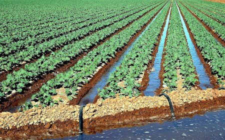
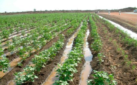
Lakes provide water for irrigation e.g. Lake Victoria provides water for the West Kano Irrigation Scheme and Kakira Sugar Plantation, while Lake Naivasha provides water for the horticultural farms near Naivasha.
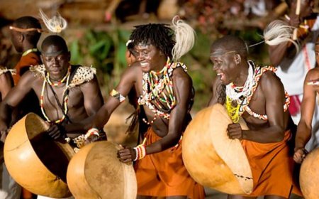
Lakes are important tourist attraction features. Lake Bunyonyi in south western Uganda is a case in point with its surrounding well-terraced hill slopes. Another example is Lake Nakuru with its vast flocks of flamingo birds.
Lakes are used as mining grounds. Lakes such as Magadi in Kenya and Katwe in Uganda are a source of salt. The shores of Lake Victoria are important sources of sand e.g. at Kajansi near Kampala.
Large lakes such as Victoria, Tanganyika and Malawi supply water vapour to winds passing over them and thus leading to the formation of rainfall of the nearby regions which promotes agricultural activities e.g. tea and sugar cane growing in Lugazi, Mukono and Buikwe north of Lake Victoria.Henry M. Kichodo
Disadvantages of Lakes in East Africa: Challenges and Impacts.
Lakes in East Africa play a crucial role in the region’s economy, biodiversity, and water supply. However, they also present significant challenges that affect communities, agriculture, and industries. Understanding these disadvantages is vital for sustainable management and conservation efforts.
1. Risk of Flooding
Many East African lakes experience rising water levels due to heavy rainfall, climate change, and human activities such as deforestation. Flooding can displace communities, destroy infrastructure, and damage farmlands.
Example: Lake Victoria (Uganda, Kenya, Tanzania) – In 2020, water levels rose to record highs, submerging homes, businesses, and ports, forcing thousands to relocate.
2. Spread of Waterborne Diseases
Lakes provide breeding grounds for disease-causing organisms, increasing the spread of malaria, bilharzia (schistosomiasis), and cholera. Poor sanitation and contamination further worsen the situation.
Example: Lake Kyoga (Uganda) – Communities around the lake suffer high rates of bilharzia due to freshwater snails that carry the disease. Lake Tanganyika (Tanzania, Burundi, DRC, Zambia) – Mosquito breeding in stagnant waters contributes to high malaria prevalence.
3. Loss of Agricultural Land
Fluctuating water levels often result in the loss of farmlands, threatening food security and livelihoods. Farmers struggle to relocate or adapt to changing conditions.
Example: Lake Baringo (Kenya) – Expanding waters have submerged agricultural land, leading to food shortages and loss of income for local farmers.
Some lakes in East Africa have been affected by invasive species that disrupt the ecosystem, threaten native fish populations, and reduce biodiversity.
Example: Lake Victoria (Uganda, Kenya, Tanzania) – The introduction of the Nile Perch led to the extinction of several native fish species, including many cichlids, disrupting the ecological balance. Lake Naivasha (Kenya) – The spread of invasive water hyacinth has reduced oxygen levels in the water, making it harder for fish and aquatic plants to survive.
5. Water Conflicts and Border Disputes
Many East African lakes are shared between multiple countries, leading to conflicts over fishing rights, water usage, and national boundaries.
Example: Lake Victoria (Uganda, Kenya, Tanzania) – Frequent conflicts arise between Ugandan and Kenyan fishermen over fishing zones and illegal fishing activities. Lake Turkana (Kenya, Ethiopia) – Water reduction due to Ethiopia’s Gibe III dam project has strained relations between Kenya and Ethiopia.
6. Salinization and Water Quality Issues
Some lakes, especially in arid areas, experience increased salinity, making them unsuitable for drinking water or irrigation. Pollution from industries and human activities further degrades water quality.
Example. Lake Nakuru (Kenya) – High salinity prevents its use for drinking or agriculture, and pollution from surrounding settlements threatens wildlife. Lake Turkana (Kenya, Ethiopia) – Rising salinity and reduced inflows from the Omo River affect fish populations and local livelihoods.
7. Unstable Fishing Industry
Overfishing and declining fish stocks threaten the livelihoods of millions who depend on lakes for fishing. Illegal fishing methods and lack of regulation worsen the situation.
Example: Lake Victoria (Uganda, Kenya, Tanzania) – Overfishing and illegal nets have drastically reduced Nile Perch and Tilapia populations, affecting fish exports and local economies.
8. Climate Change Impact
Lakes in East Africa are highly sensitive to climate change, experiencing changes in rainfall patterns, increased evaporation, and fluctuating water levels. This affects biodiversity, fisheries, and water availability. Example: Lake Chad (once partly in East Africa) – Has drastically shrunk due to climate change and human activities, serving as a warning for other East African lakes.
Conclusion
While lakes in East Africa support millions through fishing, agriculture, and tourism, they also present serious challenges such as flooding, waterborne diseases, invasive species, and conflicts. Proper management and sustainable conservation efforts are crucial to minimizing these disadvantages and ensuring that lakes continue to benefit future generations.