


Glaciation in East Africa: Landforms, Impact, and Key Examples.
Discover how glaciation shaped East Africa’s landscape. Explore key landforms like cirques and U-shaped valleys, the impact of glaciation, and notable examples such as Mount Kilimanjaro and the Rwenzori Mountains.
What Are Glaciers?
Glaciers are large masses of ice and snow, which form where temperatures are low enough to allow the falling snow to accumulate and slowly transform into ice. They also form in areas where the rate of snowfall exceeds the melting rate. They move slowly down a mountain along valleys under the influence of gravity until they finally melt.
The speed at which glaciers move depends on their temperature, amount of melt water at the bottom of the ice, the gradient of slope, thickness of the mass, type of glacier and its position within the valley and the nature of surface over which they move. Glaciers form above the snowline. The snowline is the border between those areas with permanent snow-cover, and areas in which snow does not remain throughout the year.
How Glaciers Form and Move
Glaciers originate from snow, which consists of frozen particles of water vapor. Over time, accumulated snow is compressed into a solid mass of ice, which then moves down mountains due to gravity. Most glaciers have a tongue-shaped form, being broadest at their source and narrowest at their terminus. Their general shape also conforms to the valley in which they lie.
The rate of movement is fastest at the center of the glacier because friction slows down the ice at the bottom and along the sides. As glaciers move, they collect rock fragments and other materials, which are eventually deposited when the ice melts. This process allows glaciers to perform erosion, transportation, and deposition, collectively known as glaciation.
Types of glaciers.
Glaciers are generally divided into several categories depending on their size and location.

Glaciers categorized by size.
Glaciers categorized by size include ice fields, ice caps, and ice sheets.
Ice sheets
Ice sheets are the largest ice masses found on earth, covering huge land areas. The Antarctica, surrounding the South Pole, has the largest ice sheets in the world. It is in fact estimated that this region has about 90 percent of the world's ice. The ice sheet in Antarctica cover 13 million sq km, is over 4 km thick and its weight has depressed the continent below sea level in many places. If this weight were removed, the continent would slowly rise and readjust itself, as Europe still does after the melting of the ice sheet that covered that continent during the last ice age (isostatic adjustment). If these ice sheet melted, the oceans of the world would rise by 60 meters.
Ice caps
Ice caps are smaller than ice sheets. They form when snow and ice fill a basin or cover a plateau to a considerable depth. There are many ice caps in the Canadian Arctic, Alaska, and other heavily glaciated areas. When these ice caps become thick enough, tongues of ice overflow the basins and discharge ice through valley glaciers.
Ice fields
1Ice fields develop where mountain peaks and ridges that project through the ice separate large interconnecting valley glaciers. Ice fields are common in Alaska, where they occupy up to 4,000sq km each.
Glaciers categorized by location
Glaciers categorized by location include: alpine, valley, and piedmont glaciers.
Valley glaciers
Valley glaciers flow from ice caps or originate in high mountain basins where snow accumulates. These are formed on highland peaks and upper valleys of mountain ranges. They are thus best developed in mountain regions. In Africa, small ice caps and valley glaciers exist on high mountains particularly on Mount Rwenzori in Uganda, Mount Kilimanjaro in Tanzania and Mount Kenya. Most valley glaciers move by sliding over the rock beds. Friction with the ground produces heat that in turn melts ice and helps to lubricate the sliding. U-shaped valleys are the most common landscapes that result from movement of valley glaciers.
Alpine glaciers
Alpine glaciers are also sometimes called mountain or cirque glaciers. They are located high upin the mountains and tend to be smaller than valley glaciers.
Glaciation in Africa: History, Locations, and Climate Impact
Glaciation in Africa: An Ancient Influence
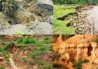
Although Africa is predominantly warm and tropical today, glaciation played a significant role in shaping its landscapes millions of years ago during the ice ages. When Africa was still part of Gondwanaland, large sections of the continent were covered by massive continental glaciers. These glaciers left behind deep deposits of tillite—a type of rock formed from glacial sediments.
Key regions where tillite deposits are found include:
- Southern Africa
- The Congo River Basin
- North-Western Sahara
During the last ice age, glaciers extended as low as 3,000 meters (10,000 feet). Today, however, they are found only at the summits of Africa's highest mountains, typically above 4,700 meters (16,000 feet).
Where Are Glaciers Found in Africa?
In East Africa, glaciers are confined to the continent's three highest mountains:
- Mount Rwenzori (Uganda/Democratic Republic of Congo)
- Mount Kenya (Kenya)
- Mount Kilimanjaro (Tanzania)
1. Glaciers on Mount Rwenzori
- Mount Rwenzori has the largest number of glaciers in East Africa, with approximately 37 glaciers.
- Major glaciers on Mount Rwenzori include:
- Stanley Glacier
- Speke Glacier
- Bujuku Glacier
- Mubuku Glacier
- Edward Glacier
- Baker Glacier
- Moore Glacier
2. Glaciers on Mount Kenya
- Mount Kenya has the second largest number of glaciers in East Africa, with around 12 glaciers.
- Notable glaciers on Mount Kenya include:
- Lewis Glacier
- Gregory Glacier
- Krapf Glacier
- Darwin Glacier
- Tyndal Glacier
- Forel Glacier
- Diamond Glacier
- Heim Glacier
3. Glaciers on Mount Kilimanjaro
- Mount Kilimanjaro is the highest mountain in Africa but has the fewest glaciers among the three.
- The key glaciers on Mount Kilimanjaro include:
- Kibo Glacier
- Great Penck Glacier
- Little Penck Glacier
- Drygalski Glacier
- Furtwängler Glacier
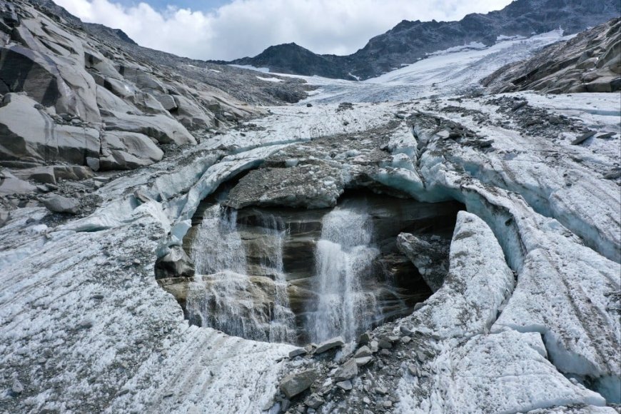
Climate Change and the Shrinking of East African Glaciers
Glaciers are highly sensitive to climate change, and those in East Africa are currently shrinking due to global warming. As temperatures rise, these glaciers are rapidly receding, threatening water sources, ecosystems, and tourism in the region.
WORK OF GLACIERS
Like rivers, glaciers perform the triple work of erosion, transportation and deposition, Glaciers are therefore one of the major agents of denudation, leading to the formation of several landforms.
GLACIAL EROSION LANDFORMS
These result from glacial erosion. Glaciers erode in a number of ways;

Plucking or exaration
This type of erosion involves the tearing away of blocks of rock, which have become frozen into the base and sides of a glacier. It is particularly common in areas with protruding and well-jointed rocks. It involves both vertical pressure by the overlying ice and down hill drag resulting from flow pressure in the direction of glacier movement. Plucking results into a jagged surface such as can be seen on the leeward side of rockie moutonees.
Abrasion
This type of erosion involves the wearing away of the surface by the grinding process of rocks embedded in the glacier. The debris frozen into the base of the glacier is dragged over the rock floor there by polishing and scouring it with deep scratches or striations. Abrasion is thus made more effective by the presence of large quantities of embedded debris in the glacier.
Basal slip
This is erosion by which glaciers slip and slide over the underlying rock floor there by polishing and scouring the surface. The basic difference between abrasion and basal slip is that the former has embedded debris acting as the grading tool while the later consists of force of moving ice.
Frost shattering
Freezing of water in rock cavities or cracks in mountain regions during night causes it to expand and shatter the surrounding rocks into small pieces. This loose material may fall from valley sides onto edges of the glacier to form lateral moraine. Mountain peaks and ridges which project above the ice such as Mt. Stanley and Mt. Baker on Mt. Rwenzori and Nelion and Piggot's peaks on Mt. Kenya are shaped by freeze-thaw.
WHY GLACIERS AND GLACIAL LANDFORMS HAVE DEVELOPED IN EAST AFRICA
1. Presence of high altitude areas. Temperatures decrease with increase in altitude. The three mountains mentioned above are as high as above 4700 metres above sea level, which is the permanent snow line in East Africa. Above this lime, glaciers do not melt. At such heights, temperatures fall below 0° in the upper slopes. The low temperatures have favoured freezing and the formation of glaciers. For glaciers to form, there must be heavy precipitation inform of snow. The high mountains in East Africa experience heavy orographic precipitation, which has favoured glacial formation.
2. As already noted, valley glaciers occur in valleys of high mountain regions. The presence of valleys and depressions in which ice accumulates has thus favoured glaciation. In addition, the slopes especially the steep slopes encourage movement of ice downwards under the influence of gravity.
3. The snowline in the Pleistocene period was much lower and glaciers descended to between 2,000 and 3,000 meters above sea level. This resulted into the formation of many glacial landforms.
4. Climate changes of alternating ice and warm ages or alternate glaciation and deglaciation. Ice ages are periods in the earth's history when ice or glaciers cove a significant portion of the planet's surface and significant cooling of the atmosphere occurs. The most recent ice age, the Pleistocene period, lasted from about 1.6 million years to 10,000 years before present. During these periods, glacial landforms were formed.
5. There were extensive glaciers that once existed have now decayed and retreated to the small patches on the summits of the three highest mountains of Kenya, Rwenzori and Kilimanjaro.
WHY GLACIERS ARE LIMITED IN EAST AFRICA
As already noted, in East Africa glaciers are found only in limited areas. They are confined only to the upper slopes of the three highest mountains i.e. Mt. Kenya, Mt. Rwenzori and Mt. Kilimanjaro. The limited coverage of glaciers in East Africa is attributed to the following reasons;
Latitudinal location: East Africa is located astride the equator where the sun is never far from the vertical. Temperatures are therefore hot all the year round. It is only in very high altitude areas that temperatures fall below 0°C that glaciers exist. The limited occurrence of very high altitude areas hence limits the occurrence of glaciers.
Altitude: Most of East Africa is a plateau lying below 3,000 meters above sea level. The snow line in East Africa lies at about 4,700 meters above sea level. It is therefore only Mt. Rwenzori, Mt.Kenya and Mt. Kilimanjaro peaks, which rise above this height.
Precipitation: The amount of precipitation received determines the amount of glaciers formed. Mt. Rwenzori is the shortest of the three mountains has the largest number of glaciers because of the heavy precipitation received on its slopes. The winds that ascend it blow from the Congo basin and they are moisture laden. When they ascend the mountain, they cause heavy precipitation. On the other hand, Mount Kilimanjaro the highest of the three mountains receives the least amount of precipitation. The winds that ascend it blow over a heated land surface and lose moisture hence causing low precipitation hence little glacial formation.
Global warming: Glaciers are very sensitive to climate change. Their size, life span, and history of growth and retreat all depend strongly on climate conditions. Since they are so sensitive to climatic changes they also serve as good indicators of climatic change. World temperatures are progressively
rising due to several reasons. One of them is the destruction of the ozone layer. This is a layer made up of three oxygen atoms, which absorbs most of the ultra-violet radiation coming from the sun. Without it, temperatures would be unbearable. This layer is being destroyed due to industrialization and other reasons. The rise in temperature has an effect of melting away glaciers. For example, the Semper glacier on Mt. Rwenzori has completely disappeared.
Aspect:
This refers to the direction of slope in relation to the sun. East Africa is located within the tropics hence having a very limited influence of aspect i.e. no protection of slopes from directheating by the sun.
Slopes:
Glaciers are mainly found on the windward slopes of mountains, which receive the highest precipitation. The winds that descend the leeward slopes are warm and dry and hence lead to little glacial formation.
Nature of precipitation:
Most of the precipitation in East Africa is in form of rain. For glaciers to form, the precipitation needs to be in form of snow.
Vulcanism:
Most highlands in East Africa are volcanic. Many of them are warmer than expected due to the hot interior. The warmth prevents the formation of glaciers on them e.g. Mt Kilimanjaro and Elgon.
Landforms resulting from glacial erosion
Corries, cirques or cwms
The name cirque is derived from a French word-meaning circle. Cirques are therefore steep-sided rock basins, circular in shape found in glaciated valleys and mountain sides. Most of then are small but with steep back walls and many now lie below the glaciated zone. They form when glaciers form in small pre-glacial hollows on mountain sides. These pre-glacial hollows are progressively enlarged by alternate freezing and thawing causing the rocks around its margins to disintegrate, a process, which is termed nivation. The melt water helps to move the resulting debris hence deepening the hollow. Plucking on the back wall helps to steepen the hollow while abrasion deepens the hollow, Water may collect in the hollow to form a lake called a tarn. Examples of tarns include Teleki,
Hidden, Simba and Square on Mt. Kenya, Lac du Speke, Lac Catherine L. Bujuku, Lac Vert and Lac Noir on Mount Rwenzori, and Mawezi, Karanga and South East tarns on Mount Kilimanjaro.
Arete
There are sharp, narrow steep-sided rock ridges separating two or more corries. They are formed as a result of head ward erosion of ice in two adjacent cirques cutting back into the mountain sides. The corries are cut back until a sharp knife-like edge is left behind which is the arêtes. The most prominent arête on Mount Rwenzori is one which starts from Peak of Mount Baker downwards for two kilometres and ends at the Bujuku valley. Point John and Midget peaks on Mount Kenya have well developed systems of radiating arêtes.
Pyramid Peak or horn
This is a sharp, jagged steep sided mountain peak found in glaciated up-lands. It has several arêtes radiating from it and it usually projects above a glacier. It is formed when three or more corries cut
back (back wall recession) into the original mountain sides leaving an isolated peak known as a pyramidal peak or horn. The peaks are sharpened by frost action. Examples include Nelion, Batian, Lenana, Midget and Sendeyo peaks on Mount Kenya, Margherita, Stanley, Speke, Albert, Alexandra and Baker and peaks on Mt. Rwenzori and Kibo peak on Mt. Kilimanjaro
U-shaped valleys or glacial troughs.
These are broad, flat-bottomed, steep sided valleys with roughly U-shaped cross profile. Most glacial troughs are former river valleys. Before glacial erosion, a river is winding between interlocking spurs and the valley cross profile is V-shaped. During glaciation the valley is filled with a glacier, which wears away the interlocking spurs by abrasion, plucking and basal slip as it down the valley. The valley cross profile is changed by this erosion from V-shaped to U-shape. Within the glacial troughs are many other landforms by both glacial erosion and deposition. Bujuku is the largest glacial trough on Mount Rwenzori.
This great glacial trough originated from the nearby glaciers notably Stanely and Speke glaciers. These formed a huge glacier that over-deepened and modified the Bujuku valley. Within this valley are landforms such as rock steps, roche mountonnee and several lateral, recessional and terminal moraines. Other troughs on Mt. Rwenzori include Mubuku, Mugusu, Kamusoso and Luzilube troughs. On Mount Kenya the glacial troughs include Hobley, Teleki, Gorges, Mackinder and Hausberg. In the Gorges Valley are several landforms notably cirques, rock steps and moraines. The Karanga and South East valley troughs occur on Mt. Kilimanjaro.
Truncated spurs
Interlocking spurs in glaciated mountain regions are often eroded into straight, steep slopes in U- shaped valleys known as truncated spurs.
Hanging valleys
These are tributary valleys left high above the main valley. They descend steeply into the main valley. They are formed when minor glaciers occupy the tributary valleys while major glaciers occupy the main valleys. Consequently, the main valleys are eroded much faster than the tributary valleys.
The tributary valleys are left high above the main valleys and hence termed hanging. Rivers flowing through tributary valleys have to plunge down the main valley through waterfalls e.g. the Nithi River is joined by one of its most important tributaries called Little Nithi from a hanging valley on Mt. Kenya via Vivienne waterfall. On Mount Rwenzori, the over flow of Lac Vert joins Kamusoso valley via a waterfall while melt waters from the Speak glacier joins the Bujuku trough via waterfall.
Rock steps
When a tributary glacier joins the main glacier, the additional weight of ice on the main glacier causes it to cut deeper at the point of convergence to form rock steps e.g. on Mt. Kenya the upper part of Gorges valley as far down as Vivienne falls is divided into sections by four rock steps. Similarly, the long profile of the Mubuku valley is broken by a series of rock steps.
Rock basins
The uneven excavation of the bod rock of glacial valleys due to the varying weight of glacier and differences in rock type result into the formation of rock basins. Some rock basins are filled with water to form lakes. For example, on the second step of the Gorges valley, the Nithi River is interrupted by a small waterfall. Below this fall, the valley has been over-deepened to form a rock basin now occupied Lake Michaelson. Other rock basins that have been occupied by water to form lakes are Lake Hohnel on Mount Kenya as well as Lac Noir and Lac Vert in the Kamusoso Valleyon Mount Rwenzori.
Striations or crevasses
These are irregular cracks that tend to open up where a glacier negotiates a bend or precipitous slope.
Roche moutonnee
This is a rock mass glacially moulded with a smooth gently sloping, rounded up-stream side, while the down stream slope side is rough and rugged. The up slope side is made smooth or polished by ice-abrasion while the down stream side, particularly if the rocks are well jointed is roughened by plucking and ice wedging. A large roche moutonnee over seven meters long is found on the upper floor of the Mubuku valley on Mount Rwenzori while another occurs in the Gorges valley on Mount Kenya.
Crag and tail
A crag is an outcrop of resistant rock obstructing the movement of glaciers and protecting the weaker rocks on the leeward slope from being eroded by glaciers. The obstacle rock forms the crag while the elongated protected weak rocks on the leeward slope form the tail. Crag and tail landforms are common on Mt. Kilimanjaro especially between Kibo and Mawezi peaks where parasitic cones have formed resistant obstacles.

Trough end
This is a steep rock wall forming an abrupt end of a glaciated valley above which lies several cirques. As the glacier straightens the valley, it also deepens it especially where several glaciers join forming a much larger and thicker glacier. The extra weight of the ice enables glaciers to carry out greater downward erosion, deepening the valley to form the trough end e.g. along the Mubuku valley on Mt. Rwenzori.
Glacial Depositional Landforms: Types, Formation, and Key Examples in East Africa
Glacial depositional landforms are created when glaciers transport and deposit materials such as rock flour, gravel, sand, silt, and boulders. These materials, collectively known as glacial drift, can significantly alter landscapes. The deposition of drift occurs when glaciers melt, leading to the formation of various landforms. These features are most common in glaciated lowlands, in contrast to glacial erosional landforms, which dominate upland regions.
Types of Glacial Deposits
Glacial deposits are categorized into two main types:
1. Till Deposits
These are sediments directly deposited by glaciers without being sorted by meltwater. Till consists of mud, clay, silt, sand, gravel, and boulders, and forms distinct landforms such as moraines.
2. Fluvio-Glacial Deposits
These materials are transported and deposited by glacial meltwater. Meltwater washes away finer particles such as silt and clay, while heavier materials like sand and gravel settle closer to the melting glacier. This process creates unique depositional landforms.
Key Glacial Depositional Landforms
1. Moraines
Moraines are accumulations of rock debris (till) deposited by a glacier. As glaciers advance, they transport these materials, which are then left behind when the glacier retreats. There are different types of moraines:
a) Lateral Moraines
- Form along the sides of a glacier as frost action and erosion break off rocks that accumulate at the glacier’s edges.
- Appear as elongated ridges of debris parallel to the glacier’s path.
- Notable examples in East Africa include Gorges Valley (Mt. Kenya), Teleki Valley (Mt. Kenya), and Bujuku and Mubuku Valleys (Mt. Rwenzori).
b) Medial Moraines
- Form when two glaciers merge, combining their lateral moraines into a single ridge of debris in the center of the glacier.
- Typically found in the middle of a glaciated valley.
c) Terminal Moraines
- These mark the furthest advance of a glacier before it starts retreating.
- Form when glaciers remain in one position for a long time, leading to the accumulation of large mounds or ridges of till.
- Typically more than 50 meters high and can extend several kilometers across valleys.
- Examples in East Africa include:
- Gorges Valley on Mt. Kenya
- Karanga and S Valleys on Mount Kilimanjaro
- Kamusoso and Nyamugasani Valleys on Mt. Rwenzori
2. Moraine-Dammed Lakes
- Moraine deposits can block valleys, forming lakes that are trapped behind glacial debris.
- Examples in East Africa include:
- Lake Alice on Mt. Kenya
- A moraine-dammed lake in the upper Kamusoso Valley on Mt. Rwenzori
Illustration
Ground moraine.
This is the moraine that is deposited over the valley floor. However, if the glacier retreats the terminal moraine is less clearly defined and a more or less horizontal sheet of ground moniformed.
Recessional moraines
Sometimes, terminal moraines are deposited in stages because the ice melts in stages. Brief pace or even of slight advances during a retreat result into recessional moraines.
Erratics
Erratics are boulders of varying sizes that were transported and deposited directly by glacie elsewhere when the ice began to melt. Most erratics are found in till plains. Erratics are so cal because they are composed of materials, which are very different from those of the region in whic they are deposited and discovered. They are of great help in tracing the source and direction of t ice movement e.g. the erratics below the junction of Nithi and Little Nithi rivers in the Gorges vale on Mt. Kenya and in the Kamusoso and Bujiku valleys on Mount Rwenzori.
Till plains.
Till plains are extensive areas of monotonous relief formed by direct deposition of materials glaciers. Former hills and valleys are buried by a thick layer of boulders, clay, sand and rock for deposited beneath the ice and plastered onto the sub-glacial surface by the pressure of the ice. Mis till plains are a result of accumulated deposits during several ice advances e.g. on the floord Mubuku and Bujuku valleys on Mt. Rwenzori. Very large areas of lowland regions in Canad Germany, Britain, Poland and northern U.S.A are today free from ice but covered by a layer of t forming till plains, on which most agriculture is carried on. In Canada, the till plains occur in the north eastern corner of British Columbia province, most of Alberta, the southern half of Saskatchewan, and the southern one-third of Manitoba, which is an important wheat growing region.
Kettles.
Kettles are depressions formed when an ice block is detached from the main glacier as it retreats. Such a block is then buried within the till plain by fluvial glacial deposits. The subsequent melting of the ice block leaves a depression called a kettle. Water may collect in the depression to form a kettle lake e.g. Lake Mahoma on Mt. Rwenzori and Lake Ellis on Mt. Kenya.
Drumlins.
Drumlins are low, elongated, oval-shaped hills of boulder clay parallel to the direction of ice movement. They are usually about one kilometre long and about 30 metres high. Most drumlins occur on till plains in large groups. Drumlins are formed as a result of friction between the rocks embedded in the ice and the solid ground rock and ground moraine. The detached layers are compressed by ice movement into elongated hills or ridges, which are oval called drumlins. They appear steeper on the on set side and taper on the leeward end e.g. in Teleki valley on Mt. Kenya. In Millom in northwest England, there are many developed drumlins.-
Eskers.
Eskers are long, narrow, winding ridges of sand and gravel. They are more than thirty metres high and several kilometres long. Most eskers are ice-contact features formed by rivers flowing beneath or within the ice. They develop in areas of stagnant ice where rivers maintain sub-glacial tunnels. Water flowing through such tunnels is under hydrostatic pressure making it impossible to carry a very large load, much of which is deposited within the tunnel. When the ice finally melts, it leaves long, winding steep sided ridges known as eskers. Others form where streams drop their load in a mound as they emerge from the ice front e.g. along river Nithi in the Georges valley and in the Teleki Valley on Mt. Kenya.
Outwash plains.
Outwash plains are wide gently sloping plains of gravel and fine sand. The deposits are often over 50 metres thick some with many small lakes. They are a result of enormous volumes of melt water spreading materials in great fans beyond the ice front (fluvioglacial deposits). Coarser gravel is deposited first while the fine sand is carried further e.g. in the Mubuku valley on Mt. Rwenzori, Hunde valley on Mt. Kenya and in the saddle between Kibo and Mawezi peaks on Mount Kilimanjaro.
Kame
Kames are irregular mounds or hills of sand and gravel. They vary greatly in size and shape and occur in isolation or in groups. They are ice-contact features formed in, on or at the margins of stagnant ice or glacier. They are formed by the uneven deposition along the front of a stagnant end of a melting glacier e.g. at the end of the Tyndal glacier on Mount Kenya and at the end of the Moore glacier on Mount Rwenzori.
Kame terrace
This a mound of gravel and sand, which was formed by the deposition of the sediments from a stream as it, runs from beneath a glacier. There are two broad types of Kame i.c. the Kame-terraces and the Kame-moraines. Kame-terraces are formed along the edge of the glacier ice. They are laid down by streams occupying a trough between the ice-tongue and the valley sides, forming narrow flat topped terrace like ridges e.g. in the Kamusoso and Mubuku valleys on Mt. Rwenzori and Hobley and Hunde valleys on Mt. Kenya. Kame moraine or Kame deltas on the other hand consist of undulating mounds of bedded sands and gravel arranged in a chaotic and complicated pattern.
Value of Glaciated Regions to Humans: Economic & Environmental Benefits in East Africa
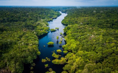
Glaciated regions, characterized by their ice-capped peaks, U-shaped valleys, hanging valleys, and glacial lakes, provide significant benefits to human activities. These landscapes are not just remnants of past ice ages but continue to offer economic, environmental, and social advantages. In East Africa, prominent glaciated mountains like Mount Rwenzori (Uganda), Mount Kilimanjaro (Tanzania), and Mount Kenya (Kenya) contribute to tourism, hydroelectric power, water resources, agriculture, and construction.
1. Tourism & Foreign Exchange
- The breathtaking scenery of glaciated regions in East Africa, including snow-capped peaks, plunging waterfalls, and hanging valleys, attracts thousands of tourists annually.
- Mount Kilimanjaro tourism and Mount Rwenzori hiking are major sources of foreign exchange for Tanzania and Uganda, with visitors paying for permits, guides, accommodations, and park fees.
- The Rwenzori Mountains National Park and Mount Kenya National Park are UNESCO World Heritage Sites, boosting eco-tourism in East Africa.
2. Hydroelectric Power Generation
- Waterfalls originating from hanging valleys provide ideal locations for hydroelectric power in East Africa.
- The glacial meltwater rivers from Mount Rwenzori and Mount Kilimanjaro water sources contribute to renewable energy generation in Uganda and Tanzania.
- Several rivers, such as River Nyamwamba in Kasese, have the potential for hydropower production, supporting industries and households.
3. Natural Routeways & Transport
- U-shaped valleys formed by glaciers create natural transport routes in highland regions, making movement easier.
- Climbers and hikers use glacial valleys on Mount Kilimanjaro and Mount Kenya as pathways to navigate the mountains.
- These valleys also serve as traditional trade and migration corridors for communities such as the Chagga of Tanzania and the Bakonzo of Uganda.
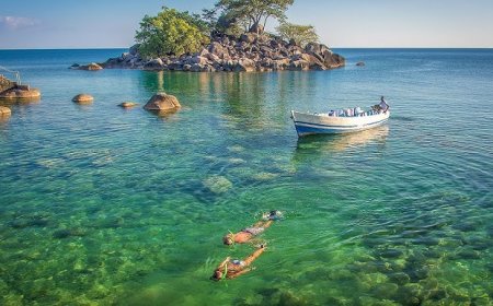
4. Water Supply & Fisheries
- Glacial lakes in East Africa, such as Lake Mahoma on Mount Rwenzori, act as natural reservoirs for domestic water supply and irrigation.
- These lakes influence rainfall formation in mountain regions, ensuring a steady supply of water for local communities.
- Some glacial lakes serve as fishing grounds, supporting food security and economic activities.
5. Irrigation & Agriculture
- Meltwater from glaciers provides a permanent water source for irrigation in East Africa.
- The Chagga farmers of Tanzania use Kilimanjaro meltwater to irrigate banana and coffee plantations, contributing to cash crop farming.
- Similarly, the Bakonzo people of Uganda depend on Rwenzori glacial meltwater for subsistence farming and food production.
6. Alpine Grazing & Livestock Farming
- Glacial valleys and plateaus offer rich pasturelands for alpine grazing, supporting cattle, sheep, and goat farming.
- Many highland communities in Mount Kenya and Mount Rwenzori regions depend on these alpine pastures for dairy and meat production.
- The cool climate and permanent water sources ensure the sustainability of livestock farming in East African highlands.
7. Construction Industry & Raw Materials
- Glacial deposits such as terminal moraines and outwash plains provide essential raw materials like sand, gravel, and stones for the construction industry in Uganda and Tanzania.
- In Kasese, Uganda, construction materials are extracted from Mount Rwenzori glacial deposits, reducing building costs.
- These materials are used for road construction, bridges, and urban infrastructure development.
Challenges of Living in Glaciated Regions: Lessons from East Africa
Glaciated regions, shaped by the movement of ice over thousands of years, present significant challenges for human settlement and economic activities. While such landscapes are often associated with regions like the Alps or the Arctic, East Africa also has its own glaciated areas, particularly on high mountain peaks such as Mount Kilimanjaro (Tanzania), Mount Kenya (Kenya), and the Rwenzori Mountains (Uganda and DRC). These areas illustrate the difficulties posed by glaciation, including:
1. Unsuitability for Agriculture
- Loss of fertile topsoil: Upland glaciation strips away the nutrient-rich soil, leaving behind rocky surfaces unsuitable for farming. For example, the high-altitude areas of Mount Rwenzori have barren land with little vegetation, limiting agricultural activities.
- Infertile soils in outwash plains: Glacial deposits in some areas contain stony and sandy soils that lack essential nutrients for crop growth. The lower slopes of Mount Kenya, though used for agriculture, have patches of infertile moraine deposits.
- Short growing seasons: The high-altitude glaciated regions in East Africa experience extremely cold temperatures, limiting the types of crops that can grow.
2. Creation of Extensive Wasteland
- Large portions of glaciated landscapes remain unproductive and uninhabitable due to extreme cold and rugged terrain. The Rwenzori Mountains, for instance, have vast stretches of land covered in ice, offering little opportunity for agriculture or settlement.
3. Lake Landscapes and Limited Land Use
- Morainic deposits create numerous lakes: The glacial lakes of Mount Rwenzori, such as Lake Kitandara and Lake Bujuku, are beautiful but occupy large portions of land, reducing space available for human activities.
- Difficult terrain for development: The irregular landscapes caused by glaciers limit infrastructure development, making road construction and human settlement challenging.
4. Natural Hazards: Avalanches and Glacial Movement
- Avalanches: Glaciers moving downhill on high-altitude mountains such as Mount Kilimanjaro can trigger landslides and rockfalls, causing destruction.
- Melting glaciers and flooding: The rapid melting of Rwenzori glaciers due to climate change has led to increased flooding and landslides in lower-lying areas, affecting communities and farms.
- Unpredictable climate: Sudden temperature changes in glaciated regions increase the risk of natural disasters.
5. Transport and Communication Challenges
- The steep and icy slopes of East Africa’s glaciated mountains make travel difficult, increasing transportation costs. Climbers attempting to reach the summits of Mount Kilimanjaro and Mount Kenya often struggle with extreme conditions.
- Remote glaciated areas in East Africa lack adequate communication networks, isolating local communities and making development difficult.
6. Economic Limitations
- Limited industrial development: The extreme conditions and rugged terrain prevent large-scale economic activities such as farming, mining, and manufacturing.
- High costs of infrastructure maintenance: Buildings, roads, and power lines in high-altitude regions like the Rwenzori Mountains face damage from freezing and thawing cycles.
Conclusion
While glaciated regions in East Africa, such as Mount Kilimanjaro, Mount Kenya, and the Rwenzori Mountains, attract tourists and provide important water sources, they present major challenges for agriculture, settlement, infrastructure, and economic development. Their harsh climate, infertile soils, and natural hazards limit opportunities for human activity, making them some of the most difficult environments to inhabit.
FAQs:
1. What is glaciation in East Africa?
Glaciation in East Africa refers to the process where ice and glaciers shaped the region’s high-altitude landscapes, particularly on mountains like Kilimanjaro, Rwenzori, and Mount Kenya.
2. What are the major glacial landforms in East Africa?
Key glacial landforms in East Africa include cirques, U-shaped valleys, moraines, and glacial lakes, mainly found in the high-altitude regions of the Rwenzori Mountains and Mount Kenya.
3. How has glaciation impacted East Africa?
Glaciation has influenced East Africa by shaping its topography, contributing to water sources, and affecting biodiversity. However, due to climate change, glaciers are rapidly melting.
4. Which mountains in East Africa have glaciers?
The Rwenzori Mountains, Mount Kilimanjaro, and Mount Kenya have historically had glaciers, although they are shrinking due to rising global temperatures.
5. Why are glaciers in East Africa disappearing?
Glaciers in East Africa are disappearing due to global warming, deforestation, and changes in precipitation patterns, leading to reduced ice accumulation.