


What Are Mass Movements in East Africa? Causes, Types, and Effects Explained"
Learn about mass movements in East Africa, including their causes, types, and effects. Understand how landslides, mudflows, and soil erosion impact the region’s environment and communities.

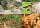
Mass movements is the creeping, flowing, sliding and falling of weathered debris and r materials down slope under the influence of gravity. The various kinds of down slope movements occurring under the pull of gravity are collectively termed as mass movements. There is no actual transportation agency such as running water and ice. The cause of movement is pull of gravity. However, the presence of water may act as a lubricant but not a transportation agent.
All such movements play an important role in the denudation of continental surfaces. They cause effects on the landscape sometimes graphically known as 'slope collapse' or 'slope failure'. The results of mass movements are referred to as mass wasting. Abundant evidence shows that on most slopes at least a small amount of downhill movement is going on at all times. In East Africa, areas mainly affected by mass movement are the highlands. In Uganda mass movements particularly landslides, have been reported in the mountainous areas in the west and east of the country, like. in the districts of Bundibugyo, Kabarole, Kasese, Mbale, Bududa, Bukwo, Manafwa, Sironko, Kabale, Kisoro and Kapchorwa.
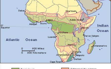
In Kenya the areas include the Eastern and Western Highlands, which are separated by the Rift Valley Basin. The highlands have an altitude, which varies from 1,500 to 5,200 m. The Western Highlands are marked by the Mau Hills (about 3,100 m), which occur in the central part of the area. Further north, the area is marked by the Cherangani Hills (about 3,400m) and Mount Elgon (about 4,300 m). The Eastern Highlands are marked by the Ndoto Mountains in the north, while the Aberdare Ranges (about 4,000 m) and Mount Kenya (about 5,200 m) mark the highest peaks in the central area of the eastern highlands.
In Tanzania, mass movements are common in isolated mountain groups that rise in the northeast and southwest. These include Mounts Kilimanjaro and Meru region, Pare, Usambara, Uluguru and Kondoa mountain regions, Ol Doinyo Lengai and the Southern Highlands.
Types of mass movements
There are two broad categories of mass movements:
1. Slow movements.
2. Rapid movements
SLOW MOVEMENTS
These are slow, almost imperceptible or cannot be easily noticed and act continuously over a long period of time.
Types of slow mass movements
Soil creep
Soil creep is the very slow movement of soil and very fine material on a very gentle slope under the influence of gravity. Any process that disturbs the soil and regolith causes them to move down slope under the influence of gravitational pull. What causes soil creep?

A number of processes each capable of producing only very slight movements combine to cause soil creep. Heating and cooling of the soil, growth of frost needles, alternate drying and wetting of the soil, trampling and burrowing by animals and others all produce soil creep.
During times of heavy rainfall, moisture increases the volume and weight of the soil, causing expansion and allowing the regolith to move down under the influence of gravity. In subsequent dry periods, the soils dry out and contraction takes place. In the case of frost action, the particles beneath the ice crystals are heaved up or lifted at right angles to the slope. On melting of the ice crystals, the particles fall back perpendicularly or vertically under the influence of gravity. This produces small movements of soil particles. In addition, if the ice crystals melt rapidly, particles tumble a short distance down slope. The diagram below shows the short distances moved by the soil particles.
illustration
There are various evidences to show the slow downhill movement of materials on a slope. These include tilted fence posts and telegraph posts on Kololo and Makindye hills, bent trunks of trees e.g. on the Nakasongola and Ngeta hills, turf rolls and over hanging banks above rivers and roads.
Soil creep is influenced by:-
Soil creep is a gradual, almost imperceptible downslope movement of soil and rock under the influence of gravity. This process is influenced by various factors that either promote or inhibit the movement of soil particles. Let's delve deeper into the causes you've listed:
1. Presence of scanty vegetation or absence of vegetation cover:
Vegetation plays a crucial role in stabilizing soil on slopes. Plant roots create an interlocking network that binds soil particles together, enhancing slope stability. In the absence of sufficient vegetation, this binding effect is lost, making the soil more susceptible to movement. Additionally, vegetation helps absorb excess water, reducing soil saturation and the potential for downslope movement. Without adequate plant cover, the soil lacks this reinforcement and moisture regulation, increasing the likelihood of creep.
2. Presence of very gentle slopes:
While steeper slopes are more prone to rapid mass movements like landslides, very gentle slopes are susceptible to slow processes like soil creep. On gentle inclines, the gravitational force acting on soil particles is sufficient to induce slow, steady movement over time. This gradual displacement is often imperceptible in the short term but becomes evident over extended periods.
Grazing of animals on the slopes:
The trampling action of grazing animals can disrupt the soil structure on slopes. Repeated trampling compacts the soil, reducing its cohesion and making it more prone to movement. Moreover, the disturbance of surface layers can dislodge soil particles, facilitating their gradual downslope migration. Over time, this contributes to the process of soil creep.
3. Burrowing by animals:
Burrowing animals, such as rodents and insects, disturb the soil by creating tunnels and voids. This activity loosens the soil structure, reducing its stability. The displaced soil from burrowing can be more easily moved downslope by gravity, especially when combined with other factors like rainfall or freeze-thaw cycles. The cumulative effect of burrowing contributes to the gradual movement characteristic of soil creep.
4. Alternate heating and cooling or wetting and drying:
Soil undergoes expansion and contraction due to temperature fluctuations and moisture changes. During periods of heating, soil can expand, and upon cooling, it contracts. Similarly, wetting causes soil to swell, while drying leads to shrinkage. These cyclical processes cause soil particles to move slightly with each cycle. On slopes, the net movement from these expansions and contractions tends to be downslope due to gravity, contributing to soil creep over time.
In summary, soil creep is influenced by a combination of factors that affect soil stability and movement. Understanding these factors is essential for managing and mitigating the impacts of soil creep on landscapes and human structures.
Solifluction or sludging
This refers to the slow movement of saturated soil, solid gravel and weathered rocks on a moderate slope under the influence of gravity. It takes place where the top layer of soil remains saturated and moves over a mass of underlying frozen ground which experiences alternate freezing and thawing. The thawing provides melt water which acts as a lubricant for the movement of materials. In East Africa, such conditions are limited to high mountain regions such as Rwenzori, Kilimanjaro and Kenya.
Solifluction is thus influenced by the following factors;
Solifluction is a type of mass wasting characterized by the slow, downslope flow of water-saturated soil, predominantly occurring in periglacial environments. Several factors influence this process:
1. Thawing of Saturated Surface Layers:
In periglacial regions, the seasonal thawing of the active layer—the top layer of soil above permafrost—results in a water-saturated layer. This saturated layer becomes mobile and can slowly flow over the still-frozen ground beneath, leading to solifluction. The degree of soil saturation and the depth of thaw significantly affect the rate of movement.
2. Presence of High Mountain Regions with Subzero Temperatures:
High-altitude mountainous areas often experience temperatures that drop below freezing, creating conditions conducive to permafrost formation. The cyclical freezing and thawing in these regions contribute to solifluction processes. The steepness of slopes in such terrains also plays a role, as steeper slopes can enhance the downslope movement of saturated soils.
3. Presence of Glacial Conditions:
Glacial environments provide the necessary conditions for solifluction by maintaining permafrost and facilitating freeze-thaw cycles. The melting of glaciers can lead to increased water availability, saturating soils and promoting their slow movement downslope. Additionally, glacial activity can create over-steepened slopes, further influencing solifluction rates.
4. Presence of Massive, Well-Jointed Rocks:
The geological composition of an area significantly impacts solifluction. Massive, well-jointed rocks can fragment due to freeze-thaw weathering, producing debris that mixes with soil. This mixture can become saturated and more prone to downslope flow. The joints in the rocks also facilitate water infiltration, increasing soil moisture and contributing to solifluction processes.
In summary, solifluction is influenced by a combination of climatic, geological, and topographical factors that together facilitate the slow movement of saturated soils in cold environments.
RAPID MOVEMENTS
These are sudden and rapid and they are of immediate danger to the surrounding areas. They involve downhill movement of surface material such as soil and rocks under the influence of gravity. They occur on slopes of more than 40° in angle. The various types of rapid movements are generally referred to as landslides.
Types of rapid movements or landslides
Slumping or slipping
Slumping or slipping refers to the rapid downhill movement of large masses of rock and debris along a curved slip surface, often resulting in the formation of a scarp, cliff, or roadside cuttings. This process involves the tearing away of material from a steep, concave upland, leaving a fresh scar on the hillside. Notable occurrences of rock slumps have been observed near Lake Magadi and in Bunyaruguru near Lake Nkugute in western Uganda.
Several factors influence the occurrence of slumping:
1. Availability of Large Massive Rocks Overlying Weak Rocks:
The presence of large, massive rocks situated above weaker, unconsolidated materials can create conditions conducive to slumping. The heavy, rigid rocks exert significant pressure on the underlying weaker layers, increasing the likelihood of slope failure. When these massive rocks become saturated with water, their weight increases, further destabilizing the slope and promoting slumping.
2. Presence of Steep Slopes:
Steep slopes provide the necessary gradient for gravitational forces to act on the accumulated materials. When the angle of the slope exceeds the angle of repose—the steepest angle at which loose material remains stable—the risk of slumping increases. Natural processes such as erosion or human activities like road construction can steepen slopes, making them more susceptible to slumping.
3. Presence of Scanty Vegetation:
Vegetation plays a crucial role in stabilizing slopes by anchoring soil and rock with root systems. Areas with sparse or no vegetation lack this natural reinforcement, making them more prone to erosion and slope failure. The absence of adequate plant cover allows weathering processes to weaken rock structures, facilitating their movement downslope.
4. Vibrations from Earthquakes or Heavy Moving Traffic:
Seismic activities and vibrations from heavy machinery or traffic can destabilize rock masses on steep slopes. In regions like Bundibugyo, seismic events have been known to trigger rock slides by loosening rock structures and reducing friction along potential slip planes. Similarly, continuous vibrations from heavy traffic can induce stress within rock formations, leading to slope failures.
5. Heavy Rainfall Leading to Saturation of Materials:
Heavy rainfall increases the water content within slope materials, reducing their cohesion and increasing their weight. This saturation can lead to the loss of friction along potential slip surfaces, facilitating the downslope movement of materials. The combination of increased weight and reduced cohesion makes the slope more susceptible to slumping.
Talus creep
Talus creep refers to the slow, downhill movement of angular rock fragments of various sizes on moderate slopes, driven by gravity. This process is similar to soil creep but involves coarser materials, typically larger than 2 millimeters in diameter
Several factors influence talus creep:
1. Availability of Large Talus Sheets Produced by Freeze and Thaw in High Mountain Regions:
In high-altitude areas like Mount Rwenzori, Mount Kilimanjaro, and Mount Kenya, freeze-thaw cycles play a significant role in the formation of talus. Water infiltrates rock fractures, freezes, and expands, causing the rock to fracture and break apart. These fragmented rocks accumulate at the base of cliffs, forming extensive talus sheets. Over time, these sheets are subject to gravitational forces, leading to their gradual downslope movement.
2. Climatic Conditions Favoring Freeze and Thaw Cycles:
Regions with climates that experience frequent freeze and thaw cycles, such as highland areas, are particularly susceptible to talus formation. The repeated expansion and contraction of water within rock fractures during freezing and thawing accelerate the breakdown of rock material, contributing to the accumulation of talus. This process is most effective in climates where temperatures fluctuate around the freezing point, allowing for the continuous cycle of freezing and thawing.
3. Presence of Gentle Slopes:
While talus accumulates at the base of steep cliffs, the subsequent movement of this material, known as talus creep, occurs on gentler slopes. The angle of repose—the steepest angle at which loose material remains stable—determines the slope's susceptibility to talus accumulation. Once the accumulated talus exceeds the angle of repose, it begins to move downslope under the influence of gravity, resulting in talus creep.
Rock slide
This refers to the sliding and slipping of large masses of rocks and other debris over steep slopes under the influence of gravity.
It is influenced by:
· Availability of Steep Slopes (e.g., Scarps, Cliffs, or Road Cuttings):
Steep slopes, such as those formed by faulting, create conditions conducive to rock slides. In regions like Bundibugyo and Kapchorwa, geological processes have led to the formation of escarpments and cliffs, which are particularly susceptible to such mass movements. Human activities, including road construction that involves cutting into slopes, can further steepen terrains, increasing the likelihood of rock slides.
· Presence of Scanty Vegetation:
Vegetation plays a crucial role in stabilizing slopes by anchoring soil and rock with root systems. Areas with sparse or no vegetation lack this natural reinforcement, making them more prone to erosion and slope failure. The absence of adequate plant cover allows weathering processes to weaken rock structures, facilitating their movement downslope.
· Vibrations from Heavy Moving Traffic or Earthquakes:
Seismic activities and vibrations from heavy machinery or traffic can destabilize rock masses on steep slopes. In regions like Bundibugyo, seismic events have been known to trigger rock slides by loosening rock structures and reducing friction along potential slip planes. Similarly, continuous vibrations from heavy traffic can induce stress within rock formations, leading to slope failures.
Rock fall
This refers to the falling down of individual rocks and boulders freely from steep slopes under the influence of gravity. This process is common in areas with significant elevation changes, such as cliffs, road cuttings, and mountainous regions like Mount Rwenzori and Mount Kilimanjaro. Several factors influence the occurrence of rockfalls:
It is influenced by:
1. Presence of Very Steep Slopes (e.g., Cliffs or Road Cuttings):
Steep slopes provide the necessary gradient for rocks to detach and fall freely. Natural formations like cliffs and human-made structures such as road cuttings create abrupt vertical or near-vertical faces, increasing the likelihood of rockfalls. The lack of support on these steep faces allows gravity to act more effectively on loosened rocks.
2. Availability of Well-Jointed Rocks Loosened by Freeze-Thaw or Weathering Processes:
Rocks with numerous joints or fractures are more susceptible to weathering processes. Freeze-thaw cycles, where water enters cracks, freezes, and expands, can progressively widen these fractures, leading to rock detachment. Chemical weathering can also weaken rock structures, making them more prone to falling.
3. Precipitous Slopes (e.g., on Mount Rwenzori and Kilimanjaro):
High-altitude mountainous regions often feature precipitous slopes that are prone to rockfalls. The combination of elevation, steep gradients, and geological conditions in these areas contributes to the frequency of rockfall events. Factors such as glacial activity and seismic events can further destabilize these slopes.
4. Presence of Scanty Vegetation:
Vegetation helps stabilize slopes by anchoring soil and rock with root systems. Areas with sparse or no vegetation lack this natural reinforcement, making rocks more susceptible to detachment. The absence of plant roots allows weathering processes to act more directly on rock surfaces, increasing the potential for rockfalls.
Mud flows
A mudflow is a type of mass wasting characterized by the rapid downslope movement of a water-saturated mixture of mud, soil, rock debris, and organic material. These flows typically occur on moderate to steep slopes and are often channeled through established pathways. Mudflows can reach speeds exceeding
15 km/h, making them particularly hazardous. In East Africa, significant mudflows, known as lahars, have been documented on the slopes of Mount Sabinio and Mount Elgon in Uganda, Mount Rungwe and Mount Meru in Tanzania, and Mount Longonot in Kenya.
illustration
Several factors influence the occurrence of mudflows:
- Availability of Large Volumes of Unconsolidated Material:
The presence of loose, uncemented sediments such as soil, volcanic ash, and weathered rock provides the necessary material for mudflows. These unconsolidated materials are easily mobilized when saturated with water, facilitating their rapid downslope movement. Volcanic regions, in particular, often have abundant loose tephra deposits that are susceptible to remobilization as lahars.
- Availability of Heavy Rainfall Leading to Super-Saturation of Material:
Intense or prolonged rainfall saturates the unconsolidated materials, increasing pore water pressure and reducing internal friction, which destabilizes the slope. In arid and semi-arid regions, sudden torrential rains can rapidly infiltrate dry, loose sediments, leading to their swift mobilization as mudflows. The rapid addition of water decreases the cohesion among particles, facilitating their movement under gravity.
- Presence of Scanty Vegetation:
Vegetation plays a crucial role in stabilizing slopes by anchoring soil with root systems and absorbing water. Areas with sparse or no vegetation lack this stabilizing effect, making soils more prone to erosion and movement. The absence of plant cover allows for increased water infiltration and reduces the mechanical binding of soil particles, thereby enhancing the likelihood of mudflows.
- Presence of Moderate or Steep Slopes:
The gradient of a slope significantly influences the potential for mudflows. Moderate to steep slopes provide the necessary gravitational force to propel saturated materials downhill rapidly. Steeper slopes increase the velocity of the flow and the energy available to entrain additional materials, thereby amplifying the impact and reach of mudflows.
California Department of Conservation
Understanding these contributing factors is essential for assessing mudflow hazards and implementing effective mitigation strategies in vulnerable regions.
Availability of large volumes of unconsolidated material.
Availability of heavy rainfall, which leads to the super-saturation of material. In arid and semi-arid regions sudden torrential rains sweep away any unconsolidated materials.
Presence of scanty vegetation.
Presence of a moderate or steep slope.
Earth flows:
This refers to the movement of saturated soil and other debris on steep slopes under the influence of gravity. It is similar to a mudflow except relatively drier. While similar to mudflows, earthflows typically involve less water content, resulting in a more viscous flow. Several factors influence the occurrence of earthflows:
It is influenced by:
1. Availability of Heavy Rainfall:
Prolonged or intense rainfall saturates the soil, increasing pore-water pressure and reducing the internal friction that holds soil particles together. This saturation leads to a decrease in shear strength, making the slope materials more susceptible to movement. The infiltration of water during and after rainstorms is a primary trigger for earthflow mobilization.
2. Presence of Steep Slopes:
Steep slopes enhance the gravitational force acting on saturated soils, facilitating their downslope movement. The combination of gravity and reduced shear strength due to saturation makes steep terrains particularly prone to earthflows. The angle of the slope directly influences the velocity and extent of the flow.
3. Presence of Scanty Vegetation:
Vegetation plays a crucial role in stabilizing slopes by reinforcing the soil with root systems and reducing surface erosion. Areas with sparse or no vegetation lack this stabilizing effect, making them more vulnerable to earthflows. The absence of plant cover allows for increased water infiltration and diminishes the cohesive strength of the soil, promoting instability.
In summary, earthflows are influenced by a combination of hydrological, topographical, and ecological factors that collectively reduce slope stability and facilitate the downslope movement of saturated soils.
Avalanches
This refers to the sudden downfall of materials embedded in the ice or glaciers on mountain slopes under the influence of gravity. It is common. in high altitude areas such as Mount Kenya and Mount Rwenzori which experience very cold temperatures and glaciers exist.
It is influencedby:
1. Very Cold Temperatures Below 0°C Favoring Glacial Formation:
Sustained subzero temperatures contribute to the accumulation and compaction of snow, leading to glacier formation. In these cold environments, snow layers can become unstable due to various processes, such as the formation of weak layers within the snowpack. These weak layers can act as failure planes, making the snowpack susceptible to avalanches when additional stress is applied.
2. Heavy Precipitation in the Form of Snow:
Significant snowfall adds weight to the existing snowpack, increasing the gravitational force acting on it. Rapid accumulation of snow can overwhelm the bonding strength between snow layers, especially if the new snow is not well-bonded to the underlying layers. This scenario is a common natural trigger for avalanches, as the added load can cause a weak layer to fail, resulting in a downslope movement of snow.
3. Presence of Steep Slopes:
The steepness of a slope is a critical factor in avalanche formation. Avalanches typically occur on slopes with angles between 30 and 50 degrees. On slopes less steep than 30 degrees, the gravitational force may be insufficient to overcome the frictional resistance of the snowpack, while on slopes steeper than 50 degrees, snow tends to slough off regularly, preventing significant accumulation. Therefore, slopes within the 30 to 50-degree range are particularly prone to avalanche activity.
In addition to these factors, other elements such as wind, temperature fluctuations, and the structure of the snowpack play significant roles in avalanche dynamics. Understanding these contributing factors is essential for assessing avalanche risks and implementing effective safety measures in mountainous regions..
CAUSES OF MASS MOVEMENTS
Climate
Climate influences weathering in a number of ways; If rainwater fills the pore spaces between individual grains in a deposit, the surface tension that assists in maintaining its cohesion will be diminished. Rainwater therefore acts as a lubricant and weakens the friction between rock particles and the ground surface thus promoting chances of movement. In addition, rainwater also adds to the bulk and weight of the mass on the slope, which promotes over loading hence accelerating the outward and downward motion. In Kenya landslides especially mudslides occur mostly during the rainy season and are accelerated by flooding. Usually they affect parts of the country like western, Nyanza and north Rift Valley provinces. However the most vulnerable areas have been the following: - Murang'a district in central province, Kirinyaga, Nyeri, parts of Meru, which are areas around the Mount Kenya region, Kisii and Mombasa Island. These are areas with annual rainfall of over 1200 mm and steep slopes. The mass movements are triggered by rapid saturation of the soil, which in turn reduces cohesion, surface tension and friction. The El Niño rains experienced between October 1997 and February 1998 exacerbated the landslide hazards. Other parts of East Africa which have experienced mudflows due to heavy continuous rains are Mount Sabinio in south western and Bulucheke in Uganda as well as Mounts Rungwe and Meru in Tanzania.
Temperature changes affect mass movements by influencing freeze and thaw processes in cold environments. When temperatures fall, ice forms and when temperatures rise it melts. On melting, water is added onto the rock particles in the active layer in the pre-glacial environment. This increases the weight of the material and enhances slippery conditions. Any external disturbances will get the mass rolling down slope under the influence of gravity e.g. the solifluction which occurs in the upper slopes of Mounts Rwenzori and Kenya.
Furthermore, when trapped water below the surface of the earth freezes during winter or night periods, its volume inevitably increases resulting into the exertion of pressure on the overlying rocks a process known as congeliturbation. As this process goes on, the surface of the earth is raised to form mounds or hills, which then roll down slope under the influence of gravity e.g, on the upper slopes of Rwenzori, Kilimanjaro and Kenya mountains. Temperature changes which lead to contraction and expansion or melting and drying all aid in the loosening of materials and their down slope movement.
Very low temperatures lead to the formation of glaciers. When they become too heavy they move downhill under the influence of gravity often carrying within them large quantities of debris (avalanches). These occur only on the three highest mountains of Rwenzori, Kilimanjaro and Kenya which have glaciers.
Gradient or angle of slope.
The gradient of the slope determines the rate at which materials move down slope under the influence of gravity. Mass movements such as soil creep occur on gentle slopes. It can be seen on hills in Nakasongola, Ngeta and Akai evidenced by bent tree trunks and turf rolls.
Mass movements such as solifluction, talus creep, and mud flows on moderate slopes. In East Africa mudflows are common on the slopes of Mt.Sabinio in Uganda, Mts Rungwe and Meru in Tanzania and Mt.Longonot in Kenya with moderate slopes.
Mass movements such as rock fall, rockslides, earth flows and slumping occur on steep slopes. On the slopes of the Aberdare Ranges and in the Mount Kenya region, most of the mass movements particularly landslides occur as a result of the interplay of several factors, including steep slopes, heavy rainfall and high-clay moisture-absorbing andosols (andosols are soils that form from volcanic ash and other volcanic materials)
In some cases steepening is caused by wave action, faulting and volcanicity. Mass movements have been triggered off easily in areas with steep slopes such as Mau and Elgeyo escarpments bordering the eastern rift valley in Kenya. Therefore the steeper the gradient, the more likely that mass movements will take place.
Type of rocks
The nature of the rocks has a great influence on mass movements. Rocks differ in terms of texture, permeability, joints and structure. Highly jointed rocks are susceptible to mass movements. The landslides which occur in the Coastal and Rift Valley basins of Kenya are partly a result of the area being constituted geologically by Mozambique belt rocks, which are a network of well-jointed and fractured metamorphic rocks.
Where a permeable rock layer over lie an impermeable rock, the later absorbs water and easily gets saturated and slides off the impermeable rocks. The absorption of water by the permeable rocks further leads to over loading. In addition, the additional weight and volume of water absorbed by the debris triggers off mass movements. This occurred between Limuru and Longonot in 1990 when a slump of pervious rocks blocked the railway line in Kericho District.
In the Tukuyu area of Tanzania, volcanic ash beds overlie basalt lavas. During heavy rains thewaterlogged ash layers slump and slide over the impervious lavas.
On the eastern slopes of the Aberdare Ranges, where the Gatara and Maringa landslides occurred, the highly permeable Miocene pyroclastic rocks which rest over the impervious Tertiary basalts became over saturated after continuous heavy rainfall hence promoting mass movements
Nature of soils
Clay soils have individual mineral grains that are microscopic in size and shaped like flakes. This makes their aggregate surface area much greater than their thickness and allows them to take up large amounts of water by adhesion, giving them plasticity and causing some varieties to swell. These soils absorb water increasing their weight and volume.
The absorption of water also promotes lubrication and slippery conditions triggering off downhill movement of materials under the influence of gravity e.g. the high-clay moisture-absorbing andosols on the slopes of the Aberdare Ranges and in the Mount Kenya region. Furthermore, softer soils on cliff tops on the slopes of Mount Kilimanjaro succumb to gravity when the soil becomes too wet to hold together.
Sandy soils are loose and consist of angular particles, which respond to temperature changes and creep. When heated, they expand more on the down slope side. This is because gravitational pull acts with expansion downwards. When temperatures fall, contraction takes place and it is more on the up slope side. This produces very slow movements termed as soil creep. It occurs on the upper slopes of Mt Rwenzori where large quantities of sandy soils are found.
Crustal instability
These include earth movements and vulcanicity which trigger off down hill movement of materials under the influence of gravity. The western and eastern rift valleys lie in areas of crustal instability and hence earthquakes and tremors are common. These trigger off downhill movement of materials on slopes under the influence of gravity. The earthquakes or tremors originate naturally within the earth's interior. They are one of the main causes of mass movements in Bundibugyo, Kabarole, Ntoroko and Kyenjojo in western Uganda. Similarly, earth tremors in some parts of the rift valley province of Kenya has provided wide spread movements of materials.
Over loading
Over loading especially on steep slopes subjects materials to down hill movement under the influence of gravity. Over loading is caused by a number of factors. Permeable rocks overlying impermeable rocks absorb water until they are saturated and overloaded. Any disturbances such as cultivation, movement of animals and vibrations lead to down hill movement of material for example; on the slopes of Mount Elgon. Weathering leads to the accumulation of debris on slopes and once it is not removed overloading takes place triggering off landslides such as rock fall and rock slide e.g. on mount Rwenzori.
Human activities
Various human activities lead to mass movements. These include the following;
Construction of communication routes.
Mass movements are common on the sides of railways and road cuttings especially in mountainous regions of Kapchorwa, Bukwo, Budadiri, Bududa, Manafwa and Mbale in the Mt. Elgon area in eastern Uganda, Kisoro and Kabale in south western Uganda and other mountainous regions in East Africa. Mass movements are common on the sides of hill or mountain slopes where roads or railway lines have been constructed. The vibrations caused by the heavy moving traffic together with the pull of gravity triggers off sudden and rapid downhill movement of debris on these slopes e.g. rock fall and rock slide. Notable areas include along Kabale - Kisoro road in south-western Uganda, Mbale-Kapchorwa road in eastern Uganda, and along the Fort Portal-Bundibugyo road. Other man's activities, which promote mass movements, include incautious quarrying and mining.
Deforestation
Tree roots and other vegetation matter help to bind together materials on the slope. Their removal will thus remove this binding effect. In many parts of East Africa, people have expanded their agricultural land to create room for their farm crops in formerly forested areas. This deforestation means that trees can no longer stop the earth from sliding down hillsides. When this happens many people are buried with the sliding mud. In Murang'a district there were reports of whole families being buried in the long rains of April and May in 2002 and 2003. On the slopes of Mount Elgon (Bududa, Bulucheke, Mbulambuli), Mt. Kilimanjaro and the Kigezi Highlands, deforestation is a major cause of mudflows and earth flows experienced.
Animal grazing
Slow mass movements such as soil creep result from the movement of domestic animals such as cattle grazed on slopes. As the animals move on the slopes they trample over the surface materials on these slopes making them unstable hence causing them to move down hill under the influence of gravity e.g. on the slopes of Kadam and Moroto mountains as well as on the Rwampara hills in Ankole and Kitara uplands in Bunyoro. In addition, movement of human beings across slopes triggers off some form of slow mass movement.
Mining and quarrying
The activities of man such as incautious mining and quarrying lead to the formation of steep slopes, which triggers off mass movements. In addition, explosives used to blast and break up rocks. Their impact is to shake up the ground thus triggering of down slope movement. Mining also weakens rocks making them prone to land slides e.g. mining of limestone in the Sukulu Bukusu hills in eastern Uganda and cobalt mining at Kilembe.
Poor cultivation method
Poor cultivation methods such as ploughing up and down hill slopes induce mass movements e in the Kondoa region of Tanzania. This is made worse by the presence of steep slopes Cultivation also involves the removal of the original dense vegetation cover which protected materials on the slope. originallyPopulation pressureAnother human activity that destabilizes already fragile slopes is population pressure and settlement built on steep slopes e.g. on the slopes of Aberdares and Mt. Kenya. Manjiya County on the Ugandan slopes of Mount Elgon is a densely populated mountainous area where landslides have been reported since the beginning of the twentieth century. Beside the fact that steep slopes, high rainfall and typical soil properties and stratification turn Manjiya into an inherently unstable area, human interference cannot be neglected. Whereas deforestation has reduced the stability of the shallow soils on the eastern slopes, the excavation of slopes, mainly for house building to absorb the increasing population, is an important destabilizing factor for the western slopes.
Mount Elgon area in eastern Uganda covers about 240 km2. The relief is characterised by steep slopes ranging between 2000 m to 4300 meters above sea level. These slopes have been cleared off the original forest cover and turned into farmlands. The population density in the area is very high and according to the population census of 2002 the population density ranges from 250-700 persons per km2. There is a high demand for land for farming and settlement, steep slopes. has forced some of the people Annual rainfall ranges between 2000 and 3000 mm and it is characterised by two peaks in April and September. All the above conditions make the area prone to mass movements.
In conclusion, mass movements are triggered off by both natural and artificial causes. The more rapid movements are triggered off by causes such as intensive rainstorms, earth tremors or earthquakes and the clear felling of trees. The slow movements are on the other hand mainly as a result of ploughing up and down hill slopes, burrowing animals, passage of grazing stock and human beings and such. Several factors thus come into play to induce mass movements. This can be seen by looking at the following mass movements which have occurred.
EFFECTS OF MASS MOVEMENTS
Mass movements in East Africa have been on the increase in the recent past. This has both social and economic impacts such as loss of life, agricultural land and crops as well as destruction of infrastructure. Landslides in particular tend to burry all that is their way resulting in destruction of life and property. They may burry or sink buildings, rubble and boulders moved to block roads, railways, and lines of communication or waterways. They may destroy all property along their way and render agricultural land unproductive. The casualties of mudflows, massive boulders, rocks and all that can be moved by the landslides may be thousands of people and animals. The major negative effects of mass movements are summarised below;
Loss of Life.
Loss of life for example in 1985, a landslide buried several people in Nyeri in Kenya. The Maringa landslide caused the deaths of 11 people, who were buried while they slept. This landslide occurred when deeply weathered pyroclastic rocks became over saturated and slid along their contact with the underlying impervious basalts. On 3rd January 1998 a major landslide also occurred along the Embu-Meru highway and washed away a 3-kilometer section of the highway. The landslide washed away a moving bus, which was carrying about 70 passengers into a deep ravine on the slopes of Mount Kenya and 36 passengers were killed. The rest were critically injured.
Displacement of people.
In May 2002 landslides and floods displaced at least 5,000 people in the Bundibugyo district in western Uganda. According to the Red Cross about 1000 families numbering about 5000 people were displaced by landslides, which pushed homes off slopes and buried others in valleys of the Bundibugyo district. The floods in the north west corner of the district drove people from their homes. In 2011, mudflows displaced thousands of people from Bududa and many were resettled in Kiryandongo in Masindi District.
Destruction of agricultural land and crops
Mass movements lead to the loss of the fertile top soils hence reducing the productivity of the land for agriculture e.g. in Bulucheke and Bubulo areas on the slopes of Mt Elgon, and in the Kigezi Highlands. On 26th December 1997, a landslide occurred at Gatara village located in Murangia, which swept away an estimated 50,000 tea bushes in addition to killing three people who were buried while asleep in their house.
Destruction of infrastructures
Mass movements especially landslides lead to destruction of infrastructures e.g. bridges, railways, roads, electric transmission and telegraph lines. In the 1990s a landslide blocked the Kapchorwa-Bukwa road hindering movement between Mbale and Kapchorwa. Similarly in 1989 and 1995, road links between Fort Portal- Bundibugyo, and Kabale-Kisoro respectively were cut of by blocked of deposited material as a result of mass movements. In Kenya, 10th November 1997, a landslide occurred along the Thika-Murang’a highway at Karugia, swept away a one-kilometer section of the highway down slope.
The most devastating landslide, however, occurred near the Kibwezi market along the Nairobi-Mombasa highway. The landslide damaged about three kilometers of the highway, is addition to destroying a major water pipeline which was constructed parallel to the highway. The Nairobi-Mombasa highway connects Mombasa town, which is a major port for the East Africa region and a famous tourist destination.
In addition to the above, on 10th November 1997, a landslide occurred along the Thiks Murang'a highway at Karugia, which swept away a one-kilometer section of the highway down slope. The landslide rendered about 356 km of arable land useless in addition to cutting off road and other communications between Thika and Murang'a towns, which are major administrative and commercial centres with very rich agricultural hinterlands.
Alteration of drainage
Materials deposited along a river channel have an effect of damming of rivers to form either temporary or permanent lakes. A lake was formed in the Mbaka Valley in southern Tanzania by a landslide but drained away when the water broke through the barrier. Lake Bujuku on the upper slopes of Mt Rwenzori is a lake formed by such deposition.In April 1973, a single, large landslide occurred in the catchment of the Morogoro River, Uluguru Mountains, creating a 300 m long and up to 10 m deep slide scar in a cultivated valley side.
The slide is a so-called bottle slide, with retrogressive slumping in the upper, wider part and episodic mud flowing through its narrower outlet and into a stream. High sediment concentration in the stream water damaged the water intake to Morogoro town and resulted in silt pollution in the tap water. A new water intake had to be built.
Loss of vegetation
Mass movements particularly landslides lead to the destruction of valuable forest resources. Not only are the forest resources lost but also valuable catchment areas e.g. in Bulucheke on the slopes of Mt.Elgon.
Positive effects of mass movements
1. Exposure of underlying rocks which promotes mining and quarrying activities e.g, the exposed rock in Bubulo on the slopes of Mount Elgon.
2. Exposure of fresh rocks to weathering which ultimately leads to soil formation. The soils formed sustain agricultural activities. In addition, the soils deposited on the lower slopes by soil creep and other types of mass movements tend to be fertile supporting agricultural activities Miwani-Chemilil-Muhoroni zone in the Nyanza Province of Kenya, owe the origin of their fertile soils to volcanic wastes washed from Nandi Hills.
3. Flooding and silting of lakes and rivers. The Semliki River for example often floods as a result of deposition of sediments derived from mass movements on Mount Rwenzori. This has resulted in building up of fertile flood plains for agriculture.
4. Various landforms result from mass movements. Slow movements such as soil creep lead to the formation of step-like features known as terracettes e.g. on the hills of Ankole. Scars on the other hand are hollows left behind on hillsides where rock debris has been removed e.g. along the Bahati scarp east of Nakuru in Kenya. Where the rock debris finally rests is a hummocky landform. The landforms resulting from mass movements are used for various purposes such as tourist attractions and research or study purposes.
MEASURES THAT ARE BEING TAKEN TO CONTROL MASS MOVEMENTS
1. Afforestation and re-afforestation is being practiced especially on steep slopes to hold the materials together. This is because the roots of the trees bind the soils and other materials together. This is being done in Mount Elgon Forest Reserve, in the Kigezi Highlands e.g. the Mafuga and Echuya forests.
2. In areas where the natural vegetation has been cut, cover crops are being grown such that the land is not left bare. In the Kigezi Highlands, crops such as sorghum, Arabica coffee and millet are grown while coffee and bananas are grown in the Pare, Usambara and Kilimanjaro regions of Tanzania.
3. Terracing involves the cutting of the slopes into a series of wide steps on which crops are grown. This reduces the steepness of the slope hence controlling mass movement. This method is widely used in the highlands of Kabale and Kisoro as well as Poroto mountains in south-eastTanzania.
4. Contour cultivation: Here crops are planted in furrows, which follow contours. This, like terracing reduces the incidence of mass movement. This method is widely used in the Kenyan Highlands.
5. Fertilizers and manures are used to maintain soil fertility and structure. The soil sticks together better, making it less susceptible to mass movement. Tea plantations grown on hill slopes in Mukono, Bushenyi, Mubende and Kericho are highly fertilized to maintain soil fertility and structure.
6. Restricting of some land use practices especially on steep slopes reduces the incidence of mass movements. In Kisoro and Kabale, settlements tend to avoid very steep slopes in preference for lower gentle slopes and valleys. Similarly, road construction on steep slopes is avoided where possible. In such areas, footpaths are more common.
7. Where roads have to be constructed in hilly areas, it is possible to reduce the danger of mass movements by various engineering measures such as revetment or fencing of stones and sand bags to protect the wall and the construction of drains to prevent the accumulation of water within the mass of material on the slope e.g. along the Mbale-Kapchorwa, Kabale- Kisoro road as well as Fort Portal - Bundibugyo road.
8. Sensitization of the population on the causes, dangers and measures of controlling mass movements is being done. In the Kapchorwa and Manafa regions on the slopes of Mount Elgon, sensitization is mainly done by the Mount Elgon Conservation Project. People are encouraged to plant trees and use energy saving methods which reduce the consumption of firewood. In Bundibugyo and other parts of Uganda, the FM Radio stations, Local Newspapers and Local council officials do the sensitization.
9. Filling in of any pits left after mining and quarrying as is being done in south-east highlands of Tanzania.
In conclusion, controlling mass movements in East Africa requires a combination of sustainable land management practices, effective community engagement, and engineering interventions. Efforts such as afforestation, terracing, and contour cultivation help stabilize slopes and prevent soil erosion. Additionally, proper land use management, like restricting settlement on steep slopes and regulating road construction, plays a key role in reducing the risk of mass movements. Fertilization of soils and promoting crop cover also contribute to maintaining soil structure, making it more resilient to landslides. Sensitization initiatives and education programs ensure that local populations are aware of the dangers and proactive measures to take. While challenges remain, these multi-faceted approaches continue to protect both the environment and communities from the devastating effects of mass movements.