


Climate in East African and Rest of Africa: Types of Climate & Characteristics.
Discover the diverse climate in East Africa and the rest of Africa, including equatorial, tropical, desert, and Mediterranean climates with their characteristics.

What is Climate?
Climate refers to the long-term average weather conditions of a particular region, typically measured over 30 years or more. It includes factors such as temperature, humidity, precipitation, wind patterns, and atmospheric pressure. Unlike weather, which changes daily, climate defines the general conditions of an area over extended periods. Climate plays a significant role in shaping the environment, agriculture, and livelihoods of people across Africa. The climate in East Africa, along with the rest of the continent, is characterized by a mix of equatorial, tropical, desert, and Mediterranean climate zones. Each climate type exhibits unique temperature, precipitation, and weather patterns. This article explores the major climate zones of East Africa and Africa, their defining characteristics, and the factors that influence them
Understanding Climate Zones
Climate varies significantly across the world—some areas are hot, others are cold, some are wet, while others are dry. Certain regions experience rainfall throughout the year, whereas others have distinct wet and dry seasons. To better understand these variations, the world is divided into climatic zones, each with unique temperature and precipitation patterns.
Major Climate Zones
Although there are no strict boundaries between climate types, the global climate can be broadly categorized into the following zones:
1. Equatorial Zone
2. Hot Zone
3. Warm Temperate Zone
4. Cold Temperate Zone
5. Cold Zone
6. Alpine Zone
Hot, Wet Equatorial Climate
Location
The hot, wet equatorial climate is found between 10° North and 10° South of the Equator. It is well developed in:
- Amazon Basin (South America)
- Congo Basin (Central Africa)
- East African Highlands (modified equatorial climate)
- Guinea Coast (West Africa)
- Parts of Central and Latin America
Climatic Characteristics
This climate is known for high temperatures and heavy rainfall throughout the year. Key features include:
1. Heavy Rainfall – Typically over 1,500 mm annually, often exceeding 2,000 mm.
2. Double Rainfall Maximum – Two peak rainy seasons, aligning with the equinoxes.
3. Convectional Rainfall – Afternoon rains accompanied by thunder and lightning due to the Intertropical Convergence Zone (ITCZ).
4. Orographic Rainfall in Mountainous Regions – Higher elevations receive even heavier rainfall.
5. High and Constant Temperatures – Annual mean temperature ranges between 26-27°C.
6. Minimal Annual Temperature Variation – The difference is only about 3°C throughout the year.
7. Small Daily Temperature Range – Around 7°C, making the temperature stable day and night.
8. High Humidity – Relative humidity is approximately 80% year-round.
9. Consistently Cloudy Skies – Overcast conditions are common.
10. No Distinct Seasons – The region remains in the Doldrums low-pressure zone all year.
11. Equal Day and Night Length – Around 12 hours of daylight and 12 hours of nighttime throughout the year.
12. Light Winds & Sea Breezes – Gentle winds dominate, with strong coastal breezes being a noticeable feature.
HOT ZONE
This type of climate is divided into three;
1. Tropical continental (Sudan) Climate.
2. Tropical Monsoon climate.
3. Hot Desert Climate
Tropical Continental (Sudan) Climate: Characteristics & Explanation
What is the Tropical Continental Climate?
The Tropical Continental Climate, also known as the Sudan Climate, is a type of climate found in regions located between 10° and 30° north and south of the equator. It is characterized by distinct wet and dry seasons, making it a transitional climate between the equatorial climate (which is wet year-round) and the hot desert climate (which is extremely dry).
Where is the Tropical Continental Climate Found?
This climate is best developed in the following regions:
- Central and East Africa – Including parts of Sudan, South Sudan, Uganda, Kenya, Tanzania, and Zambia
- East, Central, and South America – Found in regions like the Orinoco Basin in Venezuela and Colombia
- Northern Australia – Particularly in areas close to the tropical grasslands (savannahs)
Climatic Characteristics of the Tropical Continental Climate
1. Moderate Rainfall (750-1,000 mm Annually)
- The mean annual rainfall ranges between 750 mm and 1,000 mm.
- Rainfall is seasonal, with most of it falling during the summer months.
2. Distinct Wet and Dry Seasons
- The climate experiences two distinct seasons:
- Wet Season (Rainy Season) – Occurs in summer when the Intertropical Convergence Zone (ITCZ) moves overhead, bringing convectional rainfall.
- Dry Season (Winter Season) – Characterized by little to no rainfall as the ITCZ moves away, causing prolonged drought conditions.
3. Convectional Rainfall (Rainfall Coincides with the Overhead Sun)
- Rainfall occurs due to intense heating of the land, causing warm air to rise, form clouds, and result in afternoon thunderstorms.
- Areas closer to the equator receive more rainfall, while regions further away (poleward) experience less rainfall.
4. Hot Temperatures Throughout the Year
- Summers are very hot, with temperatures ranging between 31°C - 32°C.
- Winters are cooler but still warm, with temperatures between 21°C - 22°C.
5. Moderate Annual Temperature Range (9°C - 11°C)
- Compared to equatorial climates (which have minimal temperature variation), the tropical continental climate has a moderate temperature range of about 9°C - 11°C annually.
6. Large Diurnal Temperature Range (Hot Days, Cold Nights)
- Daytime temperatures are often very high, but nights are much cooler due to the loss of heat from the land.
- This results in significant temperature fluctuations between day and night.
7. Prolonged Drought During the Dry Season
- The dry season can last for several months, leading to water shortages and vegetation stress.
- This makes the region prone to bushfires, dust storms, and desertification if rainfall patterns shift over time.
8. Savannah Vegetation and Wildlife Adaptations
- The dominant vegetation in this climate is savannah grasslands, interspersed with trees like acacia and baobabs, which are adapted to long dry periods.
- Wildlife in these regions includes large herbivores like elephants, zebras, giraffes, and antelopes, as well as predators like lions and cheetahs.
9. Influence of the Intertropical Convergence Zone (ITCZ)
- The movement of the ITCZ controls rainfall patterns in this region.
- When the ITCZ moves northward during summer, the region experiences rainfall.
- When it shifts southward, the region enters the dry season, leading to drought conditions.
TROPICAL MONSOON CLIMATE
In some tropical and temperate latitudes, seasonal land and sea winds operate on a huge scale affecting both continents and oceans. These seasonal winds are called Monsoon winds. These winds are best developed in Central America, India, West Indies, Northern Australia and Eastern Brazil.
Characteristics of Tropical monsoon Climate
1. Annual precipitation is moderate but varies from place to place.
2. Rainfall is unevenly distributed, falling mainly in the summer with the bust of the south-westmonsoon.
3. Very heavy monsoon rainfall is concentrated in the wet season causing floods.
4. The dry season occurs when the monsoon blow off-shore. This is a period of drought and famine.
5. The mean annual temperature is high, being around 26° C.5.6.Mean annual temperature range is moderate.
6. Relative humidity is high during the wet season.
7. Snow and frost may be experienced in highland areas.
8. A typical monsoon climate consists of three seasons:-
9. The cool, dry season (November to February) when the off-shore north-east monsoon winds blow.
10. Hot, dry season (March to May) when temperatures are high because of the near overhead mid-day sun and when winds blow.
11. Hot ,wet season(june to October) when the on-shore south west monsoon winds blow and when rainfall is very heavy in regions receiving the full force and fury of on-shore winds. During this season, the clounds skies cause temperatures to fall a little, but humidity rises to it’s maximum for the year.
THE HOT DESERT CLIMATE
Hot deserts are located mainly on western parts of continents in the sub-tropical high-pressure belts between 200 and 30° North and South of the equator. They include the Sahara Desert, the Kalahari Desert, the Namib Desert, the Arabian Desert, the Thar Desert and the Atacama Desert.
Climatic characteristics.
· Annual rainfall is less than 250 mm, often only 125 mm, and it is practically rainless in most of the deserts.
· Rainfall is most irregular and unreliable. It normally occurs in thunderstorms of the conventional type.
· Flash floods may occur after a torrential down-pour.
· The deserts are some of the hottest spots on earth and have very high temperatures throughout the year. The average temperature is about 30°C in the hot deserts but lower in continental deserts.
· There is an extremely great diurnal range of temperature. There is intense insolation by day, followed by rapid radiation by night. Thus while days are very hot, nights tend to be very chilly. The daily temperature range is very large often 22° C and more.
· Coastal deserts with maritime influence and breezes have lower temperatures.
· The relative humidity in hot deserts is very low usually less than 30%.8.10.11.Coastal deserts are washed by cold currents and fog may develop when on-shore winds blow over them.
· Being in the sub-tropical high-pressure belt, the dry sinking air results in clear, blue, cloudless skies.
· The weather as a result, is consistently hot and dry.
· Coastal deserts washed by cold ocean currents develop fog when on-shore winds blow over them.
WARM TEMPERATURE ZONE
This type of climate occurs between 30°-45° North and South of the equator. It consists of:-
· Warm temperature western margin or Mediterranean climate.
· Warm temperate interior climate or stopper type of climate.
· Warm temperate eastern margin or China type of climate.
MEDITERRANEAN CLIMATE
This type of climate is located on the western portions of continents between 300 and 45° North and South of the equator. These areas include Central California, Central Chile, South-West Africa (around Cape Town), South-West Australia and countries around the Mediterranean shore land.
Climatic characteristics.
1. The areas with this climate have distinct seasons.
2. Summers are dry and hot, winters are cool/warm and wet.
3. Precipitation is moderate ranging between 600-1000 mm per annum.
4. The rain comes mainly from the Westerlies, which enter the Mediterranean region only in winter with the shift of the wind belt, caused by the sun being overhead at the tropics.
5. In winter, cyclonic storms are experienced. These bring heavy but infrequent rain, causing floods in many places.
6. There is little rain in summer as the trade winds are off-shore.
7. Rainfall is heaviest on the west, decreasing inland and least in the rain shadow areas.
8. The mean annual temperature is moderate, about 8° C but doubles in interior locations.
9. Very warm summers and blue skies. Daily temperatures of about 25° C are common.
10. Winters are mild with temperatures of about 14° C. Frequent depressions also cool the atmosphere.
11. Annual temperature range is moderate, about 8°C.
12. Fog is common off the coast where winds cross cold currents.
13. On highlands and in the middle of winter, frosts occur.
14. Many local winds most of which are hot and dusty.
STEPPE CLIMATE.
The Steppe type of climate is found in the Steppe and the prairies of North America. In the south hemisphere you find the milder climates of the Pampas, the African Veld and the Downs of Murray-Darling Basin. (Australia).
Characteristics of Steppe Climate.
1. The annual rainfall is light and varies from 380 mm to 700 mm. Pretoria for example receives 660 mm of rain while the continental interiors of Asia the amount is about 380 mm.
2. Rainfall is mainly convectional, falling mainly in the hot summer.
3. Summer precipitation is in form of rain showers while winter precipitation in the form of snow.
4. Warm summers with temperate of about 18° C, with maximum temperatures in July.
5. Cold winters with temperatures about freezing point or blow. Snow and frost are common.
6. The annual temperature range is great about 26°C in summer and 10°C in winter.
7. Evaporation is high in summer and this often makes irrigation essential for crop cultivation.
8. The local winds blow across miles and miles of rolling grassland almost without obstruction and are quite strong.
WARM TEMPERATE EASTERN MARGIN (CHINA TYPE)
This type of climate is found on the eastern margins of continents between 200 and 35° North and South of the equator. These regions include north and central China, southern Japan, south-east USA, south-east Australia, Natal, Southern Brazil and Uruguay.
Climatic characteristics of warm temperate climate1.2.Rainfall is moderately high between 762 mm and 1524 mm and fairly well distributed throughout the year.
Very often there are two periods of heavy rain. There is a distinct summer maximum from trade winds which are strongest in the hot season. There is also heavy rainfall from hurricanes and typhoons in autumn.
Snow may fall on the highlands but rarely is it significant.3.4.Warm summers.5.Mild winters.6.Annual temperature range is moderate.
COOL TEMPERATE ZONE
This type of climate is received between 45°-650 North and south of the equator. It is divided into three major categories:-
Cool temperate western margin (British type)
Cool temperate interior climate (Siberian type)
Cool temperate eastern margin (Laurentian type)
COOL TEMPERATE WESTERN MARGIN CLIMATE
This type of climate occurs on the western sides of continents between 450-60° North and South. It is best developed in North-western Europe, Western Canada, Tasmania and South island of New Zealand.
Characteristics of cool temperate western margin climate.
1. There is rainfall throughout the year.
2. Rainfall is moderate about 760 mm though in mountainous regions it is higher.
3. Rainfall comes mainly through the depressions or cyclones in form of cyclonic rain.
4. Rainfall is greatest in winter or autumn when the Westerlies are strongest.
5. There is a fair equability of temperature with no extremes due to the sea influence all around, Warm summers with temperatures of 13°-17°C.
6. Mild winters with temperature ranges between 2°C and 7°C.The annual temperature range is moderately small usually between 8° and 11°C.9.
7. Prevailing winds throughout the year are from the West, but they blow more strongly and persistently in winter.
8. Four distinct seasons i.e. spring, summer, autumn and winter.
COOL TEMPERATE INTERIOR CLIMATE
This type of climate occurs in the interior of North America and Eurasia between altitudes 35° North and 60° North. It is best developed in the provinces of Alberta, Saskatchewan, Manitoba in Canada, the north-central and mid-west of the USA, in central and Europe and western parts of the former USSR.
Climatic characteristics of cool temperate climate
1. Annual precipitation is low and rarely exceeds 513 mm.
2. Rainfall is mainly convectional and falls in summer.
3. There is no dry season as rainfall is distributed throughout the year.
COLD ZONE
TUNDRA CLIMATE
This type of climate is experienced in the Arctic and Antarctica circles, Greenland, Alaska, northern Arctic Canada, the Arctic seaboard of Eurasia and the Antarctica.
Climatic characteristics of tundra climate.
1. Very light precipitation less than 250 mm some of which falls as rain in summer and same as snow in the winter.
2. Very low mean annual temperature.
3. Large annual temperature range.
4. Short cool summers with long hours of day light all the time resulting into a small diurnal range of temperature.
5. In most stations, temperatures are below freezing for 8 months.
6. Long, bitterly cold winters are usual. Winter days are short that there are continuous hours of darkness.
7. Humidity is low because of the low temperatures.
8. Frost occurs all the year round.9.
9. Fog develops on coastal waters where warm winds blow over cold currents,
10. At the poles, the cold, dense, sinking air crates a high-pressure belt, winds blowing out to the temperature low-pressure belt as the Polar Easterlies.
11. In the Arctic regions, the snow accumulates to great depth building up ice sheets that never thaw.
ALPINE ZONEALPINE OR MOUNTAIN CLIMATE
This type of climate occurs in the highland regions of the world e.g. in the Himalayas, Alps, Rockies, Andes, the African highlands and all the major mountain ranges.
Climatic characteristics.
1. This type of climate is determined by the relief and altitude of the region.
2. Mountainous regions possess a number of micro-climates instead of a single climatic type.
3. A rise in altitude brings about a drop in temperature (lapse rate) at the rate of 1°C for every 165meters.
4. There is a very great diurnal range of temperature. Days are hot, even on snow-capped peaks and the nights are bitterly cold due to rapid radiation.
5. There comparatively small annual range of temperature as a result of temperature being quite constant in mountainous areas.
6. Heavy rainfall on the windward slope as orographic or relief rain.
7. Due to the rarefication of the air in the higher atmosphere, mountain tops experience intense sunlight. The sunny slopes can be very hot and the shady slopes can be very cold.
8. Pressure decreases as one ascends the mountain. High mountains therefore have lower pressure.
9. Cold, heavy air moves down the slope and accumulates at the valley bottom, pushing the warmer air upwards. Temperature inversion takes place.
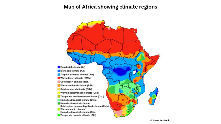
CLIMATE OF AFRICA
Most of Africa lies between the Tropic of Cancer and the Tropic of Capricorn and has high temperatures throughout the year. The amount, duration, and seasonal distribution of rainfall is therefore the most important factor differentiating its climates. The continent experiences a variety of climatic types most of which follow the other with each merging into the other region. These types include equatorial climate, tropical climate, hot deserts, Mediterranean climate, warm temperate eastern margin climate and alpine or mountain climate.

Lying between latitudes 37° north and 35° south, Africa has virtually the same climatic zones in the Northern Hemisphere as in the Southern Hemisphere, and they are arranged symmetrically on either side of the equator. The zones are determined mainly by latitude, except in the east where highlands greatly modify the climate. Only its northern and southern extremes are directly influenced by mid- latitude westerly winds and are considered to have temperate climates.
Equatorial Climate and Other Major Climate Zones in Africa
Africa experiences a variety of climate zones, ranging from tropical wet regions near the equator to desert and Mediterranean climates further away. These climate types influence temperature, rainfall, vegetation, and human activities across the continent.
1. Equatorial Climate (Tropical Wet Climate)
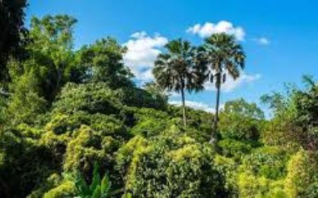
The equatorial climate, also called the tropical wet climate, occurs in West and Central Africa and parts of eastern Madagascar, close to the equator.
Key Characteristics of Equatorial Climate:
- High Rainfall: Annual rainfall typically exceeds 1,500 mm, with rain occurring every month—there is no completely dry month.
- Consistently High Temperatures: Average temperatures remain above 27°C annually, rarely dropping below 21°C.
- Humidity and Vegetation: Due to abundant rainfall, this climate supports dense tropical rainforests, including the Congo Basin.
2. Tropical Climate (Savanna Climate)
The tropical climate, also known as the savanna climate, occurs north and south of the tropical wet zone. It is found in much of West Africa, southern Africa, and most of Madagascar.
Key Characteristics of Tropical Climate:
- Distinct Dry and Wet Seasons: A well-defined dry season lasts between 3 to 8 months, followed by a rainy season.
- Moderate to High Rainfall: Annual rainfall ranges between 500 mm and 1,500 mm, with some areas receiving considerably more.
- Rainfall Variation:
- Areas with a long rainy season experience two rainy periods separated by a short dry spell.
- Areas with a shorter rainy season have one rainy period.
- High Temperatures Year-Round: Daily average temperatures exceed 30°C, making the region hot and humid.
- Vegetation: This zone supports savanna grasslands, which transition into semi-arid regions further away from the equator.
3. Desert and Semi-Desert Climate
The desert and semi-desert climate surrounds the tropical savanna climate, covering north-central Africa, east-central Africa, and southern Africa. The largest desert region is the Sahara Desert, spanning from the Atlantic Ocean to the Red Sea.
Key Characteristics of Desert and Semi-Desert Climate:
- Low and Unreliable Rainfall: Some regions go years without precipitation, making plant growth difficult.
- Extreme Temperature Variations:
- Semi-arid zones: Daily high temperatures range from 25°C to 36°C.
- Sahara Desert:
- Daytime temperatures can exceed 50°C in summer.
- Winter nights can drop below freezing.
- Sparse Vegetation: Due to the extreme lack of moisture, vegetation is adapted to arid conditions, such as cacti and drought-resistant shrubs.
4. Mediterranean Climate
The Mediterranean climate is found along the coastlands of the Cape region of South Africa and the North African coast from Morocco to Tunisia.
Key Characteristics of Mediterranean Climate:
- Seasonal Rainfall Pattern:
- Mild, rainy winters bring most of the region’s 600 mm to 1,000 mm of annual rainfall.
- Long, dry summers with warm conditions and little to no rain.
- Mild Temperature Variations: Winters remain cool and wet, while summers are hot and dry.
- Vegetation: This climate supports Mediterranean scrubland, vineyards, and olive groves.
CLIMATE OF EAST AFRICA
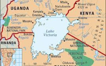
East Africa has a number of climatic regions and these are shown on the map below.
Sketch map of east Africa showing climate
Equatorial climate.
This type of climate is best developed in the Lake Victoria Basin in areas such as Kalangala, Bukoba, Mukono, and large areas of northern and north eastern parts of the lake.
Characteristics of an equatorial climate.
1. Rainfall is heavy and well distributed throughout the year. Annual rainfall exceeds 1,500mm but often between 2000-2500 mm per annum.
2. The areas are located astride the equator and receive two rainfall peaks are received usually in March and November. However, no distinct dry season is experienced as the areas are wet throughout the year.
3. Temperatures are hot and even throughout the year. Average daily temperatures are 24-27° C. Annual temperature range is small, less than 3° C.
4. Small daily temperature range is experienced due to the areas being located where there is greatest heating or insolation.
5. Relative humidity is high throughout the year.
6. There is a great deal of cloud cover.
7. Winds are generally light.
8. Rainfall is usually convectional resulting from heating by the sun's insolation.
Climate of the Lake Victoria Basin
The Lake Victoria Basin experiences a modified equatorial climate, with variations in rainfall, temperature, and humidity due to factors such as altitude and human activities.
1. Equatorial Climate Characteristics in the Lake Victoria Basin
Most areas in the Lake Victoria Basin conform to the equatorial climate characteristics, including:
a) High Rainfall Throughout the Year
- Rainfall exceeds 1,500 mm annually in most regions.
- Examples of annual rainfall totals:
- Kiisi – 1,687 mm
- Entebbe – 1,513 mm
- Bukoba & Kalangala – Over 2,000 mm
- Rainfall occurs throughout the year, with two peaks coinciding with the overhead sun.
- Cause of Rainfall:
- Rainfall is convectional, formed when moist air is heated, rises, cools, and condenses.
- This process is driven by the sun’s insolation, which remains near-vertical in the region.
b) High and Stable Temperatures
- Temperatures remain high all year round, with an annual range of less than 3°C.
- Examples of temperature variations:
- In the northern and northeastern Lake Basin, temperatures are always above 21°C.
- Entebbe & Jinja have an annual temperature range of about 1°C.
- Relative Humidity:
- Due to the lake’s proximity, humidity levels remain above 70%.
2. Modifications to the Equatorial Climate in the Lake Victoria Basin
While the Lake Victoria Basin largely follows the equatorial climate, some areas experience variations due to factors such as altitude, geographical location, and human activities.
a) Rainfall Variations
- Some areas receive less rainfall than a typical equatorial climate:
- Mwanza (South of Lake Victoria) – 989 mm annually.
- Kisumu – 1,220 mm annually.
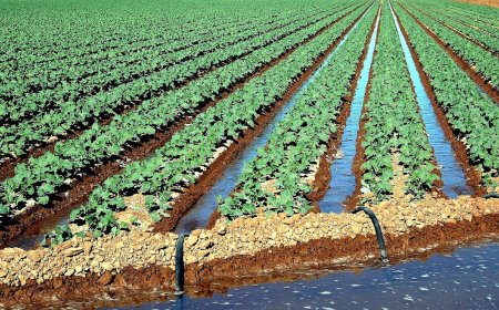
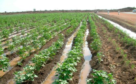
- Impact on Agriculture:
- Areas with lower rainfall, like the southern lake region, are suitable for cotton farming.
b) Temperature Variations Due to Altitude
- Higher-altitude areas (e.g., Kiisi and Karasuk in Kenya) experience lower temperatures than typical equatorial conditions.
- Northwestern parts of the basin experience hot temperature ranges and a marked dry season.
3. Human Influence on Climate in the Lake Victoria Basin
Human activities have modified the climate in certain areas:
- Deforestation – Reduces rainfall and increases local temperatures.
- Swamp reclamation – Alters humidity and local precipitation patterns.
- Bush burning – Contributes to temperature fluctuations.
- Industrialization & Borehole Drilling – May influence local climate by affecting groundwater and heat absorption.
TROPICAL CLIMATE
This type of climate is experienced in Songea, Morogoro, Tabora and Dodoma of central and souther Tanzania, areas of Lira, Gulu, Dokolo, Amuru and Pader in northern Uganda and Kibale, Kiboga Mubende and Hoima of western and central Uganda as well as parts of southern Kenya.Characteristics of tropical climate1. Rainfall is moderate ranging between 500-1000 mm per annum.2.3.Rainfall is convectional coinciding with the overhead sun.
The climate consists of alternating wet and dry seasons. In most areas there is one very hot, wet season followed by one warm or hot dry season.
Temperatures are high throughout the year usually above 20°C.4.5.Annual temperature range is moderate about 9-11° C.6.7.There is extensive cloud cover during the wet season and little in the dry season. Moderate humidity.
TROPICAL MONSOON CLIMATE
The tropical monsoon climate is influenced by the monsoon winds. These winds change with seasons depending on the position of the sun. This type of climate is best experienced along the East African coast.
Characteristics of monsoon climate.
1. Rainfall is moderate ranging between 500-1000 mm per annum.
2. Rainfall results from winds blowing from the sea to the land.
3. Alternate wet and dry seasons are experienced.
4. Temperatures are very hot during the day and cool during the night.
5. Daily temperature range is very high about 17° C.
DESERT AND SEMI-DESERT CLIMATE
This type of climate is experienced in areas such as Kotido, Amudat, Abim, Kaabong, Moroto and Nakapiripirit in north eastern Uganda, Lodwar, Marsabit, Turkana and Mandera in northern Kenya, Magadi and Masai in southern Kenya and parts of central and northern Tanzania such as Iringa and north of Arusha.
Characteristics of arid and semi-arid climate
1. Rainfall rarely falls.
2. Day temperatures are very hot usually over 30° C while night temperatures are very low.
3. Large annual temperature range of about 30° C.
4. Large diurnal temperature range.
5. Little or no cloud cover.
6. Very low relative humidity.
MONTANE CLIMATE
This type of climate occurs in the highlands and mountain areas of East Africa. The areas include Kigezi Highlands, Mount Rwenzori, Mount Elgon, Kenya Highlands, Mount Kenya, Mount Kilimanjaro, Mount Meru and the Southern Highlands of Tanzania. In these regions, altitude exerts a strong influence on temperature and rainfall. Temperatures fall with increase in altitude. The rainfall amount received depends on the position of the station in relation to the rain bearing winds. Generally, in East Africa the south east facing slopes receive heavy rainfall while the north west receive least rainfall.
FACTORS AFFECTING THE CLIMATE OF EAST AFRICA
Altitude.
Altitude refers to the height above sea level. Altitude has affected the climate of East Africa in the following ways;
An increase in altitude brings about a drop in temperature e.g. on the slopes of Mts. Kenya and Kilimanjaro. The drop in temperature with increase in altitude is estimated at 6.5°C for every 1,000 meters of ascent. This is attributed to air at lower altitudes containing more water vapour and dust particles. These prevent the sun's insolation from escaping as they attract and help to retain the heat. Air in the higher attitudes is rarefied and heat rapidly escapes and temperatures remain cool. This results in the modified equatorial climate.
In East Africa the highlands intercept the North East and South East Trade winds. the winds cool and condense leading to the formation of cumulo-nimbus clouds and heavy orographic rainfall e.g. in the Kigezi and Kenya Highlands and the slopes of Mount Elgon. However, rain falls mainly on the windward slopes while the leeward slopes receive less rainfall. Once over the crest the winds descend the leeward slopes as dry wind hence causing little or no rainfall. Meru station on the north eastern slopes of Mount Kenya receives 1320 mm of rainfall per annum while Nyeri on the south western slopes receives only 737 mm of rainfall per annum. Similarly, areas such as Kasese and Buliisa receive little rainfall because of being on the leeward slopes of Mt. Rwenzori.
The rift valley forms one of the lowest areas in East Africa. Because of this temperatures are very hot often above 30° C. These areas also receive low rainfall because the winds that descend these slopes are warmed hence hindering condensation and rainfall formation e.g. Kasese and Buliisa in the western rift valley. The low altitude at Mombasa and Dar se Salaam at the coast also accounts for the hot temperatures experienced there.
Altitude further affects the amount of water vapour in the atmosphere. Generally, there is more humidity or water vapour in lower altitudes compared to the high altitudes.
Atmospheric pressure decreases with increase in altitude. Areas in low altitude such as Kilembe at the foot of Mt. Rwenzori have to support dense air above them hence the pressure exerted is high. In contrast, areas in high altitudes such as Margherita peak the pressure exerted by the air is lower as a smaller column of air is supported.
Latitude.
Latitude refers to the equi-angular distance measured in degrees north and south of the equator. It affects the climate of East Africa in a number of ways discussed below;East Africa is located astride the equator where the sun is always high in the sky. The sun's rays strike the earth's surface vertically covering a small area and hence the intensity of the heat is high.
The high intensity of the sun's rays account for the hot temperatures of over 20° C in most areas of East Africa especially areas around the equator such as Wakiso, Mpigi, Mukono and Kisumu. The hot temperatures all year round create a low pressure belt around the equator resulting in the convergence of the South East and North East trade winds. Rainfall is received throughout the year with no distinct dry season a characteristic of an equatorial climate.
The apparent movement of the sun north and south of the equator affects the amount and distribution of rainfall. The greatest insolation usually occurs when the sun is overhead. This insolation or heating leads to the formation of a low-pressure zone known as the Inter Tropical Convergence Zone (ITCZ).
The trade winds converge on and meet each other producing a region of unstable air masses. It therefore oscillates in the tropics north and south of the equator following the apparent movement of the sun.
The convergence of the North East Trade winds and South East Trade winds results into the convectional currents rising and cooling, condensation, clouds and the formation of convectional rainfall.
The annual pattern of rainfall in East Africa is related to the movement of the I.T.C.Z. Places within the equatorial zone receive double maximum rainfall due to the effect of ITCZ when the sun is overhead in March and September with no distinct dry season thus having an equatorial climate. Examples of these areas include Entebbe, Kampala, Mukono, Wakiso, Mombasa and Nairobi. Places to the north of the equator receive one rainfall with peak period ranging from May to September when the ITCZ lies across the regions.
It is important to note the would be two rainfall seasons merge further away from the equator making the regions experience one long wet season and one dry season a characteristic of tropical climate. Examples of these regions include Gulu, Lira and Pader.
Places to the south of the equator receive one peak period between the months of October to March or April when the ITCZ lies across these regions. As in the case of the areas north of the equator where the would be two rainfall seasons merge into one further away from the equator, areas south of the equator similarly experience the same effect making them experience one long wet season and one dry season. Examples include of these regions include Dar- re- salaam, Tabora, Morogoro and Mbeya. Therefore, since the regions lie on opposite sides of the equator, they have their rainy seasons at different times.
Winds
There are three main wind systems affecting the climate of E. Africa;
The North-East Trade winds.
The North East Trade winds comprise of a tropical continental air mass. It includes wind blowing from Arabia and the Horn of Africa, which are desert zones hence have little moisture. In addition, the winds loose moisture in the Ethiopian Highlands. They therefore have very little moisture hence accounting for the aridity in Lodwar, Marsabit, Turkana and Mandera in northern Kenya and Kaabong, Moroto, Kotido and Amdat in north-eastern Uganda.
The South-East Trade winds.
The South-East Trade winds comprise of a maritime air mass blowing from the Indian Ocean. This wind is moisture laden hence causing heavy rainfall to many parts of East Africa especially in April and May. Such areas include Pemba, Zanzibar and the northern shores of Lake Victoria.
The Monsoon winds
The seasonal reversal in the direction of the winds at the coast is often described as monsoonal. North East monsoon winds blowing along the East African coast in January and December cause heavy rainfall. However, these winds are on shore only in southern Tanzania. When the winds reverse their direction to the north west a dry season is experienced hence the tropical monsoon climate.
Water bodies.
Large water bodies such as Lake Victoria and the Indian Ocean affect the climate of the surrounding areas in several ways. This effect is better referred to as land and sea breezes. Lake Victoria is so large as to be almost an inland sea, and breezes develop in the same way as land and sea breezes along the coast.
Sea breeze.
During the day, the land heats up faster than the water. Therefore, the air above it becomes warmer and expands until it is at a lower pressure than the air over the water. By the afternoon, the pressure difference is so great that a flow of cool, moist air begins to push its way beneath the warm air over the land. This daily movement of cool, moist air from the sea to the land is referred to as a sea breeze.
The warm land air is pushed upwards to levels of the atmosphere where it quickly cools. Its moisture condenses, cumulus clouds form and heavy rain falls in the adjacent areas. The sea breeze cools do temperatures on land especially in the afternoons and evenings. In addition, evaporation from these water bodies results in high humidity in the adjacent areas. This is experienced at stations such as Kampala, Entebbe, Kisumu, Bukoba and Mwanza close to Lake Victoria.
Land breeze.
This refers to the diurnal movement of air from the land to the sea. At night, the land cools much faster than the sea. The cooling results from terrestrial radiation at night. Temperatures are therefore cooler over land than the sea, which retains much of its heat. Lower pressure is created over the warmer sea and higher pressure over the cold land. Wind blows from the land to the lower pressure belt over the sea as land breeze. This land breeze cools temperatures on sea. The cooling over the sea brought by land breeze also causes fog formation. Temperature inversions result over the open sea.
Illustration
Ocean currents.
Warm ocean currents have an effect of raising the temperature and amount of rainfall received along the coasts. This is because they raise the temperature of winds blowing over them and this warmth is transferred to the adjacent lands. The increase in temperature of the wind increases its ability to hold moisture. The wind therefore picks-up a lot of moisture that is later deposited on adjacent land in form of rain. Along the East Africa coast, the warm Mozambique current has resulted in higher temperatures and rainfall at Mombasa, Tanga and Dae es Salaam.
Distance from the sea.
Coastal areas experience land and sea breezes which result in rainfall and moderating effect on temperature. This is experiences at stations such as Mombasa, Mtwara, and Dar es Salaam at the East African coast. In addition, the effect of prevailing winds is felt more near coastal areas than inland. The South East Trade winds for example lose most of their moisture as they blow over the heated land surface. The effect on rainfall formation therefore reduces further inland.
Vegetation
Tropical forests modify the climate of the adjacent areas by increasing the amount of rainfall received through evapo-transpiration. Mabira, Bugala and Malabigambo forests in the Lake Victoria basin have contribution to the formation of heavy rainfall and the occurrence of an equatorial climate. It is therefore not surprising that forest covered areas are wetter than areas with savannah or any other type of vegetation.
Man's activities.
Over the centuries man has felled trees for fuel and building materials, or to make room for crops, he has burnt off wide areas of savannah woodlands either deliberately or by accident, drained swamps for agricultural purposes and over grazed grasslands. All these activities have led to increasing aridity in many areas of East Africa. Over grazing in Turkanaland and Karamoja for example are partly responsible for the semi-arid climate experienced there.
ARID CONDITIONS IN AFRICA
Africa has some of the greatest arid regions in the world. The Sahara Desert area in northern Africa is a broad belt of arid land that extends from the Atlantic Ocean eastward to the Red Sea. The entire desert is about 1,610 km wide and about 5,150 km long from east to west.
The Kalahari Desert is another arid region on the interior plateau of southern Africa, occupying central and south-westem Botswana and parts of west central South Africa and eastern Namibia. The desert covers an area of about 260,000 sq km. The Namib Desert extends about 1,500 km along the coast of south-western Africa, mainly in Namibia.
The desert reaches inland from the Atlantic Ocean for up to about 130 km. In East Africa, areas with the above climatic characteristics include Karamoja(Kaabong, Moroto, Kotido, Abim, Nakapiripirit), Anicole-Masaka corridor parts of Isingiro, Kiruhura, Semabule, Rakai), Lake Albert flats, Northern Kenya(Turkana, Marsabit, Wajir, Lodwar), Northern Tanzania (Masailand), parts of central Tanzania (Iringa). The low plateau area in northern Kenya such as Wajir for example receives an average annual rainfall of 320 mm.
Characteristics of arid areas.
Arid areas are characterised by having very hot temperatures of 30°C and above, high diumal temperature range, high evaporation rates, low cloud cover, low rainfall below 500 mm which is also unreliable, very low humidity, seasonal rainfall and strong winds. Below are some of the causes of aridity in Africa.
Causes of aridity in Africa.
Atmospheric high pressure.
Most arid areas lie in the centre or on the west coast of continents, between 15° and 30° north or south of the Equator. Air which has been warmed at the equator rises, cools and eventually descends at 30° north and 30 south of the equator. This descending air warms and, as a consequence, its water-holding capacity increases. In turn, this results in very low atmospheric humidities at these latitudes, making cloud formation or rain unlikely.
Rain shadow.
This is the effect produced by tall mountain ranges. The windward slopes of such barriers will be wetter than the leeward slopes, which may therefore experience an arid climate. In case of the Atlas Mountains, precipitation is heaviest in the northwest and very lightest in the east and south. Northern Kenya and north-eastern Uganda are on the leeward side of the Ethiopian Highlands.
As the air rises on the windward slopes of the mountains, pressure decreases and it cools, resulting in condensation, cloud formation and rain. As air then descends on the leeward sides of these large, mountainous regions, pressure increases and the air is warmed, thus preventing condensation.
Cold ocean currents.
Several arid areas lie along western coasts where, due to the action of circulating wind currents, there is upwelling of cold sea water. This cools the passing air masses, reducing the amount of water that the air can hold, so limiting the amount of precipitation which can be held. The Namib Desert on the west coast of Africa was formed in this way and is kept cool and dry by the effects of the cold Benguela Current. Only about 50 mm of rain falls each year.
Continentality.
As an air mass moves from the ocean over a continent, it will lose moisture as precipitation. Equally, the air will take up very little moisture due to the low evaporation rates over land surfaces. This means that areas in the centre of continents have very little rainfall simply because the air has become much drier. This effect is made worse in that some continental interiors are far from water bodies which would help to recharge the winds with moisture e.g. areas of Mandera, Marsabit and Wajir, in northern Kenya, Karamoja and Sahara in the interior of Africa.
Winds.
The regions of north eastern Uganda and northern Kenya are visited by the North East Trade winds, which cross the northern part of the Indian Ocean and loose most of their moisture in the Ethiopian highlands. Therefore, instead of dropping moisture they pick more causing these regions to be dry. The South East Trade winds blow over a large expanse of land and much of their moisture is lost in the Kenya Highlands. These winds therefore have no influence on rainfall formation in the northern parts of Kenya. The dry wind results into low rainfall and very low humidity in the atmosphere.
Configuration.
The configuration of the coast causes winds to blow parallel to the coast e.g. the South West monsoon winds blow parallel to the cost so that the rain bearing influence is not felt far in land. These winds therefore do not cause rainfall in the interior making areas such as Morogoro, Iringa, Dodoma and Arusha in central and northern Tanzania arid.
Relief.
The arid regions have a relief, which is generally flat and hence cannot uphold winds to result into condensation and rain formation. The Sahara as a whole is a tableland with an average elevation from about 400 to 500 m while the Kalahari is mostly flat, with an average elevation of about 1,000 m above sea level. Other relatively flat areas include the Lake Albert flats, Karamoja region, Masailand and Serengeti plains in northern Tanzania.
Rotation of the Earth and Aridity in East Africa.
The rotation of the Earth plays a crucial role in influencing wind patterns and climatic conditions. According to Ferrel’s Law, freely moving objects, including winds, are deflected to the right in the Northern Hemisphere and to the left in the Southern Hemisphere. This deflection affects trade winds, such as the Southeast Trade Winds, which are diverted towards the Indian Ocean upon crossing the equator. As a result, some regions, including Isiolo, Wajir, and Lodwar in Northern Kenya, receive significantly less rainfall, contributing to arid conditions.
Overgrazing and Overstocking.
Overgrazing and overstocking are major contributors to aridity in East Africa. In areas such as Karamoja (Uganda), Turkana (Kenya), and the Serengeti National Park (Tanzania), large numbers of livestock graze beyond the land's capacity. This leads to vegetation loss, which exposes the soil to erosion, reducing moisture retention and making it difficult for new vegetation to grow. As a result, rainfall formation declines, worsening arid conditions in these regions. Overgrazing is also common in wildlife reserves, further degrading the land and intensifying desertification.
Excessive Borehole Drilling.
The sinking of boreholes in arid regions, particularly in Karamoja and Turkana, has led to a significant reduction in groundwater levels. As more water is extracted for livestock and human consumption, the water table drops, reducing the amount of moisture in the soil. This leads to the drying up of vegetation, preventing plant regeneration and increasing land degradation. Over time, the depletion of underground water sources worsens aridity, making it harder for communities to sustain their livestock and agriculture.
Deforestation and Land Clearance.
The clearing of forests and woodlands for firewood, timber, and agricultural expansion has significantly contributed to aridity in East Africa. Forests such as Mt Kadam, Napak, Kano, and Morongole have been degraded due to excessive tree cutting. The removal of trees reduces evapotranspiration, a process that helps in cloud formation and rainfall generation. Additionally, deforestation reduces carbon dioxide absorption, leading to increased greenhouse gas emissions, which contribute to rising temperatures and drier conditions. Without tree cover, the land also becomes more exposed to soil erosion, further diminishing its ability to retain moisture.
Decline in Agricultural Productivity.
Aridity negatively affects agriculture by reducing soil fertility, which limits the number of crops that can be grown. In highly arid areas such as Karamoja and Turkana, only drought-resistant crops like millet and sorghum can thrive. Unpredictable and insufficient rainfall often results in crop failures, leading to severe food shortages. In areas such as Moroto, Abim, and Kaabong, delayed rains and droughts have worsened food insecurity, increasing dependence on food aid and relief programs.
Food Shortages and Famine.
One of the most devastating effects of aridity is food scarcity, which often leads to famine. In Northern Kenya, particularly in arid regions like Isiolo and Wajir, rainfall can be absent for months or even years. This makes it difficult for farmers to cultivate crops and for pastoralists to sustain livestock. Food shortages become frequent, leading to malnutrition and increased poverty levels. In severe cases, entire communities are forced to rely on humanitarian aid for survival.
Shortage of Pasture and Livestock Loss.
With less rainfall, vegetation cover declines, leading to a shortage of pasture for livestock. This is a major problem in regions such as Sembabule, Isingiro, Kiruhura, and Mbarara (Uganda), where cattle herding is a key economic activity. Poor pasture quality results in malnourished livestock, leading to low milk yields and poor meat production. In extreme cases, severe droughts cause mass livestock deaths, particularly in Turkana and Karamoja, pushing communities further into poverty.
Human and Livestock Migration.
Due to water and pasture shortages, many pastoralist communities are forced to migrate in search of better conditions. The Karamojong frequently migrate to districts such as Katakwi, Kapchorwa, Pader, Amuria, and Kumi in search of pasture. Similarly, livestock farmers in Northern Tanzania and Southern Kenya move between different grazing lands. However, large-scale migrations often lead to conflicts between communities over scarce resources.
Water Scarcity and Long-Distance Travel.
In arid regions such as Isingiro, Kiruhura, and Nakapiripirit, people struggle with water shortages, forcing them to travel long distances to fetch water. Boreholes and wells are often congested, and in some cases, they dry up completely. This has led to mass migrations to wetter areas, such as Kasese to Kibaale, where water is more available. The lack of clean drinking water also increases the risk of diseases such as cholera and dysentery.
Wildlife Migration and Tourism Decline.
Aridity forces wild animals to migrate in search of water and food. Animals such as elephants, zebras, antelopes, and wildebeests move between protected areas like Serengeti (Tanzania) and Masai Mara (Kenya), Tsavo (Kenya) and Mkomazi (Tanzania). While migration is a natural adaptation, it affects tourism, as fewer animals remain in one place, making it harder for visitors to see wildlife. This reduces tourism revenue, impacting conservation efforts and local economies.
Increased Soil Erosion and Land Degradation.
Without sufficient vegetation cover, arid lands become highly vulnerable to wind and water erosion. In Masailand (Northern Tanzania and Southern Kenya), strong winds blow away topsoil, making farming impossible. In Karamoja and Dodoma, sudden heavy rains create deep gullies, washing away nutrients and further degrading the land. This process makes the soil less productive, worsening food insecurity.
Scarcity of Firewood and Alternative Energy Sources.
As aridity worsens, firewood and charcoal become scarce, forcing people to travel long distances to collect wood fuel. In regions such as Mt Kei (West Nile), Kilak (Gulu), and Kibeka (Masindi), rapid deforestation has left communities struggling for energy sources. This has led to increased adoption of alternative energy solutions, such as biogas and energy-saving stoves, especially in cattle-rearing areas like Mbarara and Kiruhura.
Loss of Biodiversity
Aridity has significantly reduced biodiversity in East Africa. Plants and animals that cannot adapt to dry conditions either migrate or die. This is a major threat to wildlife conservation in Marsabit, Kidepo, and Serengeti National Parks, where prolonged droughts have led to declining animal populations. The loss of plant species also disrupts ecosystems, affecting both wildlife and human livelihoods.
Positive Aspects of Aridity
Despite its challenges, aridity has some benefits. Some deserts and arid regions serve as tourist attractions, such as the Chalbi Desert in Kenya, which is known for its sand dunes, salt pans, and desert motor rallying. Additionally, these sparsely populated areas are often used for military training, as seen in some parts of the Sahara and Chalbi deserts.
Desertification: Causes, Effects, and Solutions.
What is Desertification?
Decertification is the progressive decline in the environmental conditions especially of arid and semi-arid areas. It also refers to the spread of desert-like conditions in an area more so to regions adjacent to the deserts.
Desertification is found on almost every continent except Antarctica, but more attention has focused mostly on Africa, particularly the region known as the Sahel, the region of northern Africa immediately to the south of the Sahara desert. Most of the arid regions of Africa are severely desertified. In East Africa, desertification is experienced in Karamoja, Ankole-Masaka corridor, Nakasongola, Lake Albert region, northern Kenya and northern Tanzania.
Indicators of desertification.
1. Reduction in the amount of rainfall and the rain becomes more unreliable.
2. Increased temperatures.
3. Relative humidity reduces.
4. Vegetation becomes more scanty.
5. Formation and expansion of degraded soil.
6. Accelerated soil erosion by wind and water.
7. Increasing salinisation (build up of salts) of soils and near-surface groundwater supplies.
8. Reduction in soil moisture retention.
9. Lowering of water table.
10. Increase in surface runoff and stream flow variability.
11. A decline in overall biodiversity
12. Reduction in species diversity, plant biomass and overall productivity of the ecosystem.
13. Impoverishment of the human communities dependent on these ecosystems.
Causes of desertification
A number of factors have increased land degradation and the vulnerability of the African arid regions to desertification. The activities that have contributed to desertification are mostly caused by humans and include deforestation, industrialisation, overgrazing, borehole drilling, bush burning, swamp reclamation, mining among others.
Bush burning
In many parts of Africa, burning of vegetation is carried out. The cultivators burn the vegetation to clear the fields for cultivation e.g. in Gulu, Lira, Soroti, Katakwi and Pader. On the other hand, in pastrol communities such as Karamoja and Turkana regions, burning of grass is done at the end of the dry season in anticipation of fresh pastures on the on-set of the wet season. This however results into serious soil erosion and loss of water at the beginning of the rainy season as the land is found bare without any protective vegetation cover.
Over-cultivation.
This may occur as a result of the pressure on agriculture to produce more food, either to support an increasing population, or to grow 'cash crops' for sale in city markets or for overseas export e.g in areas of Amuria, Katatwi, Kapchorwa and Soroti. The most significant effect of over-cultivation is the reduction in soil fertility, which occurs when a plot is not allowed to recover its fertility because fallow periods are shortened. In this way, soil becomes exhausted, nutrients are lost and soil structure deteriorates. In turn, this reduces crop yields and plant cover, leaving soils exposed to erosion.
Over grazing
This is one of the main human activities contributing to desertification and occurs when herd sizes exceed the carrying capacity of the land i.e. the number of cattle that can graze an area without long term damage occurring. In regions such as the Masai land, parts of Ankole-Masaka corridor and Turkana land, over stocking and over grazing are evident. The quality and quantity of vegetation is altered. Changes in species occur, with palatable grasses being replaced by drought-resistant species, which may be less able to bind soil together. Soil quality declines. The hooves of grazing animals compact the soil surface and break down the soil structure, increasing the likelihood of soil crosion by wind and rain storms. Health of animals declines. The decline in pasture area and quality affects the production of both meat and milk.
Deforestation.
Large forests such as Bugala Island forest, Namanve, Mabira and Butamiira are being depleted. This results in reduced moisture in the atmosphere through evapo-transpiration and rainfall.
Swamp reclamation.
Water from swamps evaporates and cools in upper levels of the atmosphere to form clouds and later rainfall. Swamp reclamation will therefore have an effect of increasing the aridity and desertification of the areas where they have been reclaimed. In areas of Pallisa, Butaleja, Namutumba, Busembatia, Bugiri and Lira, wetlands have been reclaimed for rice growing.
Sinking bore holes.
This is mostly done in areas where livestock rearing takes place such as Nakasongola, Moroto, Kaabong and Abim. Boreholes are drilled to provide additional provide additional drinking water for livestock especially in the long dry season. This has an effect of lowering the water table and supporting increasingly poor and scanty vegetation.
Poor farming methods.
Poor methods of farming such s shifting cultivation, over use of fertilizers, ploughing up and down slopes, and growing crops in semi arid areas expose the soils to erosion, loss of water and ultimately less vegetation cover and desertification.
Population pressure.
East Africa like Africa as a whole experiences a high population growth rate. African societies have traditionally seen large families as signs of wealth and prestige, and value the presence of children in everyday life. All the above have promoted population growth. Due to the increased sedentary population, pressures on cultivated land have led to a shortening of the fallow period on farms and the extension of cropping into the more precarious drier regions. Crop harvests became less reliable and more variable as the desert-like conditions spread.
Vegetation clearance.
In many parts of East Africa and Africa as a whole, clearing of vegetation is done either for land preparation or as a result of the increasing need for fuel wood. This has an effect of lowering the water table, removes a source of shade and food and leads to an increase in the burning of dung as a fuel source which would otherwise have been used for fertilizing soils. With less vegetation providing shade, soil temperatures rise, accelerating the breakdown of organic matter in the soil and the evaporation of water. Some soils may become compacted or crusted, reducing their ability to absorb the limited rainfall that occurs, which further reduces the amount of water available for plants.
The absence of vegetation also enhances runoff and erosion by water and wind. Erosion forms deep gullies, lowering the local water table and making less water available for plants. Wind erosion blows away nutrients in the soil and physically damage plants.
Each of these effects makes plant growth more difficult and further reduces the amount of vegetation covering the land, which in turn leads to more degradation. The shortage of firewood as a result of deforestation forces families to spend more time seeking firewood for domestic use, leaving less time for tending fieldsor animals.
Land tenure.
In Africa, there are many forms of land ownership. In Uganda for example, the Mailo land tenure in Buganda avails land to few individual in form of large square miles while the people settled on it become squatters. Such people who do not own land or who have little security of tenure are reluctant to implement long-term soil conservation techniques. In pastoral areas, land belongs to the community as a whole which hinders effective control of the land.
Stalinization and water logging.
Both of these problems are associated with irrigation schemes in arid areas which were designed to reduce the problems of unreliable rainfall. If irrigated land is not drained adequately, the groundwater levels rise in the soil and evaporation increases salt concentration in the soil. This impairs plant growth and may even result in complete water logging with an upper salt crust. A large amount of crop yield reduction attributed to salinization and water logging is in the Nile Valley, and irrigated lands in Algeria and Tunisia.
Pollution.
Pollution refers to the contamination of Earth's environment with materials that interfere with human health, the quality of life, or the natural functioning of living organisms and their physical surroundings. Industrial development leads to the emission of smoke containing carbon monoxide, sulphur dioxide, carbon dioxide among others, which are greenhouse gases. They absorb solar radiation and contribute to global warming. Acid rain is caused when industrial emissions mix with atmospheric moisture.
In soil, acid rain dissolves and washes away nutrients needed by plants. In addition to chemically burning the leaves of plants, acid rain poisons lake water, killing most of the aquatic inhabitants. Solid wastes are unwanted solid materials such as garbage, polythene papers, plastics and other synthetic materials and metals reduce the productivity of the land for agriculture. Most noise pollution comes from machines, especially automobiles, trucks, and aircraft.
Measures to control decertification in East Africa
Solutions to desertification problems in Africa are known and in general can be implemented readily if resources are available to do so. An exploding population in the developing countries, however, means that land pressures will continue to build. Reducing livestock numbers in the grazing lands until forage productivity can be improved is very difficult, at best, and introducing range use controls on communal land is not easy. There is little likelihood that marginal dry farm lands will be returned to pastoral use unless production on the better lands is increased enough to offset the loss of cultivated land.
Afforestation and Re-afforestation are being implemented e.g. in Uganda forests such as Mafuga and Muko in Kabale, as well as Kateera in Kiboga have bee planted. Cleared areas of Mt. Elgon forest have been re-plated.
Reduction in livestock numbers to avoid overgrazing is being promoted through the establishment of ranching schemes e.g. Kisozi ranch in Gomba, Maruzi ranch in Apac, Aswa ranch in Gulu and several in Mbarara, Masindi, and Ntungamo.
The National Forest Authority and National Environmental Management Authority are protecting the forests and wetlands in Uganda. Encroachers have been evicted from Mt. Elgon and Kibale forests, and from wetlands such as Lubigi along Hoima road and Bugoloobi wetlands.
Alternative sources of energy are being developed in order to reduce the clearing of forests and woodlands. Recently built hydro-electric power stations include Bugoye in Kasese and Bujagali (still under construction) in Jinja. Solar energy has been developed in areas such as Kabale, Rukungiri, Kanungu and Kampala. Biogas developed from cow dang is used in Mbarara and Kiruhura. In urban centers such as Kampala and Jinja, energy saving stoves are used.
Introduction of better farming techniques such as crop rotation in Soroti, Kumi and Lira to control soil fertility, and mulching especially in the coffee and banana plantations in Mbarara, Sironko, Manafwa and Masaka so as to minimise water loss from the soil.
Introduction of drought resistant crop varieties in areas which receive low and unreliable rainfall e.g. millet and sorghum in areas of Kasese, Karamoja and Turkana.
Introduction of agro-forestry involving the growing of crops and trees on the same piece of land. The trees help to create rainfall utilised by the crops e.g. in Luwero, Mubende and Nakaseke in Uganda as well as in Kakamega and Muranga in Kenya.
Educating the masses through the mass media, seminars, public rallies, Local Councils meetings and religious organisations on the dangers of desertification and how to control it for example. in Budadiri, Moroto, Wakiso, Buikwe and Mukono.
Creation of environmental organisations to help spear head environmental protection. They include governmental or non-governmental organisations, international or local and state or regional. Examples include the National Environmental Management Authority (NEMA), Kagera Basin Organisation, Karamoja Development Agency, Nature Uganda, Inter Governmental Authority on Drought and Desertification (IGADD) and others.
Climate change.
What is Climate Change?
Climate change refers to the effect of human-induced increase in the concentration of greenhouse gases in the atmosphere, enhancing the natural greenhouse effect. Combustion of fossil fuels, cement production and land use changes have led to carbon dioxide concentrations increasing by almost 30 percent today. Other greenhouse gases are also increasing in concentration in the atmosphere due to human activities, mainly use of landfills, agriculture in general and rice paddy cultivation in particular, animal rearing, fossil fuel use and industrial production. These gases include methane, which has more than doubled since pre-industrial times, as well as nitrous oxide, sulphur dioxide and ozone. As the concentration of these gases increases, so does the radiative forcing, and global mean surface temperature.
Climate change and desertification are perceived differently in terms of their impact. Climate change is viewed as taking place within a global-scale environmental system, while desertification is often viewed as widely dispersed effects of local environmental degradation.
Consequently, different types of measures have been suggested to combat each problem. Desertification measures have targeted local resource use and livelihoods; climate change remediation efforts have focused on reducing global greenhouse gas emissions.
As more attention is gradually being paid to climate adaptation and ameliorating local impacts of climate change, however, climate measures and desertification measures at the local level may increasingly complement each other.
FAQs
1. To what extent has the climate of East Africa been influenced by altitude?
Altitude plays a significant role in shaping the climate of East Africa, as it affects temperature, precipitation, and vegetation patterns across the region. In general, as altitude increases, the climate becomes cooler and wetter, with temperature decreases of about 6.5°C for every 1,000 meters in elevation. This is known as the lapse rate.
In highland areas, such as the East African Highlands (Mount Kenya, Mount Kilimanjaro, and the Rwenzori Mountains), the temperature is much lower than in the lowlands or coastal regions. For instance, areas like Kilimanjaro's summit can experience snow and freezing temperatures despite being located near the equator. The cooling effect at higher altitudes also means that rainfall patterns differ from those at lower elevations. Highland areas generally experience more rainfall due to the cooling of moist air as it rises, leading to condensation and precipitation. This is known as orographic rainfall.
In contrast, lowland areas such as Turkana, Garissa, and parts of Kenya’s coastal region experience warmer and drier climates due to their lower altitude. These areas are often associated with arid or semi-arid conditions, and the temperature range is wider, with hotter daytime temperatures and cooler nights.
2. Examine the factors that influence rainfall formation in East Africa.
Several factors contribute to rainfall formation in East Africa, which include:
- Intertropical Convergence Zone (ITCZ): This is one of the most crucial factors in rainfall formation. The ITCZ is a belt of low pressure where the northeast and southeast trade winds meet, causing air to rise and cool, leading to the formation of clouds and rainfall. The ITCZ shifts north and south of the equator depending on the season, which influences the seasonal rainfall patterns in East Africa, such as the long rains (from March to May) and short rains (from October to December).
- Altitude: As mentioned earlier, the lapse rate causes temperature to decrease with increasing altitude. When moist air is forced to rise in mountainous regions (like the East African Highlands), it cools and condenses to form rain. This orographic rainfall is particularly important for regions like Kilimanjaro and the Rwenzori Mountains.
- Monsoon Winds: The monsoon winds, which blow from the Indian Ocean to the East African coast, bring moisture that can lead to rainfall. The southwest monsoon from the Indian Ocean influences the coastal and inland areas such as Mombasa, Dar es Salaam, and parts of Uganda, bringing rainfall especially during the long rains season.
- Cyclones: Occasionally, cyclones originating from the Indian Ocean can cause heavy rainfall, especially in coastal regions of East Africa. These tropical storms can significantly increase rainfall amounts in affected areas.
- Convectional Rainfall: This occurs when the sun heats the ground, causing the air to rise. As the air cools at higher altitudes, condensation occurs, forming clouds and leading to rainfall. This type of rainfall is common in the interior regions of East Africa, especially during the wet seasons.
- Proximity to Water Bodies: Large bodies of water such as Lake Victoria and the Indian Ocean help to moderate temperatures and provide moisture to the atmosphere, which can lead to rainfall, especially near the coast and in the lake basins.
In summary, rainfall in East Africa is influenced by a combination of seasonal winds (ITCZ and monsoons), altitude, convection, proximity to water bodies, and occasional cyclonic storms. These factors interact in different ways throughout the year, affecting the patterns, intensity, and distribution of rainfall in the region.
3. Explain the effects of rainfall on human activities in East Africa.
Rainfall has profound effects on agriculture, water supply, infrastructure, and human settlements in East Africa, influencing daily life and economic activities.
- Agriculture: Agriculture is a key economic activity in East Africa, and its success is largely dependent on reliable and predictable rainfall. Adequate rainfall supports the growth of crops such as maize, tea, coffee, and sorghum, while also providing water for livestock. Insufficient rainfall can lead to crop failure, food insecurity, and livestock loss. For instance, areas like Turkana and Karamoja experience frequent droughts, causing food shortages and poverty. On the other hand, too much rainfall, such as the flooding caused by heavy rains in areas like Mombasa and parts of Uganda, can damage crops, destroy infrastructure, and lead to disease outbreaks.
- Water Supply: Rainfall is vital for replenishing water sources like rivers, lakes, and reservoirs, which provide water for drinking, irrigation, and industry. Regions such as Lake Victoria Basin heavily depend on rainfall to fill their water sources. Reduced rainfall during drought periods, however, leads to water shortages, affecting both domestic use and agricultural production. This can cause conflicts over water resources, particularly in semi-arid regions like Turkana.
- Transportation and Infrastructure: Heavy rainfall can cause flooding, which disrupts transportation networks, especially in low-lying areas near rivers or lakes. Roads, bridges, and railways may be washed away, as seen during the long rains in parts of Uganda and Kenya, hindering economic activities and migration. On the other hand, droughts or reduced rainfall can lead to dust storms, damaging infrastructure and affecting health.
- Health: Rainfall also has a direct effect on public health. The seasonal rains often lead to standing water, which provides breeding grounds for disease vectors like mosquitoes, increasing the spread of diseases such as malaria and dengue fever. Furthermore, excessive rainfall can lead to waterborne diseases such as cholera, especially in areas with poor sanitation infrastructure.
- Energy Production: Many hydroelectric power plants in East Africa rely on rainfall to fill reservoirs that supply water to turbines. Erratic rainfall patterns can lead to energy shortages in countries like Kenya and Uganda, affecting industrial production, economic activities, and domestic consumption.
4. Differentiate between the climatic characteristics of the Lake Victoria Basin and Turkana land.
The climatic differences between the Lake Victoria Basin and Turkana Land are substantial due to altitude, proximity to water bodies, and seasonal variations.
- Lake Victoria Basin:
- Climate Type: The Lake Victoria Basin experiences a tropical climate with high rainfall throughout the year. It is characterized by an equatorial climate with an abundance of moisture, resulting in heavy rainfall that often exceeds 1,500 mm annually.
- Temperature: Temperatures are generally high and constant throughout the year, averaging between 21°C to 27°C, with a very small annual temperature range.
- Rainfall: Rainfall is distributed throughout the year with two main peaks: the long rains (March to May) and short rains (October to December). The rainfall is convectional, caused by the rise of moist air due to intense solar heating.
- Vegetation: The region is home to dense tropical rainforests and grasslands that support a wide variety of plant and animal species, contributing to a rich biodiversity.
- Turkana Land:
- Climate Type: Turkana, located in northwestern Kenya, has an arid to semi-arid climate with low rainfall and high temperatures. It is characterized by extreme dry conditions and is part of East Africa’s desert belt.
- Temperature: Temperatures in Turkana are high throughout the year, averaging around 32°C, with extreme heat during the day and cooler temperatures at night. The region experiences a high diurnal temperature range.
- Rainfall: Rainfall in Turkana is very low, averaging 200 mm to 400 mm annually. Rain is often erratic and unreliable, with long dry spells and occasional heavy storms during the short rainy season (April-May).
- Vegetation: Due to the lack of rainfall, the vegetation is sparse and primarily consists of bushes, scrubs, and thorny trees, with minimal agricultural activity. The area is better suited for nomadic pastoralism than crop farming.